Kirtorf elevation
Kirtorf (Hesse, Regierungsbezirk Gießen), Germany elevation is 266 meters and Kirtorf elevation in feet is 873 ft above sea level [src 1]. Kirtorf is a populated place (feature code) with elevation that is 8 meters (26 ft) bigger than average city elevation in Germany.
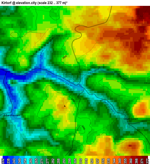
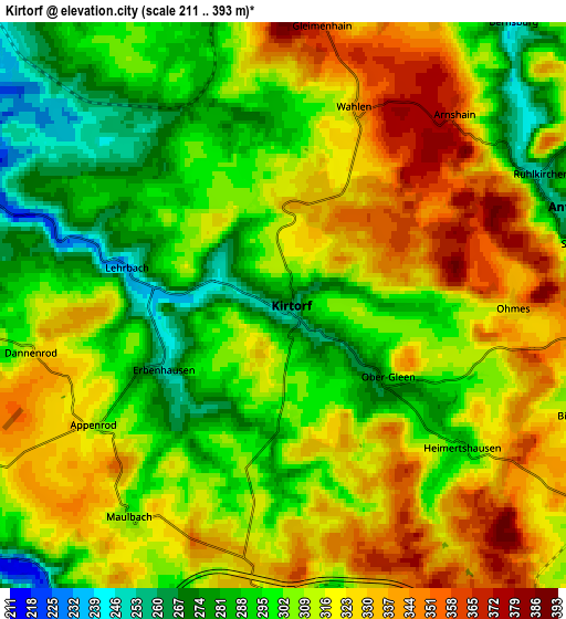
Below is the Elevation map of Kirtorf, which displays elevation range with different colors. Scale of the first map is from 232 to 377 m (761 to 1237 ft) with average elevation of 299.5 meters (=983 ft) [note 1]
These maps also provides idea of topography and contour of this city, they are displayed at different zoom levels. More info about maps, scale and edge coordinates you can find below images.
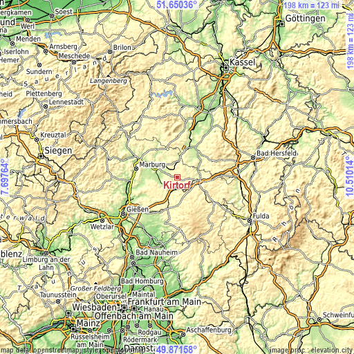
| \ | Map #1 | Map #2 | Topo.Map |
| Scale [m] | 232..377 m | 211..393 m | × |
| Scale [ft] | 761..1237 ft | 692..1289 ft | × |
| Average | 299.5 m = 983 ft | 309.3 m = 1015 ft | × |
| Width | 6.18 km = 3.8 mi | 12.36 km = 7.7 mi | 197.8 km = 122.9 mi |
| Height | 6.18 km = 3.8 mi | 12.36 km = 7.7 mi | 197.8 km = 122.9 mi |
| ↑Max Latitude | 50.797205° | 50.824973° | 51.65036° |
| Latitude at center | 50.76942° | 50.76942° | 50.76942° |
| ↓Min Latitude | 50.741619° | 50.713801° | 49.87158° |
| ← Min Longitude | 9.059945° | 9.015999° | 7.69764° |
| Longitude center | 9.10389° | 9.10389° | 9.10389° |
| →Max Longitude | 9.147835° | 9.191781° | 10.51014° |
Nearby cities:
Cities around Kirtorf sort by population:
• Stadtallendorf elevation 241 m
8.7 km,  312°
312°
• Alsfeld 273 m
11.9 km,  99°
99°
• Kirchhain 215 m
13.9 km,  297°
297°
• Neustadt (Hessen) 243 m
9 km,  5°
5°
• Homberg 243 m
8.7 km,  240°
240°
• Amöneburg 323 m
13 km,  283°
283°
• Willingshausen 230 m
11.2 km,  37°
37°
• Schrecksbach 225 m
14.5 km,  60°
60°
• Schwalmtal 348 m
12.4 km,  140°
140°
• Romrod 310 m
10.3 km,  127°
127°
• Höingen 351 m
14.1 km,  246°
246°
• Niederklein 220 m
8 km,  289°
289°
Multilingual:
 En español:
Kirtorf elevación 266 m.
 En France:
Kirtorf élévation 266 m.


Sources and notes:
- [note 1] Map square and city borders are not equal. Map elevation data is calculated only from area inside that square.
- [src 1] Elevation data from geonames database provided with same terms of usage.
- [src 2] The elevation map of Kirtorf is generated using elevation data from NASA's 3 arcsec (90m) resolution SRTM data.
- [src 3] Base (background) map © OpenStreetMap contributors tiles are generated by Geofabrik and OpenTopoMap.
Copyright & License:
This Kirtorf Elevation Map is licensed under CC BY-SA. You may reuse any part from this page, if you give a proper credit by linking to this URL:
 More info on terms of use page.