Kreuzau elevation
Kreuzau (North Rhine-Westphalia, Regierungsbezirk Köln), Germany elevation is 148 meters and Kreuzau elevation in feet is 486 ft above sea level [src 1]. Kreuzau is a seat of a fourth-order administrative division (feature code) with elevation that is 110 meters (361 ft) smaller than average city elevation in Germany.
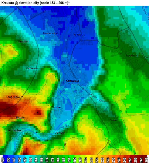
Below is the Elevation map of Kreuzau, which displays elevation range with different colors. Scale of the first map is from 133 to 266 m (436 to 873 ft) with average elevation of 178 meters (=584 ft) [note 1]
These maps also provides idea of topography and contour of this city, they are displayed at different zoom levels. More info about maps, scale and edge coordinates you can find below images.
| \ | Map #1 | Map #2 | Topo.Map |
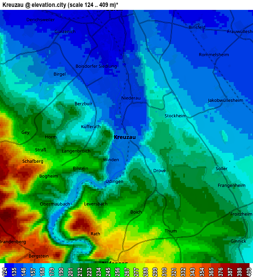
| Scale [m] | 133..266 m | 124..409 m | × |
| Scale [ft] | 436..873 ft | 407..1342 ft | × |
| Average | 178 m = 584 ft | 197.1 m = 647 ft | × |
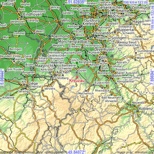
| Width | 6.18 km = 3.8 mi | 12.37 km = 7.7 mi | 197.9 km = 123 mi |
| Height | 6.18 km = 3.8 mi | 12.37 km = 7.7 mi | 197.9 km = 123 mi |
| ↑Max Latitude | 50.774788° | 50.802569° | 51.62835° |
| Latitude at center | 50.74699° | 50.74699° | 50.74699° |
| ↓Min Latitude | 50.719176° | 50.691345° | 49.84872° |
| ← Min Longitude | 6.446745° | 6.402799° | 5.08444° |
| Longitude center | 6.49069° | 6.49069° | 6.49069° |
| →Max Longitude | 6.534635° | 6.578581° | 7.89694° |
Nearby cities:
Cities around Kreuzau sort by population:
• Düren elevation 142 m
6.4 km,  1°
1°
• Stolberg 185 m
18.9 km,  279°
279°
• Eschweiler 142 m
17.3 km,  297°
297°
• Zulpich 174 m
12.9 km,  116°
116°
• Niederzier 105 m
15.3 km,  353°
353°
• Langerwehe 157 m
12.6 km,  308°
308°
• Nörvenich 119 m
12.4 km,  57°
57°
• Nideggen 301 m
6.1 km,  184°
184°
• Vettweiß 161 m
7.8 km,  101°
101°
• Hürtgenwald 344 m
9.4 km,  248°
248°
• Inden 107 m
14.1 km,  319°
319°
• Heimbach 224 m
12.3 km,  187°
187°
Multilingual:
 En español:
Kreuzau elevación 148 m.
 En France:
Kreuzau élévation 148 m.


Sources and notes:
- [note 1] Map square and city borders are not equal. Map elevation data is calculated only from area inside that square.
- [src 1] Elevation data from geonames database provided with same terms of usage.
- [src 2] The elevation map of Kreuzau is generated using elevation data from NASA's 3 arcsec (90m) resolution SRTM data.
- [src 3] Base (background) map © OpenStreetMap contributors tiles are generated by Geofabrik and OpenTopoMap.
Copyright & License:
This Kreuzau Elevation Map is licensed under CC BY-SA. You may reuse any part from this page, if you give a proper credit by linking to this URL:
 More info on terms of use page.