Kuppenheim elevation
Kuppenheim (Baden-Württemberg, Karlsruhe Region), Germany elevation is 128 meters and Kuppenheim elevation in feet is 420 ft above sea level [src 1]. Kuppenheim is a populated place (feature code) with elevation that is 130 meters (427 ft) smaller than average city elevation in Germany.
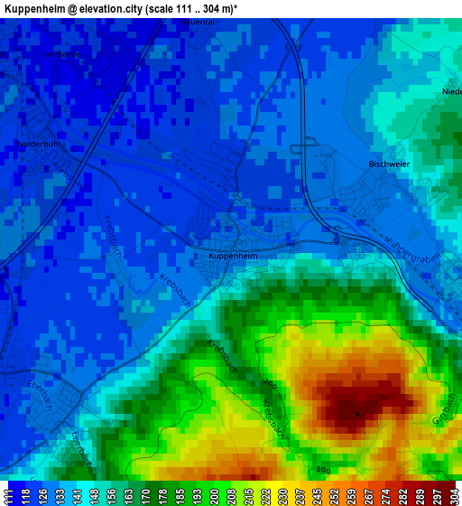
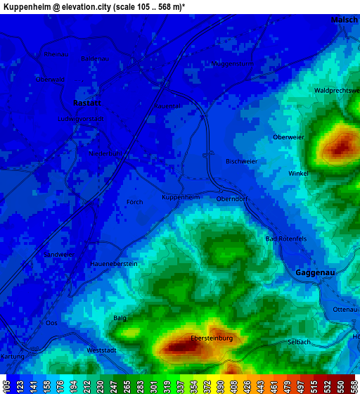
Below is the Elevation map of Kuppenheim, which displays elevation range with different colors. Scale of the first map is from 111 to 304 m (364 to 997 ft) with average elevation of 152.8 meters (=501 ft) [note 1]
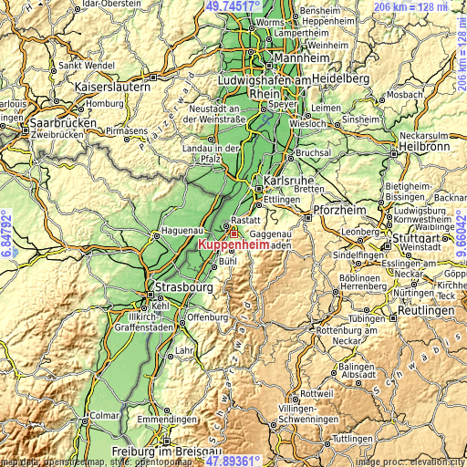
These maps also provides idea of topography and contour of this city, they are displayed at different zoom levels. More info about maps, scale and edge coordinates you can find below images.
| \ | Map #1 | Map #2 | Topo.Map |
| Scale [m] | 111..304 m | 105..568 m | × |
| Scale [ft] | 364..997 ft | 344..1864 ft | × |
| Average | 152.8 m = 501 ft | 169.6 m = 556 ft | × |
| Width | 6.43 km = 4 mi | 12.87 km = 8 mi | 205.9 km = 127.9 mi |
| Height | 6.43 km = 4 mi | 12.87 km = 8 mi | 205.9 km = 127.9 mi |
| ↑Max Latitude | 48.856862° | 48.885767° | 49.74517° |
| Latitude at center | 48.82794° | 48.82794° | 48.82794° |
| ↓Min Latitude | 48.799001° | 48.770046° | 47.89361° |
| ← Min Longitude | 8.210225° | 8.166279° | 6.84792° |
| Longitude center | 8.25417° | 8.25417° | 8.25417° |
| →Max Longitude | 8.298115° | 8.342061° | 9.66042° |
Nearby cities:
Cities around Kuppenheim sort by population:
• Baden-Baden elevation 169 m
7.6 km,  188°
188°
• Rastatt 126 m
4.7 km,  316°
316°
• Gaggenau 186 m
6.6 km,  118°
118°
• Gernsbach 161 m
9.1 km,  134°
134°
• Malsch 127 m
8.5 km,  43°
43°
• Rheinau 113 m
6.7 km, 316°
• Muggensturm 116 m
4.8 km,  26°
26°
• Bietigheim 119 m
9 km,  359°
359°
• Iffezheim 124 m
8.2 km,  265°
265°
• Ötigheim 121 m
7.1 km,  348°
348°
• Bischweier 136 m
2.4 km,  63°
63°
• Steinmauern 113 m
9.1 km,  332°
332°
Multilingual:
 En español:
Kuppenheim elevación 128 m.
 En France:
Kuppenheim élévation 128 m.
 Auf Deutsch:
Kuppenheim höhe über dem Meeresspiegel ist 128 m.

Sources and notes:
- [note 1] Map square and city borders are not equal. Map elevation data is calculated only from area inside that square.
- [src 1] Elevation data from geonames database provided with same terms of usage.
- [src 2] The elevation map of Kuppenheim is generated using elevation data from NASA's 3 arcsec (90m) resolution SRTM data.
- [src 3] Base (background) map © OpenStreetMap contributors tiles are generated by Geofabrik and OpenTopoMap.
Copyright & License:
This Kuppenheim Elevation Map is licensed under CC BY-SA. You may reuse any part from this page, if you give a proper credit by linking to this URL:
 More info on terms of use page.