Rheinau elevation
Rheinau (Baden-Württemberg, Karlsruhe Region), Germany elevation is 113 meters and Rheinau elevation in feet is 371 ft above sea level [src 1]. Rheinau is a section of populated place (feature code) with elevation that is 145 meters (476 ft) smaller than average city elevation in Germany.
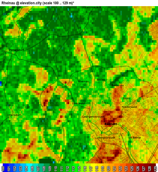
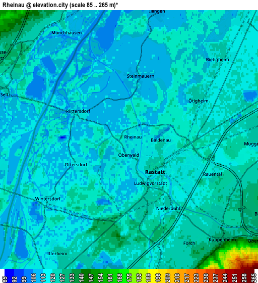
Below is the Elevation map of Rheinau, which displays elevation range with different colors. Scale of the first map is from 100 to 129 m (328 to 423 ft) with average elevation of 114.8 meters (=377 ft) [note 1]
These maps also provides idea of topography and contour of this city, they are displayed at different zoom levels. More info about maps, scale and edge coordinates you can find below images.
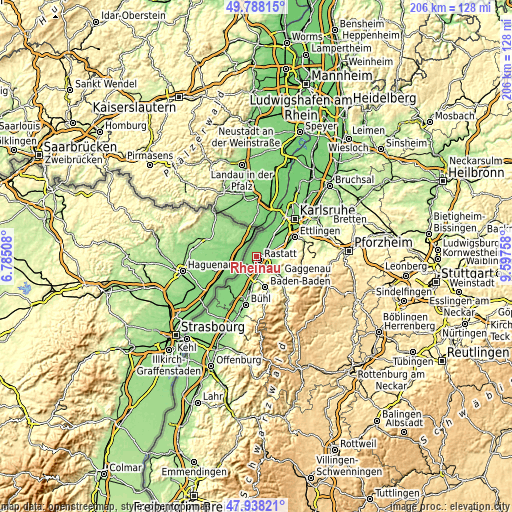
| \ | Map #1 | Map #2 | Topo.Map |
| Scale [m] | 100..129 m | 85..265 m | × |
| Scale [ft] | 328..423 ft | 279..869 ft | × |
| Average | 114.8 m = 377 ft | 118.5 m = 389 ft | × |
| Width | 6.43 km = 4 mi | 12.86 km = 8 mi | 205.7 km = 127.8 mi |
| Height | 6.43 km = 4 mi | 12.86 km = 8 mi | 205.7 km = 127.8 mi |
| ↑Max Latitude | 48.900627° | 48.929506° | 49.78815° |
| Latitude at center | 48.87173° | 48.87173° | 48.87173° |
| ↓Min Latitude | 48.842817° | 48.813887° | 47.93821° |
| ← Min Longitude | 8.147385° | 8.103439° | 6.78508° |
| Longitude center | 8.19133° | 8.19133° | 8.19133° |
| →Max Longitude | 8.235275° | 8.279221° | 9.59758° |
Nearby cities:
Cities around Rheinau sort by population:
• Rastatt elevation 126 m
2 km,  137°
137°
• Malsch 127 m
10.5 km,  82°
82°
• Durmersheim 107 m
8.8 km,  38°
38°
• Kuppenheim 128 m
6.7 km, 136°
• Muggensturm 116 m
6.8 km,  94°
94°
• Bietigheim 119 m
6.1 km,  46°
46°
• Iffezheim 124 m
6.6 km,  212°
212°
• Hügelsheim 122 m
9.7 km, 214°
• Ötigheim 121 m
3.8 km,  55°
55°
• Au am Rhein 107 m
9.2 km,  19°
19°
• Bischweier 136 m
7.8 km,  119°
119°
• Steinmauern 113 m
3.3 km,  7°
7°
Multilingual:
 En español:
Rheinau elevación 113 m.
 En France:
Rheinau élévation 113 m.


Sources and notes:
- [note 1] Map square and city borders are not equal. Map elevation data is calculated only from area inside that square.
- [src 1] Elevation data from geonames database provided with same terms of usage.
- [src 2] The elevation map of Rheinau is generated using elevation data from NASA's 3 arcsec (90m) resolution SRTM data.
- [src 3] Base (background) map © OpenStreetMap contributors tiles are generated by Geofabrik and OpenTopoMap.
Copyright & License:
This Rheinau Elevation Map is licensed under CC BY-SA. You may reuse any part from this page, if you give a proper credit by linking to this URL:
 More info on terms of use page.