Lauben elevation
Lauben (Bavaria, Swabia), Germany elevation is 675 meters and Lauben elevation in feet is 2215 ft above sea level [src 1]. Lauben is a seat of a fourth-order administrative division (feature code) with elevation that is 417 meters (1368 ft) bigger than average city elevation in Germany.
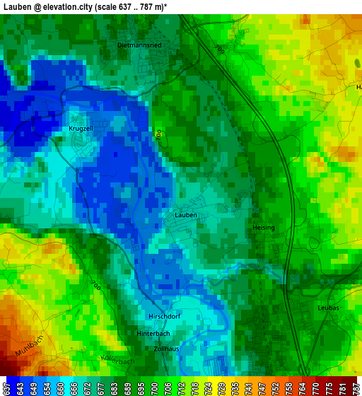
Below is the Elevation map of Lauben, which displays elevation range with different colors. Scale of the first map is from 637 to 787 m (2090 to 2582 ft) with average elevation of 688 meters (=2257 ft) [note 1]
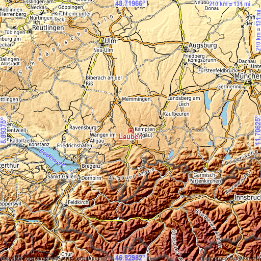
These maps also provides idea of topography and contour of this city, they are displayed at different zoom levels. More info about maps, scale and edge coordinates you can find below images.
| \ | Map #1 | Topo.Map |
| Scale [m] | 637..787 m | × |
| Scale [ft] | 2090..2582 ft | × |
| Average | 688 m = 2257 ft | × |
| Width | 6.57 km = 4.1 mi | 210.1 km = 130.5 mi |
| Height | 6.57 km = 4.1 mi | 210.1 km = 130.5 mi |
| ↑Max Latitude | 47.81285° | 48.71966° |
| Latitude at center | 47.78333° | 47.78333° |
| ↓Min Latitude | 47.753793° | 46.82982° |
| ← Min Longitude | 10.256055° | 8.89375° |
| Longitude center | 10.3° | 10.3° |
| →Max Longitude | 10.343945° | 11.70625° |
Nearby cities:
Cities around Lauben sort by population:
• Kempten (Allgäu) elevation 681 m
6.4 km,  170°
170°
• Altusried 721 m
6.8 km,  289°
289°
• Dietmannsried 680 m
2.8 km,  343°
343°
• Durach 718 m
10.4 km,  161°
161°
• Wiggensbach 853 m
6.6 km,  233°
233°
• Buchenberg 892 m
10.7 km,  205°
205°
• Haldenwang 766 m
4.2 km,  63°
63°
• Neuburg 740 m
4.4 km,  108°
108°
• Betzigau 737 m
8.3 km,  131°
131°
• Wildpoldsried 723 m
7.7 km,  103°
103°
• Günzach 774 m
11.1 km,  65°
65°
• Untrasried 855 m
8.3 km,  48°
48°
Multilingual:
 En español:
Lauben elevación 675 m.
 En France:
Lauben élévation 675 m.


Sources and notes:
- [note 1] Map square and city borders are not equal. Map elevation data is calculated only from area inside that square.
- [src 1] Elevation data from geonames database provided with same terms of usage.
- [src 2] The elevation map of Lauben is generated using elevation data from NASA's 3 arcsec (90m) resolution SRTM data.
- [src 3] Base (background) map © OpenStreetMap contributors tiles are generated by Geofabrik and OpenTopoMap.
Copyright & License:
This Lauben Elevation Map is licensed under CC BY-SA. You may reuse any part from this page, if you give a proper credit by linking to this URL:
 More info on terms of use page.