Leutkirch elevation
Leutkirch (Baden-Württemberg, Tübingen Region), Germany elevation is 655 meters and Leutkirch elevation in feet is 2149 ft above sea level [src 1]. Leutkirch is a populated place (feature code) with elevation that is 397 meters (1302 ft) bigger than average city elevation in Germany.
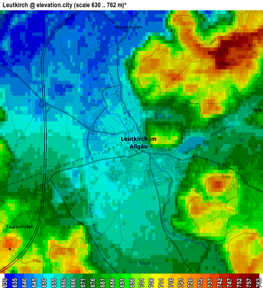
Below is the Elevation map of Leutkirch, which displays elevation range with different colors. Scale of the first map is from 630 to 762 m (2067 to 2500 ft) with average elevation of 673.2 meters (=2209 ft) [note 1]
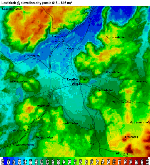
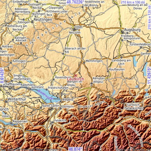
These maps also provides idea of topography and contour of this city, they are displayed at different zoom levels. More info about maps, scale and edge coordinates you can find below images.
| \ | Map #1 | Map #2 | Topo.Map |
| Scale [m] | 630..762 m | 616..816 m | × |
| Scale [ft] | 2067..2500 ft | 2021..2677 ft | × |
| Average | 673.2 m = 2209 ft | 690 m = 2264 ft | × |
| Width | 6.56 km = 4.1 mi | 13.12 km = 8.2 mi | 210 km = 130.5 mi |
| Height | 6.56 km = 4.1 mi | 13.12 km = 8.2 mi | 209.9 km = 130.4 mi |
| ↑Max Latitude | 47.856215° | 47.885694° | 48.76226° |
| Latitude at center | 47.82672° | 47.82672° | 47.82672° |
| ↓Min Latitude | 47.797208° | 47.767679° | 46.874° |
| ← Min Longitude | 9.976555° | 9.932609° | 8.61425° |
| Longitude center | 10.0205° | 10.0205° | 10.0205° |
| →Max Longitude | 10.064445° | 10.108391° | 11.42675° |
Nearby cities:
Cities around Leutkirch sort by population:
• Isny elevation 707 m
15 km,  174°
174°
• Bad Wurzach 651 m
12.9 km,  314°
314°
• Altusried 721 m
14.7 km,  99°
99°
• Kißlegg 652 m
11 km,  247°
247°
• Wiggensbach 853 m
17.9 km,  119°
119°
• Wolfegg 672 m
16.9 km,  267°
267°
• Legau 670 m
8.8 km,  68°
68°
• Aichstetten 616 m
8.5 km,  30°
30°
• Aitrach 603 m
12.7 km,  21°
21°
• Woringen 638 m
16.7 km,  53°
53°
• Kronburg 702 m
13.4 km, 49°
• Lautrach 635 m
10.8 km,  42°
42°
Multilingual:
 En español:
Leutkirch elevación 655 m.
 En France:
Leutkirch élévation 655 m.
 Auf Deutsch:
Leutkirch im Allgäu höhe über dem Meeresspiegel ist 655 m.
 На русском:
Лойткирх-им-Алльгой высота над уровнем моря 655 м
Sources and notes:
- [note 1] Map square and city borders are not equal. Map elevation data is calculated only from area inside that square.
- [src 1] Elevation data from geonames database provided with same terms of usage.
- [src 2] The elevation map of Leutkirch is generated using elevation data from NASA's 3 arcsec (90m) resolution SRTM data.
- [src 3] Base (background) map © OpenStreetMap contributors tiles are generated by Geofabrik and OpenTopoMap.
Copyright & License:
This Leutkirch Elevation Map is licensed under CC BY-SA. You may reuse any part from this page, if you give a proper credit by linking to this URL:
 More info on terms of use page.