Lohsa elevation
Lohsa (Saxony), Germany elevation is 127 meters and Lohsa elevation in feet is 417 ft above sea level [src 1]. Lohsa is a seat of a fourth-order administrative division (feature code) with elevation that is 131 meters (430 ft) smaller than average city elevation in Germany.
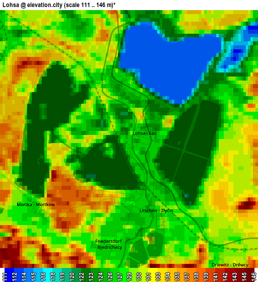
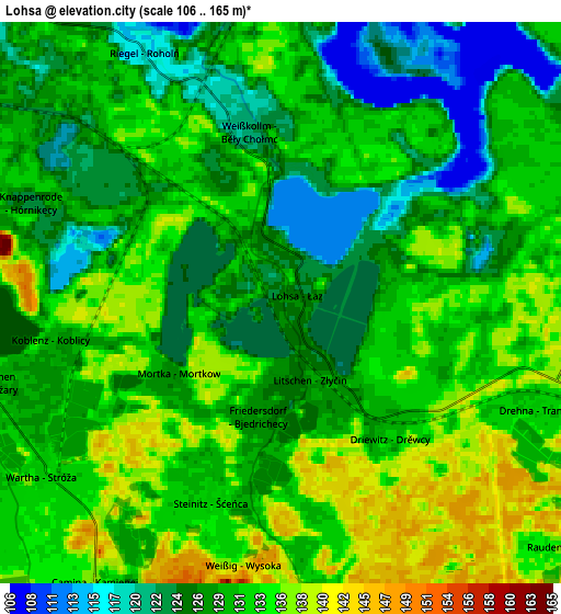
Below is the Elevation map of Lohsa, which displays elevation range with different colors. Scale of the first map is from 111 to 146 m (364 to 479 ft) with average elevation of 127.5 meters (=418 ft) [note 1]
These maps also provides idea of topography and contour of this city, they are displayed at different zoom levels. More info about maps, scale and edge coordinates you can find below images.
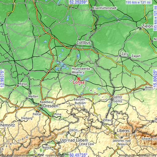
| \ | Map #1 | Map #2 | Topo.Map |
| Scale [m] | 111..146 m | 106..165 m | × |
| Scale [ft] | 364..479 ft | 348..541 ft | × |
| Average | 127.5 m = 418 ft | 130.1 m = 427 ft | × |
| Width | 6.1 km = 3.8 mi | 12.2 km = 7.6 mi | 195.2 km = 121.3 mi |
| Height | 6.1 km = 3.8 mi | 12.2 km = 7.6 mi | 195.2 km = 121.3 mi |
| ↑Max Latitude | 51.410748° | 51.43815° | 52.25259° |
| Latitude at center | 51.38333° | 51.38333° | 51.38333° |
| ↓Min Latitude | 51.355895° | 51.328444° | 50.49725° |
| ← Min Longitude | 14.356055° | 14.312109° | 12.99375° |
| Longitude center | 14.4° | 14.4° | 14.4° |
| →Max Longitude | 14.443945° | 14.487891° | 15.80625° |
Nearby cities:
Cities around Lohsa sort by population:
• Hoyerswerda elevation 118 m
12.9 km,  297°
297°
• Wittichenau 126 m
10.8 km,  270°
270°
• Großdubrau 197 m
14.9 km,  164°
164°
• Königswartha 144 m
9.5 km,  211°
211°
• Radibor 168 m
15.4 km,  180°
180°
• Boxberg 132 m
12.4 km,  79°
79°
• Neschwitz 151 m
13.5 km,  201°
201°
• Oßling 164 m
16.5 km,  260°
260°
• Horka 167 m
16.7 km,  217°
217°
• Klitten 135 m
14.7 km,  104°
104°
• Uhyst 131 m
7.6 km,  105°
105°
• Puschwitz 178 m
15.8 km, 205°
Multilingual:
 En español:
Lohsa elevación 127 m.
 En France:
Lohsa élévation 127 m.


Sources and notes:
- [note 1] Map square and city borders are not equal. Map elevation data is calculated only from area inside that square.
- [src 1] Elevation data from geonames database provided with same terms of usage.
- [src 2] The elevation map of Lohsa is generated using elevation data from NASA's 3 arcsec (90m) resolution SRTM data.
- [src 3] Base (background) map © OpenStreetMap contributors tiles are generated by Geofabrik and OpenTopoMap.
Copyright & License:
This Lohsa Elevation Map is licensed under CC BY-SA. You may reuse any part from this page, if you give a proper credit by linking to this URL:
 More info on terms of use page.