Malente elevation
Malente (Schleswig-Holstein), Germany elevation is 32 meters and Malente elevation in feet is 105 ft above sea level [src 1]. Malente is a seat of a fourth-order administrative division (feature code) with elevation that is 226 meters (741 ft) smaller than average city elevation in Germany.
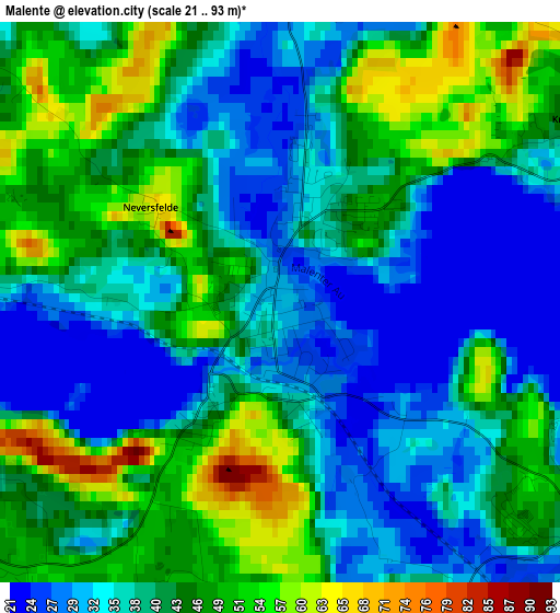
Below is the Elevation map of Malente, which displays elevation range with different colors. Scale of the first map is from 21 to 93 m (69 to 305 ft) with average elevation of 40.5 meters (=133 ft) [note 1]
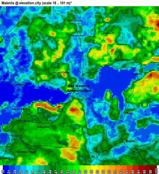
These maps also provides idea of topography and contour of this city, they are displayed at different zoom levels. More info about maps, scale and edge coordinates you can find below images.
| \ | Map #1 | Map #2 | Topo.Map |
| Scale [m] | 21..93 m | 18..101 m | × |
| Scale [ft] | 69..305 ft | 59..331 ft | × |
| Average | 40.5 m = 133 ft | 41.6 m = 136 ft | × |
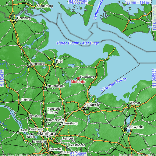
| Width | 5.72 km = 3.6 mi | 11.44 km = 7.1 mi | 183.1 km = 113.8 mi |
| Height | 5.72 km = 3.6 mi | 11.44 km = 7.1 mi | 183 km = 113.7 mi |
| ↑Max Latitude | 54.197975° | 54.223675° | 54.98725° |
| Latitude at center | 54.17226° | 54.17226° | 54.17226° |
| ↓Min Latitude | 54.146529° | 54.120781° | 53.3409° |
| ← Min Longitude | 10.515735° | 10.471789° | 9.15343° |
| Longitude center | 10.55968° | 10.55968° | 10.55968° |
| →Max Longitude | 10.603625° | 10.647571° | 11.96593° |
Nearby cities:
Cities around Malente sort by population:
• Eutin elevation 44 m
4.7 km,  138°
138°
• Plön 27 m
8.9 km,  262°
262°
• Lütjenburg 38 m
13.4 km,  8°
8°
• Süsel 35 m
13.7 km, 137°
• Bosau 47 m
11.6 km,  224°
224°
• Ascheberg 40 m
14.2 km, 260°
• Schönwalde am Bungsberg 95 m
12.4 km,  84°
84°
• Blekendorf 16 m
13.8 km,  27°
27°
• Bösdorf 28 m
5.6 km,  243°
243°
• Kasseedorf 46 m
10.2 km,  93°
93°
• Neukirchen 41 m
4.7 km,  355°
355°
• Grebin 35 m
5 km,  308°
308°
Multilingual:
 En español:
Malente elevación 32 m.
 En France:
Malente élévation 32 m.
 Auf Deutsch:
Bad Malente höhe über dem Meeresspiegel ist 32 m.

Sources and notes:
- [note 1] Map square and city borders are not equal. Map elevation data is calculated only from area inside that square.
- [src 1] Elevation data from geonames database provided with same terms of usage.
- [src 2] The elevation map of Malente is generated using elevation data from NASA's 3 arcsec (90m) resolution SRTM data.
- [src 3] Base (background) map © OpenStreetMap contributors tiles are generated by Geofabrik and OpenTopoMap.
Copyright & License:
This Malente Elevation Map is licensed under CC BY-SA. You may reuse any part from this page, if you give a proper credit by linking to this URL:
 More info on terms of use page.