Süsel elevation
Süsel (Schleswig-Holstein), Germany elevation is 35 meters and Süsel elevation in feet is 115 ft above sea level [src 1]. Süsel is a seat of a fourth-order administrative division (feature code) with elevation that is 223 meters (732 ft) smaller than average city elevation in Germany.
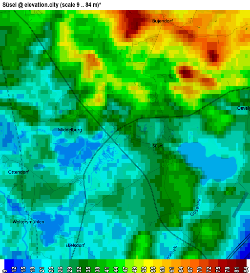
Below is the Elevation map of Süsel, which displays elevation range with different colors. Scale of the first map is from 9 to 84 m (30 to 276 ft) with average elevation of 34.6 meters (=114 ft) [note 1]
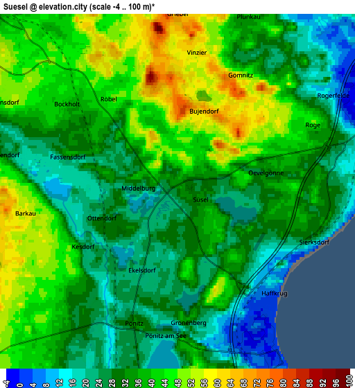
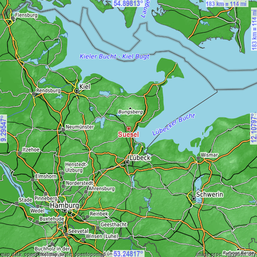
These maps also provides idea of topography and contour of this city, they are displayed at different zoom levels. More info about maps, scale and edge coordinates you can find below images.
| \ | Map #1 | Map #2 | Topo.Map |
| Scale [m] | 9..84 m | -4..100 m | × |
| Scale [ft] | 30..276 ft | -13..328 ft | × |
| Average | 34.6 m = 114 ft | 34.8 m = 114 ft | × |
| Width | 5.73 km = 3.6 mi | 11.47 km = 7.1 mi | 183.5 km = 114 mi |
| Height | 5.73 km = 3.6 mi | 11.47 km = 7.1 mi | 183.4 km = 114 mi |
| ↑Max Latitude | 54.107122° | 54.132878° | 54.89813° |
| Latitude at center | 54.08135° | 54.08135° | 54.08135° |
| ↓Min Latitude | 54.055562° | 54.029758° | 53.24817° |
| ← Min Longitude | 10.657775° | 10.613829° | 9.29547° |
| Longitude center | 10.70172° | 10.70172° | 10.70172° |
| →Max Longitude | 10.745665° | 10.789611° | 12.10797° |
Nearby cities:
Cities around Süsel sort by population:
• Eutin elevation 44 m
9 km,  316°
316°
• Neustadt in Holstein 11 m
7.9 km,  68°
68°
• Ratekau 17 m
14.8 km,  171°
171°
• Scharbeutz -2 m
6.2 km,  149°
149°
• Malente 32 m
13.7 km, 317°
• Timmendorfer Strand 3 m
10.7 km, 152°
• Ahrensbök 62 m
11.6 km,  225°
225°
• Schönwalde am Bungsberg 95 m
11.8 km,  15°
15°
• Schashagen 35 m
13.2 km,  63°
63°
• Kasseedorf 46 m
9.5 km,  5°
5°
• Sierksdorf 30 m
4.5 km,  111°
111°
• Altenkrempe -3 m
10.3 km, 56°
Multilingual:
 En español:
Süsel elevación 35 m.
 En France:
Süsel élévation 35 m.


Sources and notes:
- [note 1] Map square and city borders are not equal. Map elevation data is calculated only from area inside that square.
- [src 1] Elevation data from geonames database provided with same terms of usage.
- [src 2] The elevation map of Süsel is generated using elevation data from NASA's 3 arcsec (90m) resolution SRTM data.
- [src 3] Base (background) map © OpenStreetMap contributors tiles are generated by Geofabrik and OpenTopoMap.
Copyright & License:
This Süsel Elevation Map is licensed under CC BY-SA. You may reuse any part from this page, if you give a proper credit by linking to this URL:
 More info on terms of use page.