Marktredwitz elevation
Marktredwitz (Bavaria, Upper Franconia), Germany elevation is 539 meters and Marktredwitz elevation in feet is 1768 ft above sea level [src 1]. Marktredwitz is a populated place (feature code) with elevation that is 281 meters (922 ft) bigger than average city elevation in Germany.
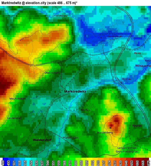
Below is the Elevation map of Marktredwitz, which displays elevation range with different colors. Scale of the first map is from 486 to 675 m (1594 to 2215 ft) with average elevation of 552.9 meters (=1814 ft) [note 1]
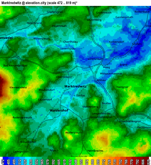
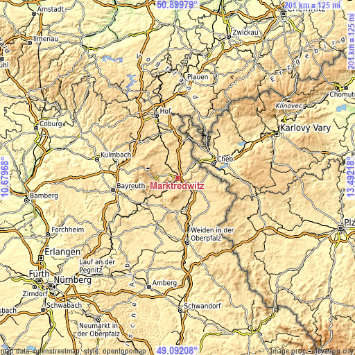
These maps also provides idea of topography and contour of this city, they are displayed at different zoom levels. More info about maps, scale and edge coordinates you can find below images.
| \ | Map #1 | Map #2 | Topo.Map |
| Scale [m] | 486..675 m | 472..819 m | × |
| Scale [ft] | 1594..2215 ft | 1549..2687 ft | × |
| Average | 552.9 m = 1814 ft | 579.5 m = 1901 ft | × |
| Width | 6.28 km = 3.9 mi | 12.56 km = 7.8 mi | 201 km = 124.9 mi |
| Height | 6.28 km = 3.9 mi | 12.56 km = 7.8 mi | 201 km = 124.9 mi |
| ↑Max Latitude | 50.032667° | 50.060887° | 50.89979° |
| Latitude at center | 50.00443° | 50.00443° | 50.00443° |
| ↓Min Latitude | 49.976177° | 49.947907° | 49.09208° |
| ← Min Longitude | 12.041985° | 11.998039° | 10.67968° |
| Longitude center | 12.08593° | 12.08593° | 12.08593° |
| →Max Longitude | 12.129875° | 12.173821° | 13.49218° |
Nearby cities:
Cities around Marktredwitz sort by population:
• Wunsiedel elevation 545 m
7.1 km,  303°
303°
• Arzberg 470 m
9.3 km,  50°
50°
• Waldershof 557 m
3 km,  212°
212°
• Tröstau 552 m
9.8 km,  277°
277°
• Röslau 563 m
11.4 km,  320°
320°
• Thiersheim 539 m
8.5 km,  19°
19°
• Pullenreuth 544 m
10 km,  217°
217°
• Fuchsmühl 599 m
10.1 km,  154°
154°
• Pechbrunn 591 m
7.1 km,  126°
126°
• Thierstein 601 m
11.4 km,  5°
5°
• Höchstädt bei Thiersheim 570 m
10.8 km,  0°
0°
• Bad Alexandersbad 580 m
5.1 km,  285°
285°
Multilingual:
 En español:
Marktredwitz elevación 539 m.
 En France:
Marktredwitz élévation 539 m.
 Auf Deutsch:
Marktredwitz höhe über dem Meeresspiegel ist 539 m.

Sources and notes:
- [note 1] Map square and city borders are not equal. Map elevation data is calculated only from area inside that square.
- [src 1] Elevation data from geonames database provided with same terms of usage.
- [src 2] The elevation map of Marktredwitz is generated using elevation data from NASA's 3 arcsec (90m) resolution SRTM data.
- [src 3] Base (background) map © OpenStreetMap contributors tiles are generated by Geofabrik and OpenTopoMap.
Copyright & License:
This Marktredwitz Elevation Map is licensed under CC BY-SA. You may reuse any part from this page, if you give a proper credit by linking to this URL:
 More info on terms of use page.