Maßbach elevation
Maßbach (Bavaria, Regierungsbezirk Unterfranken), Germany elevation is 284 meters and Maßbach elevation in feet is 932 ft above sea level [src 1]. Maßbach is a populated place (feature code) with elevation that is 26 meters (85 ft) bigger than average city elevation in Germany.
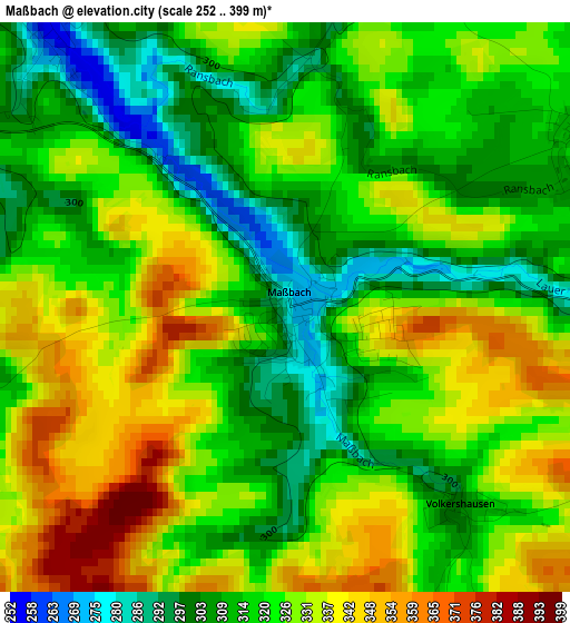
Below is the Elevation map of Maßbach, which displays elevation range with different colors. Scale of the first map is from 252 to 399 m (827 to 1309 ft) with average elevation of 322.6 meters (=1058 ft) [note 1]
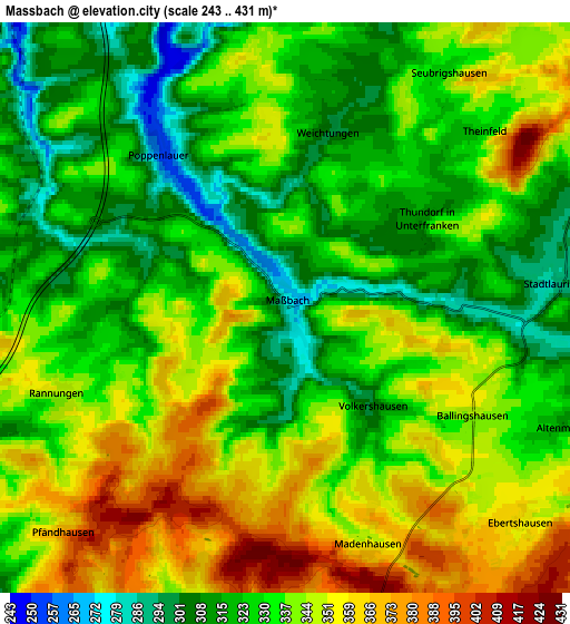
These maps also provides idea of topography and contour of this city, they are displayed at different zoom levels. More info about maps, scale and edge coordinates you can find below images.
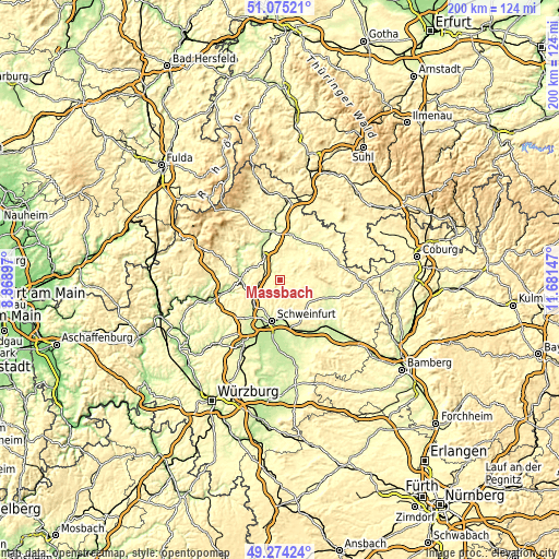
| \ | Map #1 | Map #2 | Topo.Map |
| Scale [m] | 252..399 m | 243..431 m | × |
| Scale [ft] | 827..1309 ft | 797..1414 ft | × |
| Average | 322.6 m = 1058 ft | 334.9 m = 1099 ft | × |
| Width | 6.26 km = 3.9 mi | 12.52 km = 7.8 mi | 200.2 km = 124.4 mi |
| Height | 6.26 km = 3.9 mi | 12.52 km = 7.8 mi | 200.2 km = 124.4 mi |
| ↑Max Latitude | 50.211341° | 50.239456° | 51.07521° |
| Latitude at center | 50.18321° | 50.18321° | 50.18321° |
| ↓Min Latitude | 50.155062° | 50.126897° | 49.27424° |
| ← Min Longitude | 10.231275° | 10.187329° | 8.86897° |
| Longitude center | 10.27522° | 10.27522° | 10.27522° |
| →Max Longitude | 10.319165° | 10.363111° | 11.68147° |
Nearby cities:
Cities around Maßbach sort by population:
• Münnerstadt elevation 248 m
8.7 km,  323°
323°
• Dittelbrunn 252 m
13 km,  197°
197°
• Oerlenbach 325 m
10.8 km,  249°
249°
• Stadtlauringen 292 m
6.2 km,  85°
85°
• Nüdlingen 253 m
11.6 km,  291°
291°
• Üchtelhausen 306 m
10.2 km,  182°
182°
• Aidhausen 305 m
11.9 km,  108°
108°
• Sulzfeld 300 m
12.6 km,  47°
47°
• Burglauer 236 m
12.4 km,  326°
326°
• Rannungen 342 m
5.4 km, 248°
• Thundorf in Unterfranken 311 m
3.7 km,  57°
57°
• Großbardorf 289 m
11.3 km,  35°
35°
Multilingual:
 En español:
Maßbach elevación 284 m.
 En France:
Maßbach élévation 284 m.


Sources and notes:
- [note 1] Map square and city borders are not equal. Map elevation data is calculated only from area inside that square.
- [src 1] Elevation data from geonames database provided with same terms of usage.
- [src 2] The elevation map of Maßbach is generated using elevation data from NASA's 3 arcsec (90m) resolution SRTM data.
- [src 3] Base (background) map © OpenStreetMap contributors tiles are generated by Geofabrik and OpenTopoMap.
Copyright & License:
This Maßbach Elevation Map is licensed under CC BY-SA. You may reuse any part from this page, if you give a proper credit by linking to this URL:
 More info on terms of use page.