Mittweida elevation
Mittweida (Saxony), Germany elevation is 276 meters and Mittweida elevation in feet is 906 ft above sea level [src 1]. Mittweida is a populated place (feature code) with elevation that is 18 meters (59 ft) bigger than average city elevation in Germany.
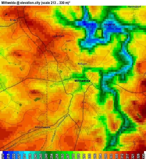
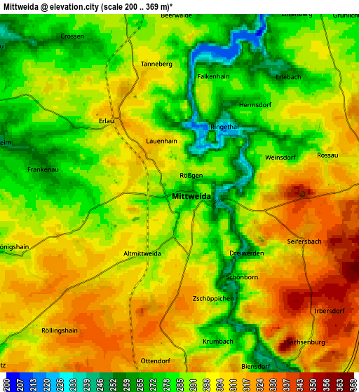
Below is the Elevation map of Mittweida, which displays elevation range with different colors. Scale of the first map is from 213 to 330 m (699 to 1083 ft) with average elevation of 286.3 meters (=939 ft) [note 1]
These maps also provides idea of topography and contour of this city, they are displayed at different zoom levels. More info about maps, scale and edge coordinates you can find below images.
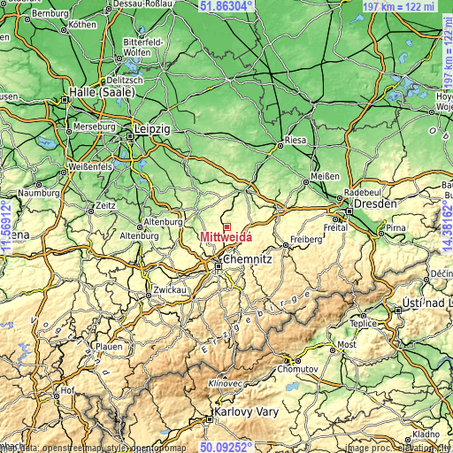
| \ | Map #1 | Map #2 | Topo.Map |
| Scale [m] | 213..330 m | 200..369 m | × |
| Scale [ft] | 699..1083 ft | 656..1211 ft | × |
| Average | 286.3 m = 939 ft | 295.2 m = 969 ft | × |
| Width | 6.15 km = 3.8 mi | 12.3 km = 7.6 mi | 196.9 km = 122.3 mi |
| Height | 6.15 km = 3.8 mi | 12.3 km = 7.6 mi | 196.8 km = 122.3 mi |
| ↑Max Latitude | 51.013876° | 51.041515° | 51.86304° |
| Latitude at center | 50.98622° | 50.98622° | 50.98622° |
| ↓Min Latitude | 50.958548° | 50.930859° | 50.09252° |
| ← Min Longitude | 12.931425° | 12.887479° | 11.56912° |
| Longitude center | 12.97537° | 12.97537° | 12.97537° |
| →Max Longitude | 13.019315° | 13.063261° | 14.38162° |
Nearby cities:
Cities around Mittweida sort by population:
• Frankenberg elevation 279 m
9.3 km,  150°
150°
• Hainichen 311 m
10.5 km,  99°
99°
• Waldheim 191 m
10.1 km,  17°
17°
• Hartha 262 m
12.5 km,  359°
359°
• Geringswalde 252 m
11.1 km,  334°
334°
• Rossau 309 m
6.6 km,  76°
76°
• Erlau 315 m
3.3 km,  320°
320°
• Claußnitz 287 m
8.7 km,  227°
227°
• Kriebstein 194 m
7.7 km, 22°
• Taura 298 m
11.7 km, 228°
• Altmittweida 298 m
2.8 km,  219°
219°
• Seelitz 228 m
12.3 km,  295°
295°
Multilingual:
 En español:
Mittweida elevación 276 m.
 En France:
Mittweida élévation 276 m.
 Auf Deutsch:
Mittweida höhe über dem Meeresspiegel ist 276 m.

Sources and notes:
- [note 1] Map square and city borders are not equal. Map elevation data is calculated only from area inside that square.
- [src 1] Elevation data from geonames database provided with same terms of usage.
- [src 2] The elevation map of Mittweida is generated using elevation data from NASA's 3 arcsec (90m) resolution SRTM data.
- [src 3] Base (background) map © OpenStreetMap contributors tiles are generated by Geofabrik and OpenTopoMap.
Copyright & License:
This Mittweida Elevation Map is licensed under CC BY-SA. You may reuse any part from this page, if you give a proper credit by linking to this URL:
 More info on terms of use page.