Nieheim elevation
Nieheim (North Rhine-Westphalia, Regierungsbezirk Detmold), Germany elevation is 201 meters and Nieheim elevation in feet is 659 ft above sea level [src 1]. Nieheim is a populated place (feature code) with elevation that is 57 meters (187 ft) smaller than average city elevation in Germany.
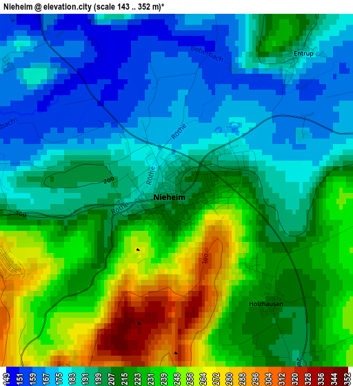
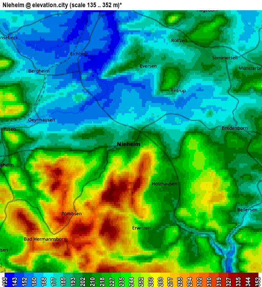
Below is the Elevation map of Nieheim, which displays elevation range with different colors. Scale of the first map is from 143 to 352 m (469 to 1155 ft) with average elevation of 209.8 meters (=688 ft) [note 1]
These maps also provides idea of topography and contour of this city, they are displayed at different zoom levels. More info about maps, scale and edge coordinates you can find below images.
| \ | Map #1 | Map #2 | Topo.Map |
| Scale [m] | 143..352 m | 135..352 m | × |
| Scale [ft] | 469..1155 ft | 443..1155 ft | × |
| Average | 209.8 m = 688 ft | 212.6 m = 698 ft | × |
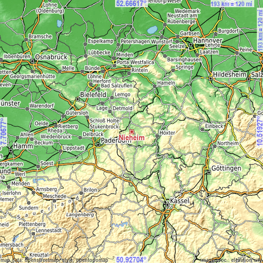
| Width | 6.04 km = 3.8 mi | 12.09 km = 7.5 mi | 193.4 km = 120.2 mi |
| Height | 6.04 km = 3.8 mi | 12.09 km = 7.5 mi | 193.4 km = 120.2 mi |
| ↑Max Latitude | 51.832155° | 51.859304° | 52.66617° |
| Latitude at center | 51.80499° | 51.80499° | 51.80499° |
| ↓Min Latitude | 51.777809° | 51.750611° | 50.92704° |
| ← Min Longitude | 9.069075° | 9.025129° | 7.70677° |
| Longitude center | 9.11302° | 9.11302° | 9.11302° |
| →Max Longitude | 9.156965° | 9.200911° | 10.51927° |
Nearby cities:
Cities around Nieheim sort by population:
• Höxter elevation 100 m
18.8 km,  100°
100°
• Bad Driburg 217 m
10.3 km,  218°
218°
• Brakel 136 m
10.9 km,  152°
152°
• Blomberg 184 m
15.5 km,  354°
354°
• Steinheim 148 m
7.5 km, 348°
• Lügde 106 m
19.4 km,  28°
28°
• Altenbeken 247 m
12.6 km,  249°
249°
• Schieder-Schwalenberg 218 m
9.8 km,  35°
35°
• Schlangen 169 m
18.4 km,  271°
271°
• Horn 220 m
13.7 km,  302°
302°
• Bad Meinberg 211 m
13.5 km,  318°
318°
• Boffzen 89 m
19.6 km,  108°
108°
Multilingual:
 En español:
Nieheim elevación 201 m.
 En France:
Nieheim élévation 201 m.


Sources and notes:
- [note 1] Map square and city borders are not equal. Map elevation data is calculated only from area inside that square.
- [src 1] Elevation data from geonames database provided with same terms of usage.
- [src 2] The elevation map of Nieheim is generated using elevation data from NASA's 3 arcsec (90m) resolution SRTM data.
- [src 3] Base (background) map © OpenStreetMap contributors tiles are generated by Geofabrik and OpenTopoMap.
Copyright & License:
This Nieheim Elevation Map is licensed under CC BY-SA. You may reuse any part from this page, if you give a proper credit by linking to this URL:
 More info on terms of use page.