Nienburg elevation
Nienburg (Lower Saxony), Germany elevation is 28 meters and Nienburg elevation in feet is 92 ft above sea level [src 1]. Nienburg is a seat of a third-order administrative division (feature code) with elevation that is 230 meters (755 ft) smaller than average city elevation in Germany.
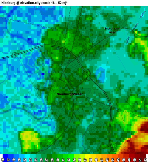
Below is the Elevation map of Nienburg, which displays elevation range with different colors. Scale of the first map is from 16 to 52 m (52 to 171 ft) with average elevation of 26 meters (=85 ft) [note 1]
These maps also provides idea of topography and contour of this city, they are displayed at different zoom levels. More info about maps, scale and edge coordinates you can find below images.
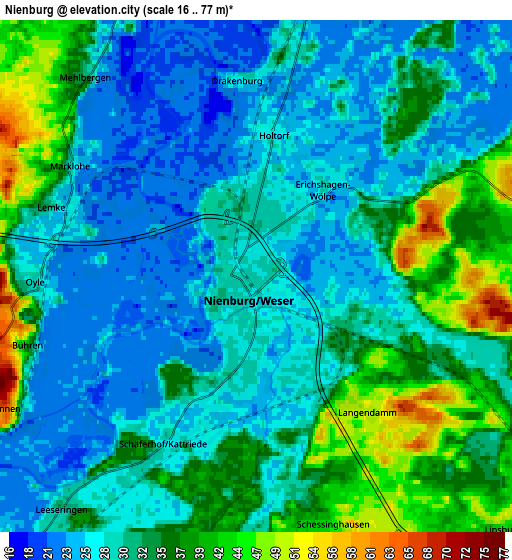
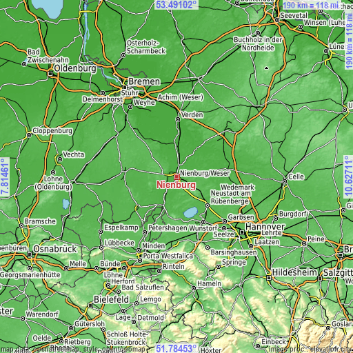
| \ | Map #1 | Map #2 | Topo.Map |
| Scale [m] | 16..52 m | 16..77 m | × |
| Scale [ft] | 52..171 ft | 52..253 ft | × |
| Average | 26 m = 85 ft | 31.4 m = 103 ft | × |
| Width | 5.93 km = 3.7 mi | 11.86 km = 7.4 mi | 189.7 km = 117.9 mi |
| Height | 5.93 km = 3.7 mi | 11.86 km = 7.4 mi | 189.7 km = 117.9 mi |
| ↑Max Latitude | 52.672755° | 52.699394° | 53.49102° |
| Latitude at center | 52.6461° | 52.6461° | 52.6461° |
| ↓Min Latitude | 52.619429° | 52.592741° | 51.78453° |
| ← Min Longitude | 9.176915° | 9.132969° | 7.81461° |
| Longitude center | 9.22086° | 9.22086° | 9.22086° |
| →Max Longitude | 9.264805° | 9.308751° | 10.62711° |
Nearby cities:
Cities around Nienburg sort by population:
• Marklohe elevation 48 m
5.9 km,  295°
295°
• Liebenau 30 m
9.6 km,  240°
240°
• Steimbke 38 m
11.5 km,  85°
85°
• Husum 42 m
9 km,  167°
167°
• Balge 23 m
8.7 km,  335°
335°
• Drakenburg 26 m
4.6 km,  351°
351°
• Estorf 32 m
8.4 km,  219°
219°
• Heemsen 24 m
6.7 km,  27°
27°
• Haßbergen 23 m
9.7 km,  4°
4°
• Stöckse 45 m
8.1 km, 94°
• Röhrsen 29 m
7.2 km,  5°
5°
• Binnen 60 m
6.8 km, 241°
Multilingual:
 En español:
Nienburg elevación 28 m.
 En France:
Nienburg/Weser élévation 28 m.
 Auf Deutsch:
Nienburg/Weser höhe über dem Meeresspiegel ist 28 m.

Sources and notes:
- [note 1] Map square and city borders are not equal. Map elevation data is calculated only from area inside that square.
- [src 1] Elevation data from geonames database provided with same terms of usage.
- [src 2] The elevation map of Nienburg is generated using elevation data from NASA's 3 arcsec (90m) resolution SRTM data.
- [src 3] Base (background) map © OpenStreetMap contributors tiles are generated by Geofabrik and OpenTopoMap.
Copyright & License:
This Nienburg Elevation Map is licensed under CC BY-SA. You may reuse any part from this page, if you give a proper credit by linking to this URL:
 More info on terms of use page.