Oberthulba elevation
Oberthulba (Bavaria, Regierungsbezirk Unterfranken), Germany elevation is 271 meters and Oberthulba elevation in feet is 889 ft above sea level [src 1]. Oberthulba is a populated place (feature code) with elevation that is 13 meters (43 ft) bigger than average city elevation in Germany.
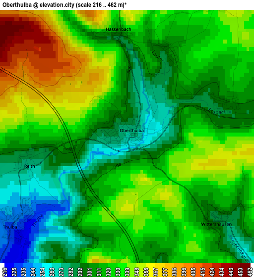
Below is the Elevation map of Oberthulba, which displays elevation range with different colors. Scale of the first map is from 216 to 462 m (709 to 1516 ft) with average elevation of 320.4 meters (=1051 ft) [note 1]
These maps also provides idea of topography and contour of this city, they are displayed at different zoom levels. More info about maps, scale and edge coordinates you can find below images.
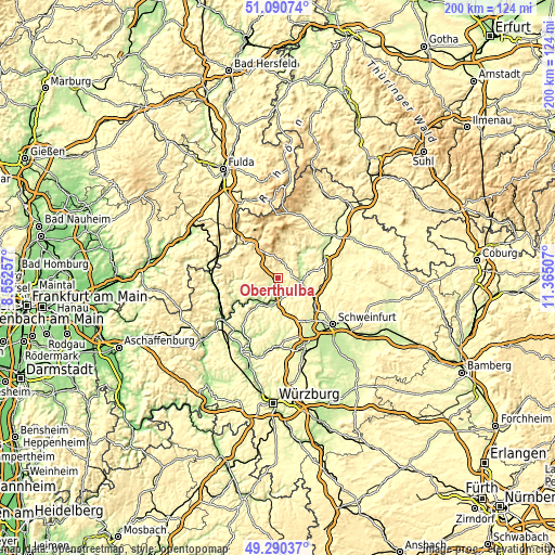
| \ | Map #1 | Map #2 | Topo.Map |
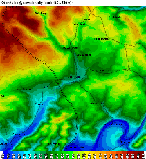
| Scale [m] | 216..462 m | 182..519 m | × |
| Scale [ft] | 709..1516 ft | 597..1703 ft | × |
| Average | 320.4 m = 1051 ft | 335.1 m = 1099 ft | × |
| Width | 6.26 km = 3.9 mi | 12.51 km = 7.8 mi | 200.2 km = 124.4 mi |
| Height | 6.26 km = 3.9 mi | 12.51 km = 7.8 mi | 200.2 km = 124.4 mi |
| ↑Max Latitude | 50.227162° | 50.255268° | 51.09074° |
| Latitude at center | 50.19904° | 50.19904° | 50.19904° |
| ↓Min Latitude | 50.170901° | 50.142746° | 49.29037° |
| ← Min Longitude | 9.914875° | 9.870929° | 8.55257° |
| Longitude center | 9.95882° | 9.95882° | 9.95882° |
| →Max Longitude | 10.002765° | 10.046711° | 11.36507° |
Nearby cities:
Cities around Oberthulba sort by population:
• Bad Kissingen elevation 207 m
8.5 km,  87°
87°
• Hammelburg 193 m
10.4 km,  207°
207°
• Burkardroth 316 m
8.4 km,  16°
16°
• Bad Bocklet 226 m
11.4 km,  48°
48°
• Nüdlingen 253 m
11.9 km,  78°
78°
• Wasserlosen 340 m
12.7 km,  156°
156°
• Elfershausen 198 m
5.7 km,  178°
178°
• Wartmannsroth 331 m
13 km,  253°
253°
• Schondra 419 m
10.3 km,  318°
318°
• Fuchsstadt 209 m
10.3 km,  190°
190°
• Euerdorf 199 m
7.3 km,  140°
140°
• Ramsthal 258 m
10.1 km,  130°
130°
Multilingual:
 En español:
Oberthulba elevación 271 m.
 En France:
Oberthulba élévation 271 m.
 Auf Deutsch:
Oberthulba höhe über dem Meeresspiegel ist 271 m.

Sources and notes:
- [note 1] Map square and city borders are not equal. Map elevation data is calculated only from area inside that square.
- [src 1] Elevation data from geonames database provided with same terms of usage.
- [src 2] The elevation map of Oberthulba is generated using elevation data from NASA's 3 arcsec (90m) resolution SRTM data.
- [src 3] Base (background) map © OpenStreetMap contributors tiles are generated by Geofabrik and OpenTopoMap.
Copyright & License:
This Oberthulba Elevation Map is licensed under CC BY-SA. You may reuse any part from this page, if you give a proper credit by linking to this URL:
 More info on terms of use page.