Oerlinghausen elevation
Oerlinghausen (North Rhine-Westphalia, Regierungsbezirk Detmold), Germany elevation is 229 meters and Oerlinghausen elevation in feet is 751 ft above sea level [src 1]. Oerlinghausen is a populated place (feature code) with elevation that is 29 meters (95 ft) smaller than average city elevation in Germany.
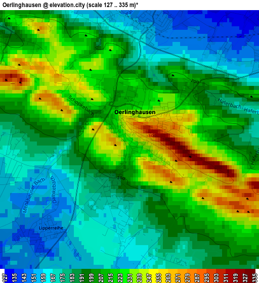
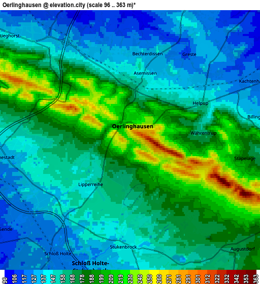
Below is the Elevation map of Oerlinghausen, which displays elevation range with different colors. Scale of the first map is from 127 to 335 m (417 to 1099 ft) with average elevation of 198.4 meters (=651 ft) [note 1]
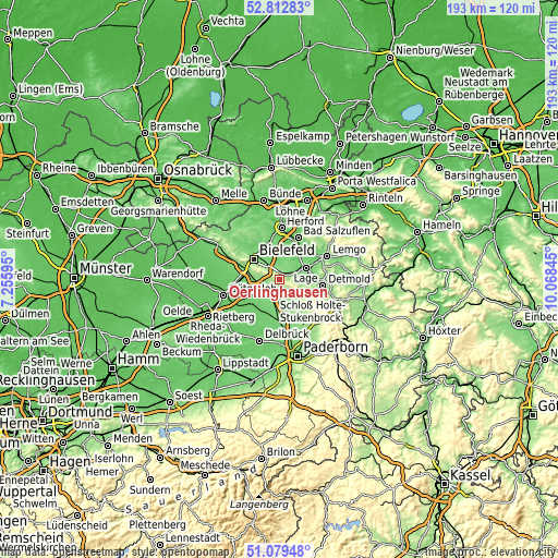
These maps also provides idea of topography and contour of this city, they are displayed at different zoom levels. More info about maps, scale and edge coordinates you can find below images.
| \ | Map #1 | Map #2 | Topo.Map |
| Scale [m] | 127..335 m | 96..363 m | × |
| Scale [ft] | 417..1099 ft | 315..1191 ft | × |
| Average | 198.4 m = 651 ft | 165.9 m = 544 ft | × |
| Width | 6.02 km = 3.7 mi | 12.05 km = 7.5 mi | 192.7 km = 119.7 mi |
| Height | 6.02 km = 3.7 mi | 12.05 km = 7.5 mi | 192.7 km = 119.7 mi |
| ↑Max Latitude | 51.981605° | 52.008663° | 52.81283° |
| Latitude at center | 51.95453° | 51.95453° | 51.95453° |
| ↓Min Latitude | 51.927439° | 51.900331° | 51.07948° |
| ← Min Longitude | 8.618255° | 8.574309° | 7.25595° |
| Longitude center | 8.6622° | 8.6622° | 8.6622° |
| →Max Longitude | 8.706145° | 8.750091° | 10.06845° |
Nearby cities:
Cities around Oerlinghausen sort by population:
• Bielefeld elevation 111 m
12.4 km,  314°
314°
• Gütersloh 79 m
20.2 km,  254°
254°
• Detmold 135 m
14.6 km,  97°
97°
• Herford 69 m
17.8 km,  2°
2°
• Bad Salzuflen 82 m
15.7 km,  21°
21°
• Lemgo 100 m
18.1 km,  63°
63°
• Lage 103 m
9.9 km, 64°
• Verl 94 m
12.7 km,  231°
231°
• Steinhagen 96 m
18.7 km,  285°
285°
• Leopoldshöhe 132 m
6.9 km, 21°
• Hövelhof 101 m
15.4 km,  183°
183°
• Augustdorf 169 m
6.9 km,  136°
136°
Multilingual:
 En español:
Oerlinghausen elevación 229 m.
 En France:
Oerlinghausen élévation 229 m.
 Auf Deutsch:
Oerlinghausen höhe über dem Meeresspiegel ist 229 m.

Sources and notes:
- [note 1] Map square and city borders are not equal. Map elevation data is calculated only from area inside that square.
- [src 1] Elevation data from geonames database provided with same terms of usage.
- [src 2] The elevation map of Oerlinghausen is generated using elevation data from NASA's 3 arcsec (90m) resolution SRTM data.
- [src 3] Base (background) map © OpenStreetMap contributors tiles are generated by Geofabrik and OpenTopoMap.
Copyright & License:
This Oerlinghausen Elevation Map is licensed under CC BY-SA. You may reuse any part from this page, if you give a proper credit by linking to this URL:
 More info on terms of use page.