Öhningen elevation
Öhningen (Baden-Württemberg, Freiburg Region), Germany elevation is 447 meters and Öhningen elevation in feet is 1467 ft above sea level [src 1]. Öhningen is a seat of a fourth-order administrative division (feature code) with elevation that is 189 meters (620 ft) bigger than average city elevation in Germany.
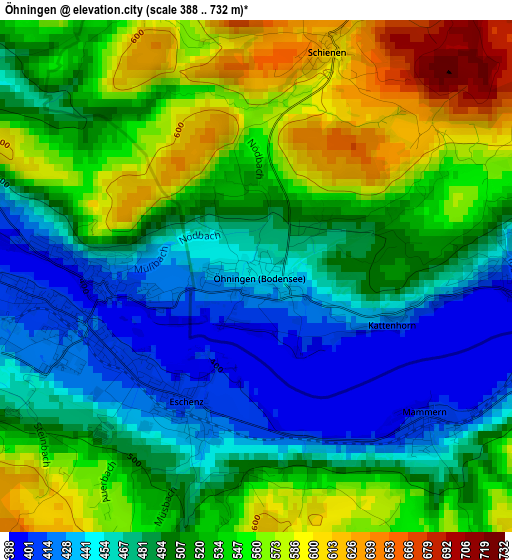
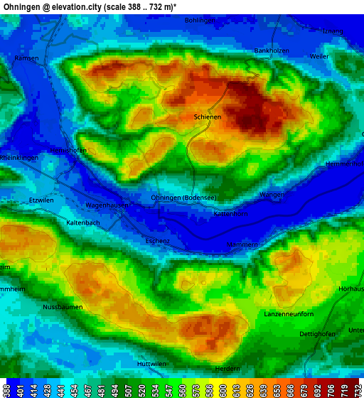
Below is the Elevation map of Öhningen, which displays elevation range with different colors. Scale of the first map is from 388 to 732 m (1273 to 2402 ft) with average elevation of 510.1 meters (=1674 ft) [note 1]
These maps also provides idea of topography and contour of this city, they are displayed at different zoom levels. More info about maps, scale and edge coordinates you can find below images.
| \ | Map #1 | Map #2 | Topo.Map |
| Scale [m] | 388..732 m | 388..732 m | × |
| Scale [ft] | 1273..2402 ft | 1273..2402 ft | × |
| Average | 510.1 m = 1674 ft | 505.9 m = 1660 ft | × |
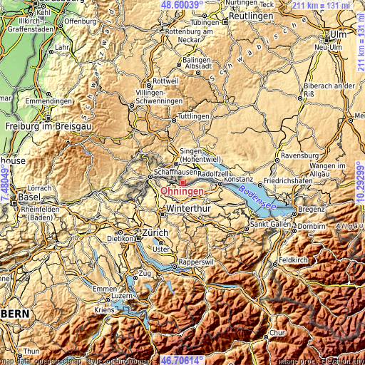
| Width | 6.58 km = 4.1 mi | 13.16 km = 8.2 mi | 210.6 km = 130.9 mi |
| Height | 6.58 km = 4.1 mi | 13.16 km = 8.2 mi | 210.6 km = 130.9 mi |
| ↑Max Latitude | 47.691449° | 47.721021° | 48.60039° |
| Latitude at center | 47.66186° | 47.66186° | 47.66186° |
| ↓Min Latitude | 47.632254° | 47.602632° | 46.70614° |
| ← Min Longitude | 8.842795° | 8.798849° | 7.48049° |
| Longitude center | 8.88674° | 8.88674° | 8.88674° |
| →Max Longitude | 8.930685° | 8.974631° | 10.29299° |
Nearby cities:
Cities around Öhningen sort by population:
• Singen elevation 436 m
11.4 km,  342°
342°
• Radolfzell 403 m
10.9 km,  35°
35°
• Rielasingen-Worblingen 421 m
8.8 km, 336°
• Gottmadingen 428 m
11.6 km,  314°
314°
• Hilzingen 468 m
14 km,  326°
326°
• Allensbach 403 m
15.1 km,  66°
66°
• Reichenau 409 m
13.6 km,  77°
77°
• Steißlingen 465 m
15.7 km,  12°
12°
• Moos 400 m
7.8 km,  27°
27°
• Gaienhofen 426 m
7.6 km, 71°
• Gailingen 463 m
10.6 km,  291°
291°
• Büsingen 396 m
15.4 km,  284°
284°
Multilingual:
 En español:
Öhningen elevación 447 m.
 En France:
Öhningen élévation 447 m.
 Auf Deutsch:
Öhningen höhe über dem Meeresspiegel ist 447 m.

Sources and notes:
- [note 1] Map square and city borders are not equal. Map elevation data is calculated only from area inside that square.
- [src 1] Elevation data from geonames database provided with same terms of usage.
- [src 2] The elevation map of Öhningen is generated using elevation data from NASA's 3 arcsec (90m) resolution SRTM data.
- [src 3] Base (background) map © OpenStreetMap contributors tiles are generated by Geofabrik and OpenTopoMap.
Copyright & License:
This Öhningen Elevation Map is licensed under CC BY-SA. You may reuse any part from this page, if you give a proper credit by linking to this URL:
 More info on terms of use page.