Opladen elevation
Opladen (North Rhine-Westphalia, Regierungsbezirk Köln), Germany elevation is 55 meters and Opladen elevation in feet is 180 ft above sea level [src 1]. Opladen is a populated place (feature code) with elevation that is 203 meters (666 ft) smaller than average city elevation in Germany.
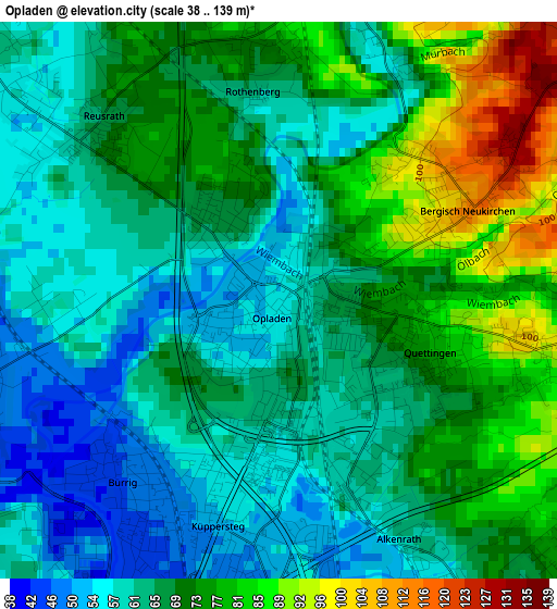
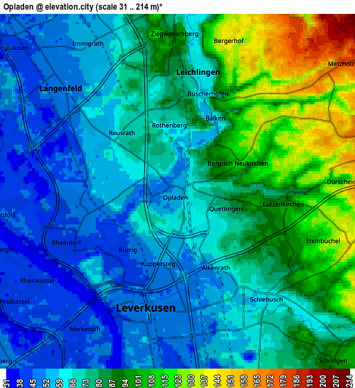
Below is the Elevation map of Opladen, which displays elevation range with different colors. Scale of the first map is from 38 to 139 m (125 to 456 ft) with average elevation of 68.1 meters (=223 ft) [note 1]
These maps also provides idea of topography and contour of this city, they are displayed at different zoom levels. More info about maps, scale and edge coordinates you can find below images.
| \ | Map #1 | Map #2 | Topo.Map |
| Scale [m] | 38..139 m | 31..214 m | × |
| Scale [ft] | 125..456 ft | 102..702 ft | × |
| Average | 68.1 m = 223 ft | 76.3 m = 250 ft | × |
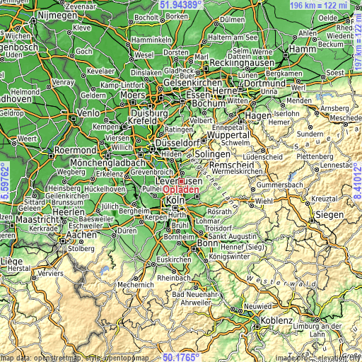
| Width | 6.14 km = 3.8 mi | 12.28 km = 7.6 mi | 196.5 km = 122.1 mi |
| Height | 6.14 km = 3.8 mi | 12.28 km = 7.6 mi | 196.5 km = 122.1 mi |
| ↑Max Latitude | 51.096237° | 51.123827° | 51.94389° |
| Latitude at center | 51.06863° | 51.06863° | 51.06863° |
| ↓Min Latitude | 51.041007° | 51.013368° | 50.1765° |
| ← Min Longitude | 6.959925° | 6.915979° | 5.59762° |
| Longitude center | 7.00387° | 7.00387° | 7.00387° |
| →Max Longitude | 7.047815° | 7.091761° | 8.41012° |
Nearby cities:
Cities around Opladen sort by population:
• Leverkusen elevation 52 m
4.5 km,  197°
197°
• Nippes 50 m
12 km, 197°
• Dormagen 45 m
12.4 km,  284°
284°
• Langenfeld 51 m
5.9 km,  318°
318°
• Hilden 52 m
12.2 km,  335°
335°
• Monheim am Rhein 44 m
8.2 km,  288°
288°
• Mülheim 54 m
11.4 km,  180°
180°
• Leichlingen 63 m
4.3 km,  13°
13°
• Burscheid 191 m
7.9 km,  76°
76°
• Odenthal 83 m
8.8 km,  116°
116°
• Bilderstoeckchen 51 m
12.1 km,  205°
205°
• Riehl 49 m
11.5 km,  189°
189°
Multilingual:
 En español:
Opladen elevación 55 m.
 En France:
Opladen élévation 55 m.


Sources and notes:
- [note 1] Map square and city borders are not equal. Map elevation data is calculated only from area inside that square.
- [src 1] Elevation data from geonames database provided with same terms of usage.
- [src 2] The elevation map of Opladen is generated using elevation data from NASA's 3 arcsec (90m) resolution SRTM data.
- [src 3] Base (background) map © OpenStreetMap contributors tiles are generated by Geofabrik and OpenTopoMap.
Copyright & License:
This Opladen Elevation Map is licensed under CC BY-SA. You may reuse any part from this page, if you give a proper credit by linking to this URL:
 More info on terms of use page.