Oppenheim elevation
Oppenheim (Rheinland-Pfalz), Germany elevation is 88 meters and Oppenheim elevation in feet is 289 ft above sea level [src 1]. Oppenheim is a populated place (feature code) with elevation that is 170 meters (558 ft) smaller than average city elevation in Germany.
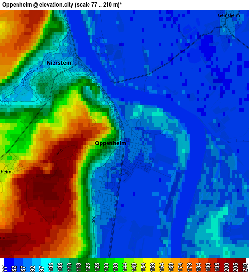
Below is the Elevation map of Oppenheim, which displays elevation range with different colors. Scale of the first map is from 77 to 210 m (253 to 689 ft) with average elevation of 112.6 meters (=369 ft) [note 1]
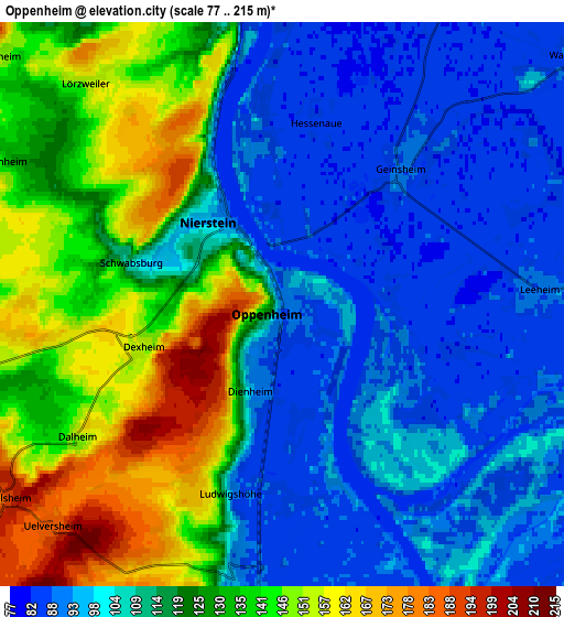
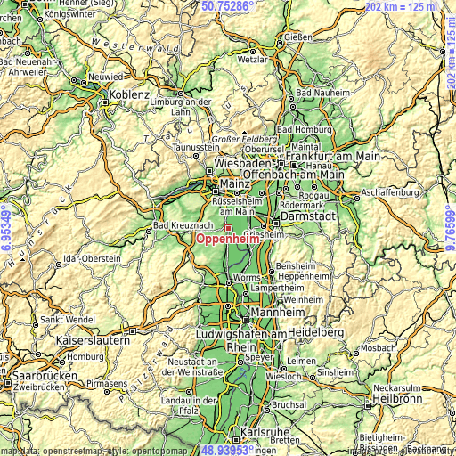
These maps also provides idea of topography and contour of this city, they are displayed at different zoom levels. More info about maps, scale and edge coordinates you can find below images.
| \ | Map #1 | Map #2 | Topo.Map |
| Scale [m] | 77..210 m | 77..215 m | × |
| Scale [ft] | 253..689 ft | 253..705 ft | × |
| Average | 112.6 m = 369 ft | 115.9 m = 380 ft | × |
| Width | 6.3 km = 3.9 mi | 12.6 km = 7.8 mi | 201.6 km = 125.3 mi |
| Height | 6.3 km = 3.9 mi | 12.6 km = 7.8 mi | 201.6 km = 125.3 mi |
| ↑Max Latitude | 49.883024° | 49.911332° | 50.75286° |
| Latitude at center | 49.8547° | 49.8547° | 49.8547° |
| ↓Min Latitude | 49.826359° | 49.798001° | 48.93953° |
| ← Min Longitude | 8.315795° | 8.271849° | 6.95349° |
| Longitude center | 8.35974° | 8.35974° | 8.35974° |
| →Max Longitude | 8.403685° | 8.447631° | 9.76599° |
Nearby cities:
Cities around Oppenheim sort by population:
• Nierstein elevation 101 m
2.4 km,  315°
315°
• Nackenheim 112 m
6.9 km,  347°
347°
• Guntersblum 94 m
6.4 km,  189°
189°
• Gimbsheim 89 m
8.6 km,  172°
172°
• Mommenheim 152 m
7.4 km,  292°
292°
• Lörzweiler 144 m
6.7 km, 316°
• Dienheim 94 m
2.1 km,  200°
200°
• Selzen 124 m
7.5 km,  274°
274°
• Dexheim 154 m
3.2 km,  254°
254°
• Köngernheim 132 m
8.2 km,  263°
263°
• Uelversheim 186 m
7.1 km,  225°
225°
• Dalheim 146 m
5.6 km,  236°
236°
Multilingual:
 En español:
Oppenheim elevación 88 m.
 En France:
Oppenheim élévation 88 m.
 Auf Deutsch:
Oppenheim höhe über dem Meeresspiegel ist 88 m.

Sources and notes:
- [note 1] Map square and city borders are not equal. Map elevation data is calculated only from area inside that square.
- [src 1] Elevation data from geonames database provided with same terms of usage.
- [src 2] The elevation map of Oppenheim is generated using elevation data from NASA's 3 arcsec (90m) resolution SRTM data.
- [src 3] Base (background) map © OpenStreetMap contributors tiles are generated by Geofabrik and OpenTopoMap.
Copyright & License:
This Oppenheim Elevation Map is licensed under CC BY-SA. You may reuse any part from this page, if you give a proper credit by linking to this URL:
 More info on terms of use page.