Osthofen elevation
Osthofen (Rheinland-Pfalz), Germany elevation is 99 meters and Osthofen elevation in feet is 325 ft above sea level [src 1]. Osthofen is a populated place (feature code) with elevation that is 159 meters (522 ft) smaller than average city elevation in Germany.
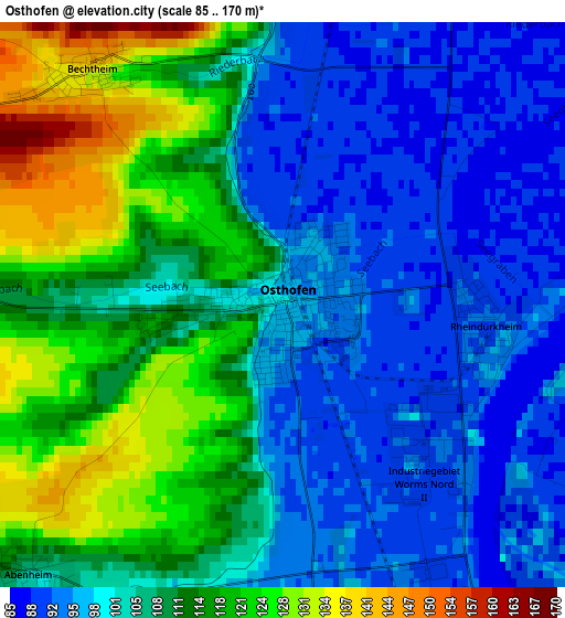
Below is the Elevation map of Osthofen, which displays elevation range with different colors. Scale of the first map is from 85 to 170 m (279 to 558 ft) with average elevation of 106.5 meters (=349 ft) [note 1]
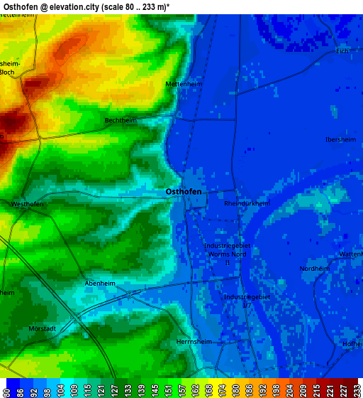
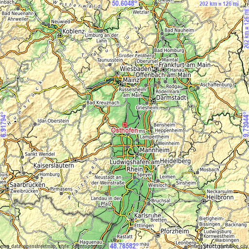
These maps also provides idea of topography and contour of this city, they are displayed at different zoom levels. More info about maps, scale and edge coordinates you can find below images.
| \ | Map #1 | Map #2 | Topo.Map |
| Scale [m] | 85..170 m | 80..233 m | × |
| Scale [ft] | 279..558 ft | 262..764 ft | × |
| Average | 106.5 m = 349 ft | 117.3 m = 385 ft | × |
| Width | 6.32 km = 3.9 mi | 12.64 km = 7.9 mi | 202.3 km = 125.7 mi |
| Height | 6.32 km = 3.9 mi | 12.64 km = 7.9 mi | 202.2 km = 125.6 mi |
| ↑Max Latitude | 49.732233° | 49.760629° | 50.6048° |
| Latitude at center | 49.70382° | 49.70382° | 49.70382° |
| ↓Min Latitude | 49.675391° | 49.646944° | 48.78582° |
| ← Min Longitude | 8.280245° | 8.236299° | 6.91794° |
| Longitude center | 8.32419° | 8.32419° | 8.32419° |
| →Max Longitude | 8.368135° | 8.412081° | 9.73044° |
Nearby cities:
Cities around Osthofen sort by population:
• Worms elevation 104 m
8.3 km,  162°
162°
• Biblis 91 m
9.8 km,  97°
97°
• Guntersblum 94 m
10.5 km,  8°
8°
• Westhofen 127 m
5.5 km,  270°
270°
• Gimbsheim 89 m
9 km,  23°
23°
• Alsheim 92 m
7.2 km, 9°
• Monsheim 133 m
11 km,  227°
227°
• Dittelsheim-Heßloch 169 m
7.7 km,  305°
305°
• Bechtheim 138 m
3.5 km,  319°
319°
• Gundersheim 148 m
8.8 km,  264°
264°
• Mettenheim 97 m
4 km,  1°
1°
• Eppelsheim 194 m
11.4 km, 270°
Multilingual:
 En español:
Osthofen elevación 99 m.
 En France:
Osthofen élévation 99 m.


Sources and notes:
- [note 1] Map square and city borders are not equal. Map elevation data is calculated only from area inside that square.
- [src 1] Elevation data from geonames database provided with same terms of usage.
- [src 2] The elevation map of Osthofen is generated using elevation data from NASA's 3 arcsec (90m) resolution SRTM data.
- [src 3] Base (background) map © OpenStreetMap contributors tiles are generated by Geofabrik and OpenTopoMap.
Copyright & License:
This Osthofen Elevation Map is licensed under CC BY-SA. You may reuse any part from this page, if you give a proper credit by linking to this URL:
 More info on terms of use page.