Pforzheim elevation
Pforzheim (Baden-Württemberg, Karlsruhe Region), Germany elevation is 256 meters and Pforzheim elevation in feet is 840 ft above sea level [src 1]. Pforzheim is a seat of a third-order administrative division (feature code) with elevation that is 2 meters (7 ft) smaller than average city elevation in Germany.
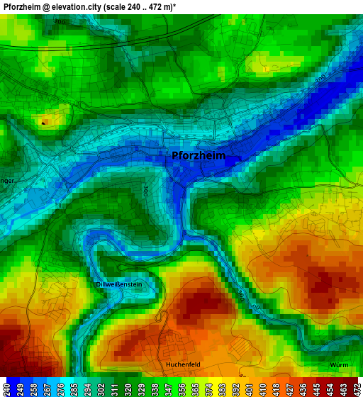
Below is the Elevation map of Pforzheim, which displays elevation range with different colors. Scale of the first map is from 240 to 472 m (787 to 1549 ft) with average elevation of 337.7 meters (=1108 ft) [note 1]
These maps also provides idea of topography and contour of this city, they are displayed at different zoom levels. More info about maps, scale and edge coordinates you can find below images.
| \ | Map #1 | Map #2 | Topo.Map |
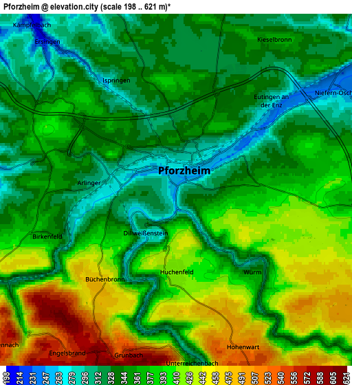
| Scale [m] | 240..472 m | 198..621 m | × |
| Scale [ft] | 787..1549 ft | 650..2037 ft | × |
| Average | 337.7 m = 1108 ft | 372.5 m = 1222 ft | × |
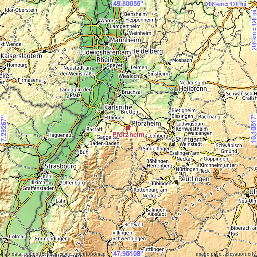
| Width | 6.43 km = 4 mi | 12.85 km = 8 mi | 205.6 km = 127.8 mi |
| Height | 6.43 km = 4 mi | 12.85 km = 8 mi | 205.6 km = 127.8 mi |
| ↑Max Latitude | 48.913249° | 48.942122° | 49.80055° |
| Latitude at center | 48.88436° | 48.88436° | 48.88436° |
| ↓Min Latitude | 48.855454° | 48.826531° | 47.95108° |
| ← Min Longitude | 8.654975° | 8.611029° | 7.29267° |
| Longitude center | 8.69892° | 8.69892° | 8.69892° |
| →Max Longitude | 8.742865° | 8.786811° | 10.10517° |
Nearby cities:
Cities around Pforzheim sort by population:
• Niefern-Öschelbronn elevation 241 m
7.1 km,  59°
59°
• Birkenfeld 382 m
5.2 km,  247°
247°
• Neuenbürg 326 m
8.7 km,  239°
239°
• Ispringen 268 m
4.3 km,  326°
326°
• Tiefenbronn 438 m
10.1 km,  131°
131°
• Eutingen an der Enz 251 m
4.8 km,  49°
49°
• Eisingen 259 m
7.7 km,  342°
342°
• Engelsbrand 576 m
6.7 km,  212°
212°
• Ölbronn-Dürrn 260 m
9.9 km,  22°
22°
• Wurmberg 448 m
8.8 km,  102°
102°
• Kieselbronn 370 m
6.6 km,  34°
34°
• Unterreichenbach 310 m
6.6 km,  173°
173°
Multilingual:
 En español:
Pforzheim elevación 256 m.
 En France:
Pforzheim élévation 256 m.
 Auf Deutsch:
Pforzheim höhe über dem Meeresspiegel ist 256 m.

Sources and notes:
- [note 1] Map square and city borders are not equal. Map elevation data is calculated only from area inside that square.
- [src 1] Elevation data from geonames database provided with same terms of usage.
- [src 2] The elevation map of Pforzheim is generated using elevation data from NASA's 3 arcsec (90m) resolution SRTM data.
- [src 3] Base (background) map © OpenStreetMap contributors tiles are generated by Geofabrik and OpenTopoMap.
Copyright & License:
This Pforzheim Elevation Map is licensed under CC BY-SA. You may reuse any part from this page, if you give a proper credit by linking to this URL:
 More info on terms of use page.