Tiefenbronn elevation
Tiefenbronn (Baden-Württemberg, Karlsruhe Region), Germany elevation is 438 meters and Tiefenbronn elevation in feet is 1437 ft above sea level [src 1]. Tiefenbronn is a seat of a fourth-order administrative division (feature code) with elevation that is 180 meters (591 ft) bigger than average city elevation in Germany.
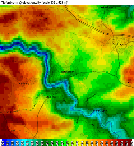
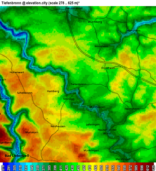
Below is the Elevation map of Tiefenbronn, which displays elevation range with different colors. Scale of the first map is from 333 to 529 m (1093 to 1736 ft) with average elevation of 446.1 meters (=1464 ft) [note 1]
These maps also provides idea of topography and contour of this city, they are displayed at different zoom levels. More info about maps, scale and edge coordinates you can find below images.
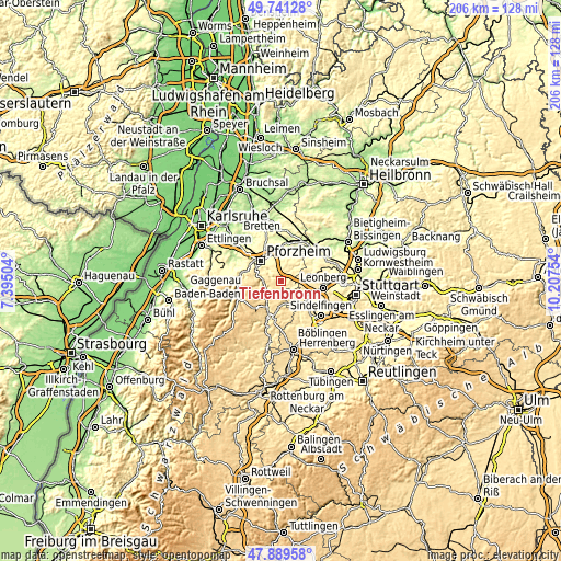
| \ | Map #1 | Map #2 | Topo.Map |
| Scale [m] | 333..529 m | 278..625 m | × |
| Scale [ft] | 1093..1736 ft | 912..2051 ft | × |
| Average | 446.1 m = 1464 ft | 449.7 m = 1475 ft | × |
| Width | 6.43 km = 4 mi | 12.87 km = 8 mi | 205.9 km = 127.9 mi |
| Height | 6.43 km = 4 mi | 12.87 km = 8 mi | 205.9 km = 127.9 mi |
| ↑Max Latitude | 48.852904° | 48.881812° | 49.74128° |
| Latitude at center | 48.82398° | 48.82398° | 48.82398° |
| ↓Min Latitude | 48.795039° | 48.766082° | 47.88958° |
| ← Min Longitude | 8.757345° | 8.713399° | 7.39504° |
| Longitude center | 8.80129° | 8.80129° | 8.80129° |
| →Max Longitude | 8.845235° | 8.889181° | 10.20754° |
Nearby cities:
Cities around Tiefenbronn sort by population:
• Weil der Stadt elevation 397 m
9.8 km,  148°
148°
• Bad Liebenzell 332 m
7.6 km,  223°
223°
• Weissach 358 m
9.6 km,  74°
74°
• Wiernsheim 423 m
7.5 km,  28°
28°
• Neuhausen 491 m
3.9 km,  207°
207°
• Heimsheim 406 m
5.2 km,  111°
111°
• Friolzheim 447 m
2.6 km, 66°
• Wurmberg 448 m
4.9 km,  13°
13°
• Mönsheim 336 m
6.7 km,  45°
45°
• Simmozheim 479 m
8.1 km,  174°
174°
• Wimsheim 420 m
3.7 km,  39°
39°
• Unterreichenbach 310 m
6.8 km,  270°
270°
Multilingual:
 En español:
Tiefenbronn elevación 438 m.
 En France:
Tiefenbronn élévation 438 m.
 Auf Deutsch:
Tiefenbronn höhe über dem Meeresspiegel ist 438 m.

Sources and notes:
- [note 1] Map square and city borders are not equal. Map elevation data is calculated only from area inside that square.
- [src 1] Elevation data from geonames database provided with same terms of usage.
- [src 2] The elevation map of Tiefenbronn is generated using elevation data from NASA's 3 arcsec (90m) resolution SRTM data.
- [src 3] Base (background) map © OpenStreetMap contributors tiles are generated by Geofabrik and OpenTopoMap.
Copyright & License:
This Tiefenbronn Elevation Map is licensed under CC BY-SA. You may reuse any part from this page, if you give a proper credit by linking to this URL:
 More info on terms of use page.