Pottenstein elevation
Pottenstein (Bavaria, Upper Franconia), Germany elevation is 362 meters and Pottenstein elevation in feet is 1188 ft above sea level [src 1]. Pottenstein is a populated place (feature code) with elevation that is 104 meters (341 ft) bigger than average city elevation in Germany.
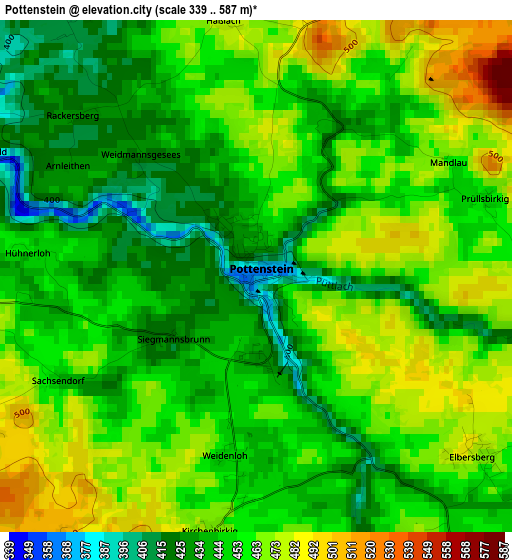
Below is the Elevation map of Pottenstein, which displays elevation range with different colors. Scale of the first map is from 339 to 587 m (1112 to 1926 ft) with average elevation of 453.3 meters (=1487 ft) [note 1]
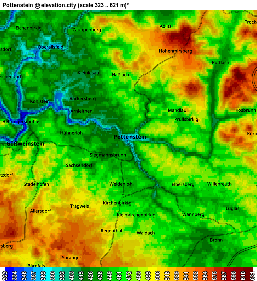
These maps also provides idea of topography and contour of this city, they are displayed at different zoom levels. More info about maps, scale and edge coordinates you can find below images.
| \ | Map #1 | Map #2 | Topo.Map |
| Scale [m] | 339..587 m | 323..621 m | × |
| Scale [ft] | 1112..1926 ft | 1060..2037 ft | × |
| Average | 453.3 m = 1487 ft | 472.8 m = 1551 ft | × |
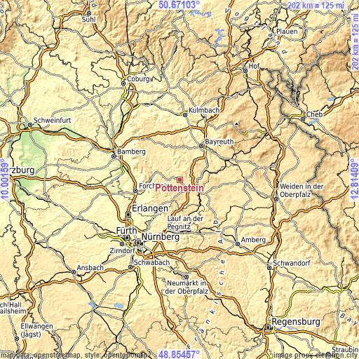
| Width | 6.31 km = 3.9 mi | 12.62 km = 7.8 mi | 202 km = 125.5 mi |
| Height | 6.31 km = 3.9 mi | 12.62 km = 7.8 mi | 202 km = 125.5 mi |
| ↑Max Latitude | 49.799683° | 49.82804° | 50.67103° |
| Latitude at center | 49.77131° | 49.77131° | 49.77131° |
| ↓Min Latitude | 49.74292° | 49.714513° | 48.85457° |
| ← Min Longitude | 11.363895° | 11.319949° | 10.00159° |
| Longitude center | 11.40784° | 11.40784° | 11.40784° |
| →Max Longitude | 11.451785° | 11.495731° | 12.81409° |
Nearby cities:
Cities around Pottenstein sort by population:
• Pegnitz elevation 433 m
9.9 km,  102°
102°
• Ebermannstadt 297 m
16.3 km,  274°
274°
• Creußen 430 m
17.7 km,  62°
62°
• Gößweinstein 465 m
5 km, 267°
• Mistelgau 438 m
16.3 km,  14°
14°
• Waischenfeld 365 m
9.4 km,  332°
332°
• Pretzfeld 289 m
16.9 km,  263°
263°
• Obertrubach 504 m
9 km,  207°
207°
• Egloffstein 417 m
13.3 km,  234°
234°
• Hiltpoltstein 519 m
13.7 km, 206°
• Glashütten 423 m
13.2 km, 12°
• Unterleinleiter 326 m
16.7 km,  290°
290°
Multilingual:
 En español:
Pottenstein elevación 362 m.
 En France:
Pottenstein élévation 362 m.
 Auf Deutsch:
Pottenstein höhe über dem Meeresspiegel ist 362 m.

Sources and notes:
- [note 1] Map square and city borders are not equal. Map elevation data is calculated only from area inside that square.
- [src 1] Elevation data from geonames database provided with same terms of usage.
- [src 2] The elevation map of Pottenstein is generated using elevation data from NASA's 3 arcsec (90m) resolution SRTM data.
- [src 3] Base (background) map © OpenStreetMap contributors tiles are generated by Geofabrik and OpenTopoMap.
Copyright & License:
This Pottenstein Elevation Map is licensed under CC BY-SA. You may reuse any part from this page, if you give a proper credit by linking to this URL:
 More info on terms of use page.