Prüm elevation
Prüm (Rheinland-Pfalz), Germany elevation is 462 meters and Prüm elevation in feet is 1516 ft above sea level [src 1]. Prüm is a populated place (feature code) with elevation that is 204 meters (669 ft) bigger than average city elevation in Germany.
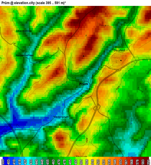
Below is the Elevation map of Prüm, which displays elevation range with different colors. Scale of the first map is from 395 to 591 m (1296 to 1939 ft) with average elevation of 489.7 meters (=1607 ft) [note 1]
These maps also provides idea of topography and contour of this city, they are displayed at different zoom levels. More info about maps, scale and edge coordinates you can find below images.
| \ | Map #1 | Map #2 | Topo.Map |
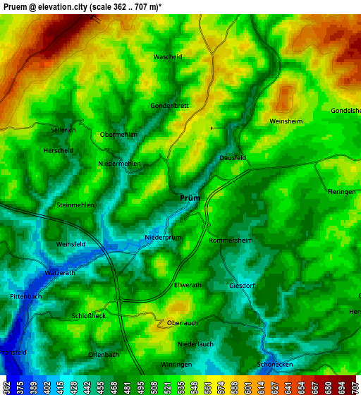
| Scale [m] | 395..591 m | 362..707 m | × |
| Scale [ft] | 1296..1939 ft | 1188..2320 ft | × |
| Average | 489.7 m = 1607 ft | 508.7 m = 1669 ft | × |
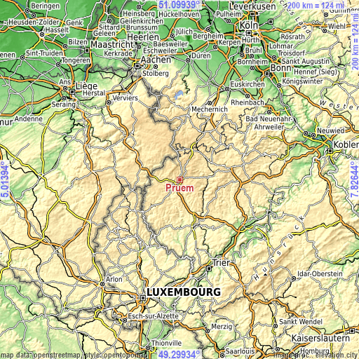
| Width | 6.25 km = 3.9 mi | 12.51 km = 7.8 mi | 200.1 km = 124.3 mi |
| Height | 6.25 km = 3.9 mi | 12.51 km = 7.8 mi | 200.1 km = 124.3 mi |
| ↑Max Latitude | 50.235967° | 50.264067° | 51.09939° |
| Latitude at center | 50.20785° | 50.20785° | 50.20785° |
| ↓Min Latitude | 50.179717° | 50.151566° | 49.29934° |
| ← Min Longitude | 6.376245° | 6.332299° | 5.01394° |
| Longitude center | 6.42019° | 6.42019° | 6.42019° |
| →Max Longitude | 6.464135° | 6.508081° | 7.82644° |
Nearby cities:
Cities around Prüm sort by population:
• Gerolstein elevation 363 m
17.1 km,  84°
84°
• Hillesheim 444 m
20 km,  62°
62°
• Jünkerath 430 m
19 km,  37°
37°
• Schönecken 457 m
6.4 km,  147°
147°
• Stadtkyll 459 m
17.7 km,  26°
26°
• Birresborn 341 m
15.4 km,  100°
100°
• Arzfeld 498 m
16.9 km,  219°
219°
• Bleialf 450 m
10.1 km,  286°
286°
• Lissendorf 472 m
17.6 km,  46°
46°
• Waxweiler 341 m
13.5 km,  197°
197°
• Pelm 385 m
19.4 km, 82°
• Weinsheim 600 m
4.4 km, 49°
Multilingual:
 En español:
Prüm elevación 462 m.
 En France:
Prüm élévation 462 m.


Sources and notes:
- [note 1] Map square and city borders are not equal. Map elevation data is calculated only from area inside that square.
- [src 1] Elevation data from geonames database provided with same terms of usage.
- [src 2] The elevation map of Prüm is generated using elevation data from NASA's 3 arcsec (90m) resolution SRTM data.
- [src 3] Base (background) map © OpenStreetMap contributors tiles are generated by Geofabrik and OpenTopoMap.
Copyright & License:
This Prüm Elevation Map is licensed under CC BY-SA. You may reuse any part from this page, if you give a proper credit by linking to this URL:
 More info on terms of use page.