Reinheim elevation
Reinheim (Hesse, Regierungsbezirk Darmstadt), Germany elevation is 169 meters and Reinheim elevation in feet is 554 ft above sea level [src 1]. Reinheim is a populated place (feature code) with elevation that is 89 meters (292 ft) smaller than average city elevation in Germany.
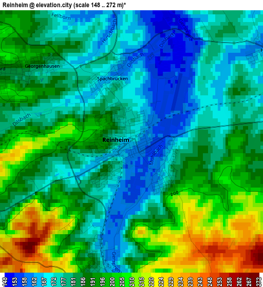
Below is the Elevation map of Reinheim, which displays elevation range with different colors. Scale of the first map is from 148 to 272 m (486 to 892 ft) with average elevation of 186.5 meters (=612 ft) [note 1]
These maps also provides idea of topography and contour of this city, they are displayed at different zoom levels. More info about maps, scale and edge coordinates you can find below images.
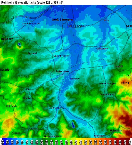
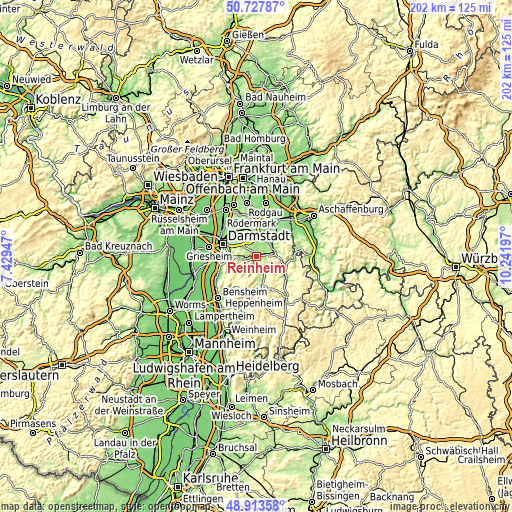
| \ | Map #1 | Map #2 | Topo.Map |
| Scale [m] | 148..272 m | 129..389 m | × |
| Scale [ft] | 486..892 ft | 423..1276 ft | × |
| Average | 186.5 m = 612 ft | 202.2 m = 663 ft | × |
| Width | 6.3 km = 3.9 mi | 12.61 km = 7.8 mi | 201.7 km = 125.3 mi |
| Height | 6.3 km = 3.9 mi | 12.61 km = 7.8 mi | 201.7 km = 125.3 mi |
| ↑Max Latitude | 49.857569° | 49.885892° | 50.72787° |
| Latitude at center | 49.82923° | 49.82923° | 49.82923° |
| ↓Min Latitude | 49.800874° | 49.772501° | 48.91358° |
| ← Min Longitude | 8.791775° | 8.747829° | 7.42947° |
| Longitude center | 8.83572° | 8.83572° | 8.83572° |
| →Max Longitude | 8.879665° | 8.923611° | 10.24197° |
Nearby cities:
Cities around Reinheim sort by population:
• Groß-Umstadt elevation 162 m
8.2 km,  57°
57°
• Ober-Ramstadt 214 m
6.2 km,  271°
271°
• Dieburg 149 m
7.6 km,  5°
5°
• Münster 139 m
10.7 km, 12°
• Groß-Zimmern 150 m
5 km,  354°
354°
• Roßdorf 186 m
6.3 km,  302°
302°
• Höchst im Odenwald 156 m
12.2 km,  105°
105°
• Reichelsheim 214 m
13 km,  178°
178°
• Lützelbach 400 m
10.9 km,  207°
207°
• Brensbach 187 m
7.1 km,  150°
150°
• Groß-Bieberau 177 m
3.3 km,  194°
194°
• Fränkisch-Crumbach 192 m
9.4 km,  169°
169°
Multilingual:
 En español:
Reinheim elevación 169 m.
 En France:
Reinheim élévation 169 m.
 Auf Deutsch:
Reinheim höhe über dem Meeresspiegel ist 169 m.

Sources and notes:
- [note 1] Map square and city borders are not equal. Map elevation data is calculated only from area inside that square.
- [src 1] Elevation data from geonames database provided with same terms of usage.
- [src 2] The elevation map of Reinheim is generated using elevation data from NASA's 3 arcsec (90m) resolution SRTM data.
- [src 3] Base (background) map © OpenStreetMap contributors tiles are generated by Geofabrik and OpenTopoMap.
Copyright & License:
This Reinheim Elevation Map is licensed under CC BY-SA. You may reuse any part from this page, if you give a proper credit by linking to this URL:
 More info on terms of use page.