Remscheid elevation
Remscheid (North Rhine-Westphalia, Düsseldorf District), Germany elevation is 351 meters and Remscheid elevation in feet is 1152 ft above sea level [src 1]. Remscheid is a seat of a third-order administrative division (feature code) with elevation that is 93 meters (305 ft) bigger than average city elevation in Germany.
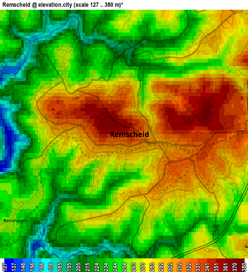
Below is the Elevation map of Remscheid, which displays elevation range with different colors. Scale of the first map is from 127 to 380 m (417 to 1247 ft) with average elevation of 264.1 meters (=866 ft) [note 1]
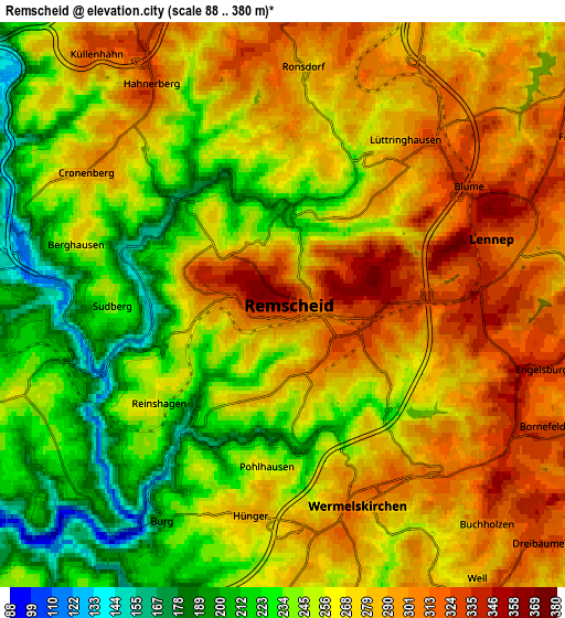
These maps also provides idea of topography and contour of this city, they are displayed at different zoom levels. More info about maps, scale and edge coordinates you can find below images.
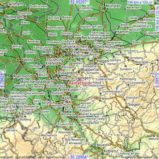
| \ | Map #1 | Map #2 | Topo.Map |
| Scale [m] | 127..380 m | 88..380 m | × |
| Scale [ft] | 417..1247 ft | 289..1247 ft | × |
| Average | 264.1 m = 866 ft | 264.9 m = 869 ft | × |
| Width | 6.13 km = 3.8 mi | 12.25 km = 7.6 mi | 196 km = 121.8 mi |
| Height | 6.13 km = 3.8 mi | 12.25 km = 7.6 mi | 196 km = 121.8 mi |
| ↑Max Latitude | 51.20737° | 51.234894° | 52.05297° |
| Latitude at center | 51.17983° | 51.17983° | 51.17983° |
| ↓Min Latitude | 51.152273° | 51.1247° | 50.28984° |
| ← Min Longitude | 7.148555° | 7.104609° | 5.78625° |
| Longitude center | 7.1925° | 7.1925° | 7.1925° |
| →Max Longitude | 7.236445° | 7.280391° | 8.59875° |
Nearby cities:
Cities around Remscheid sort by population:
• Wuppertal elevation 176 m
9 km,  340°
340°
• Solingen 229 m
7.6 km,  264°
264°
• Wermelskirchen 302 m
4.7 km,  159°
159°
• Schwelm 229 m
13.8 km,  30°
30°
• Haan 168 m
12.6 km,  277°
277°
• Leichlingen 63 m
14.6 km,  235°
235°
• Radevormwald 373 m
12 km,  77°
77°
• Wipperfürth 290 m
16 km,  116°
116°
• Wülfrath 189 m
15.6 km,  316°
316°
• Kürten 181 m
15.3 km, 160°
• Burscheid 191 m
11.9 km,  207°
207°
• Hückeswagen 258 m
11.1 km,  107°
107°
Multilingual:
 En español:
Remscheid elevación 351 m.
 En France:
Remscheid élévation 351 m.
 Auf Deutsch:
Remscheid höhe über dem Meeresspiegel ist 351 m.

Sources and notes:
- [note 1] Map square and city borders are not equal. Map elevation data is calculated only from area inside that square.
- [src 1] Elevation data from geonames database provided with same terms of usage.
- [src 2] The elevation map of Remscheid is generated using elevation data from NASA's 3 arcsec (90m) resolution SRTM data.
- [src 3] Base (background) map © OpenStreetMap contributors tiles are generated by Geofabrik and OpenTopoMap.
Copyright & License:
This Remscheid Elevation Map is licensed under CC BY-SA. You may reuse any part from this page, if you give a proper credit by linking to this URL:
 More info on terms of use page.