Rot am See elevation
Rot am See (Baden-Württemberg, Regierungsbezirk Stuttgart), Germany elevation is 422 meters and Rot am See elevation in feet is 1385 ft above sea level [src 1]. Rot am See is a seat of a fourth-order administrative division (feature code) with elevation that is 164 meters (538 ft) bigger than average city elevation in Germany.
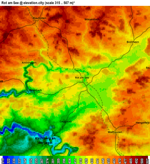
Below is the Elevation map of Rot am See, which displays elevation range with different colors. Scale of the first map is from 389 to 489 m (1276 to 1604 ft) with average elevation of 429 meters (=1407 ft) [note 1]
These maps also provides idea of topography and contour of this city, they are displayed at different zoom levels. More info about maps, scale and edge coordinates you can find below images.

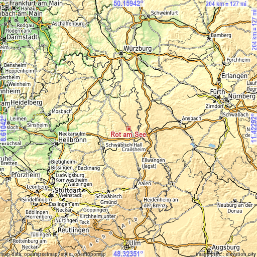
| \ | Map #1 | Map #2 | Topo.Map |
| Scale [m] | 389..489 m | 315..507 m | × |
| Scale [ft] | 1276..1604 ft | 1033..1663 ft | × |
| Average | 429 m = 1407 ft | 439.8 m = 1443 ft | × |
| Width | 6.38 km = 4 mi | 12.76 km = 7.9 mi | 204.1 km = 126.8 mi |
| Height | 6.38 km = 4 mi | 12.76 km = 7.9 mi | 204.1 km = 126.8 mi |
| ↑Max Latitude | 49.278677° | 49.307338° | 50.15942° |
| Latitude at center | 49.25° | 49.25° | 49.25° |
| ↓Min Latitude | 49.221306° | 49.192595° | 48.32351° |
| ← Min Longitude | 9.972725° | 9.928779° | 8.61042° |
| Longitude center | 10.01667° | 10.01667° | 10.01667° |
| →Max Longitude | 10.060615° | 10.104561° | 11.42292° |
Nearby cities:
Cities around Rot am See sort by population:
• Crailsheim elevation 409 m
13.5 km,  162°
162°
• Schrozberg 461 m
10.9 km,  345°
345°
• Ilshofen 443 m
11.4 km,  218°
218°
• Blaufelden 462 m
6.2 km,  329°
329°
• Satteldorf 430 m
10 km,  152°
152°
• Kirchberg an der Jagst 388 m
6 km,  204°
204°
• Wallhausen 438 m
5.5 km,  143°
143°
• Schnelldorf 468 m
13.3 km,  114°
114°
• Wolpertshausen 443 m
15.5 km,  233°
233°
• Langenburg 464 m
11.6 km,  272°
272°
• Diebach 395 m
14.3 km,  62°
62°
• Insingen 388 m
12.2 km, 62°
Multilingual:
 En español:
Rot am See elevación 422 m.
 En France:
Rot am See élévation 422 m.
 Auf Deutsch:
Rot am See höhe über dem Meeresspiegel ist 422 m.

Sources and notes:
- [note 1] Map square and city borders are not equal. Map elevation data is calculated only from area inside that square.
- [src 1] Elevation data from geonames database provided with same terms of usage.
- [src 2] The elevation map of Rot am See is generated using elevation data from NASA's 3 arcsec (90m) resolution SRTM data.
- [src 3] Base (background) map © OpenStreetMap contributors tiles are generated by Geofabrik and OpenTopoMap.
Copyright & License:
This Rot am See Elevation Map is licensed under CC BY-SA. You may reuse any part from this page, if you give a proper credit by linking to this URL:
 More info on terms of use page.