Rottendorf elevation
Rottendorf (Bavaria, Regierungsbezirk Unterfranken), Germany elevation is 251 meters and Rottendorf elevation in feet is 823 ft above sea level [src 1]. Rottendorf is a seat of a fourth-order administrative division (feature code) with elevation that is 7 meters (23 ft) smaller than average city elevation in Germany.
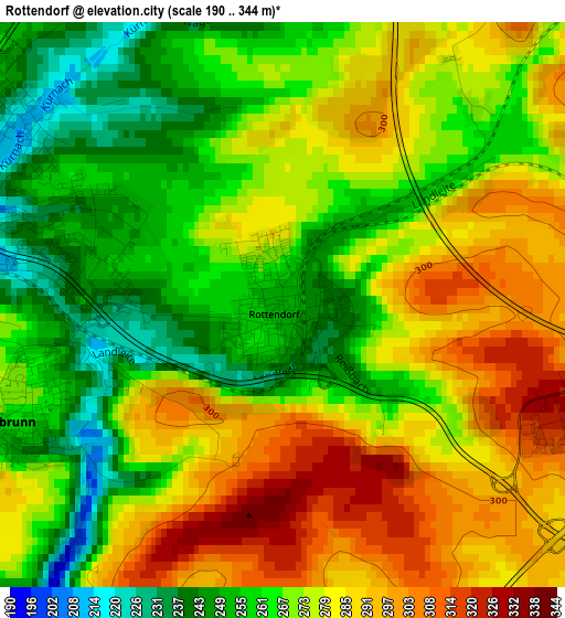
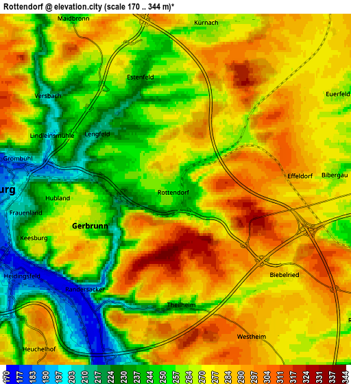
Below is the Elevation map of Rottendorf, which displays elevation range with different colors. Scale of the first map is from 190 to 344 m (623 to 1129 ft) with average elevation of 273.3 meters (=897 ft) [note 1]
These maps also provides idea of topography and contour of this city, they are displayed at different zoom levels. More info about maps, scale and edge coordinates you can find below images.
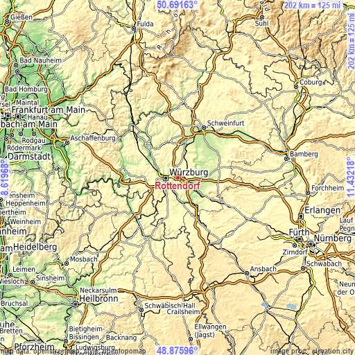
| \ | Map #1 | Map #2 | Topo.Map |
| Scale [m] | 190..344 m | 170..344 m | × |
| Scale [ft] | 623..1129 ft | 558..1129 ft | × |
| Average | 273.3 m = 897 ft | 267.5 m = 878 ft | × |
| Width | 6.31 km = 3.9 mi | 12.62 km = 7.8 mi | 201.9 km = 125.5 mi |
| Height | 6.31 km = 3.9 mi | 12.62 km = 7.8 mi | 201.9 km = 125.5 mi |
| ↑Max Latitude | 49.820661° | 49.849005° | 50.69163° |
| Latitude at center | 49.7923° | 49.7923° | 49.7923° |
| ↓Min Latitude | 49.763922° | 49.735528° | 48.87596° |
| ← Min Longitude | 9.981985° | 9.938039° | 8.61968° |
| Longitude center | 10.02593° | 10.02593° | 10.02593° |
| →Max Longitude | 10.069875° | 10.113821° | 11.43218° |
Nearby cities:
Cities around Rottendorf sort by population:
• Würzburg elevation 204 m
5.4 km,  271°
271°
• Rimpar 234 m
8.7 km,  325°
325°
• Gerbrunn 236 m
3 km,  230°
230°
• Estenfeld 246 m
4.3 km,  340°
340°
• Kürnach 266 m
6.4 km,  4°
4°
• Randersacker 182 m
4.7 km,  220°
220°
• Eibelstadt 183 m
7.8 km,  193°
193°
• Unterpleichfeld 268 m
8.6 km,  8°
8°
• Theilheim 233 m
4.3 km,  175°
175°
• Mainstockheim 207 m
9.1 km,  104°
104°
• Biebelried 276 m
5 km,  124°
124°
• Buchbrunn 247 m
8.7 km,  114°
114°
Multilingual:
 En español:
Rottendorf elevación 251 m.
 En France:
Rottendorf élévation 251 m.
 Auf Deutsch:
Rottendorf höhe über dem Meeresspiegel ist 251 m.

Sources and notes:
- [note 1] Map square and city borders are not equal. Map elevation data is calculated only from area inside that square.
- [src 1] Elevation data from geonames database provided with same terms of usage.
- [src 2] The elevation map of Rottendorf is generated using elevation data from NASA's 3 arcsec (90m) resolution SRTM data.
- [src 3] Base (background) map © OpenStreetMap contributors tiles are generated by Geofabrik and OpenTopoMap.
Copyright & License:
This Rottendorf Elevation Map is licensed under CC BY-SA. You may reuse any part from this page, if you give a proper credit by linking to this URL:
 More info on terms of use page.