Sachsen elevation
Sachsen (Bavaria, Regierungsbezirk Mittelfranken), Germany elevation is 410 meters and Sachsen elevation in feet is 1345 ft above sea level [src 1]. Sachsen is a populated place (feature code) with elevation that is 152 meters (499 ft) bigger than average city elevation in Germany.
Below is the Elevation map of Sachsen, which displays elevation range with different colors. Scale of the first map is from 386 to 485 m (1266 to 1591 ft) with average elevation of 441.6 meters (=1449 ft) [note 1]
These maps also provides idea of topography and contour of this city, they are displayed at different zoom levels. More info about maps, scale and edge coordinates you can find below images.
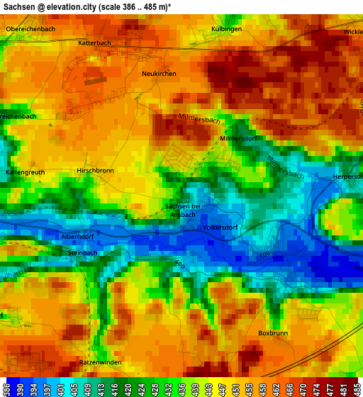
| \ | Map #1 | Topo.Map |
| Scale [m] | 386..485 m | × |
| Scale [ft] | 1266..1591 ft | × |
| Average | 441.6 m = 1449 ft | × |
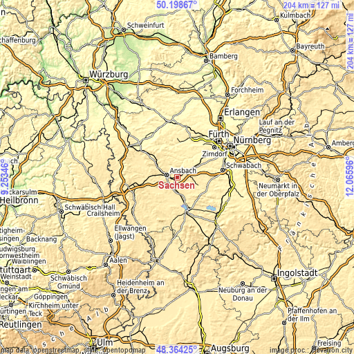
| Width | 6.37 km = 4 mi | 204 km = 126.8 mi |
| Height | 6.37 km = 4 mi | 204 km = 126.8 mi |
| ↑Max Latitude | 49.318644° | 50.19867° |
| Latitude at center | 49.28999° | 49.28999° |
| ↓Min Latitude | 49.261319° | 48.36425° |
| ← Min Longitude | 10.615765° | 9.25346° |
| Longitude center | 10.65971° | 10.65971° |
| →Max Longitude | 10.703655° | 12.06596° |
Nearby cities:
Cities around Sachsen sort by population:
• Ansbach elevation 451 m
5.1 km,  288°
288°
• Heilsbronn 417 m
10.6 km,  61°
61°
• Neuendettelsau 441 m
9 km,  94°
94°
• Dietenhofen 344 m
12.4 km,  10°
10°
• Petersaurach 450 m
6.6 km,  80°
80°
• Burgoberbach 467 m
8.4 km,  221°
221°
• Lehrberg 423 m
12.4 km,  299°
299°
• Wolframs-Eschenbach 438 m
8.6 km,  144°
144°
• Merkendorf 434 m
10.1 km,  161°
161°
• Weihenzell 399 m
7.4 km,  334°
334°
• Weidenbach 439 m
10.3 km,  186°
186°
• Bruckberg 340 m
8.3 km,  20°
20°
Multilingual:
 En español:
Sachsen elevación 410 m.
 En France:
Sachsen élévation 410 m.


Sources and notes:
- [note 1] Map square and city borders are not equal. Map elevation data is calculated only from area inside that square.
- [src 1] Elevation data from geonames database provided with same terms of usage.
- [src 2] The elevation map of Sachsen is generated using elevation data from NASA's 3 arcsec (90m) resolution SRTM data.
- [src 3] Base (background) map © OpenStreetMap contributors tiles are generated by Geofabrik and OpenTopoMap.
Copyright & License:
This Sachsen Elevation Map is licensed under CC BY-SA. You may reuse any part from this page, if you give a proper credit by linking to this URL:
 More info on terms of use page.