Salzweg elevation
Salzweg (Bavaria, Lower Bavaria), Germany elevation is 454 meters and Salzweg elevation in feet is 1490 ft above sea level [src 1]. Salzweg is a seat of a fourth-order administrative division (feature code) with elevation that is 196 meters (643 ft) bigger than average city elevation in Germany.
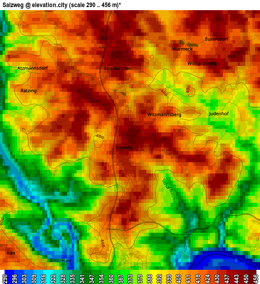
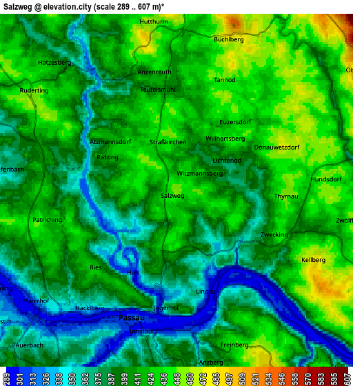
Below is the Elevation map of Salzweg, which displays elevation range with different colors. Scale of the first map is from 290 to 456 m (951 to 1496 ft) with average elevation of 396.8 meters (=1302 ft) [note 1]
These maps also provides idea of topography and contour of this city, they are displayed at different zoom levels. More info about maps, scale and edge coordinates you can find below images.
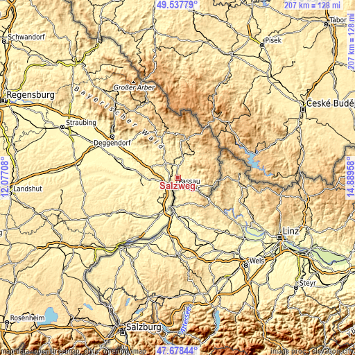
| \ | Map #1 | Map #2 | Topo.Map |
| Scale [m] | 290..456 m | 289..607 m | × |
| Scale [ft] | 951..1496 ft | 948..1991 ft | × |
| Average | 396.8 m = 1302 ft | 402.7 m = 1321 ft | × |
| Width | 6.46 km = 4 mi | 12.92 km = 8 mi | 206.7 km = 128.4 mi |
| Height | 6.46 km = 4 mi | 12.92 km = 8 mi | 206.7 km = 128.4 mi |
| ↑Max Latitude | 48.645714° | 48.67474° | 49.53779° |
| Latitude at center | 48.61667° | 48.61667° | 48.61667° |
| ↓Min Latitude | 48.58761° | 48.558533° | 47.67844° |
| ← Min Longitude | 13.439385° | 13.395439° | 12.07708° |
| Longitude center | 13.48333° | 13.48333° | 13.48333° |
| →Max Longitude | 13.527275° | 13.571221° | 14.88958° |
Nearby cities:
Cities around Salzweg sort by population:
• Passau elevation 366 m
6.8 km,  214°
214°
• Hauzenberg 526 m
11.1 km,  70°
70°
• Hutthurm 460 m
6.3 km,  352°
352°
• Röhrnbach 432 m
13.9 km,  12°
12°
• Neuburg 432 m
12.5 km,  192°
192°
• Thyrnau 432 m
3.7 km,  90°
90°
• Büchlberg 472 m
6.7 km,  24°
24°
• Obernzell 295 m
13.2 km,  121°
121°
• Ruderting 448 m
6.1 km,  307°
307°
• Witzmannsberg 430 m
1 km,  52°
52°
• Haselbach 348 m
7.6 km,  295°
295°
• Fürsteneck 354 m
11.2 km, 353°
Multilingual:
 En español:
Salzweg elevación 454 m.
 En France:
Salzweg élévation 454 m.


Sources and notes:
- [note 1] Map square and city borders are not equal. Map elevation data is calculated only from area inside that square.
- [src 1] Elevation data from geonames database provided with same terms of usage.
- [src 2] The elevation map of Salzweg is generated using elevation data from NASA's 3 arcsec (90m) resolution SRTM data.
- [src 3] Base (background) map © OpenStreetMap contributors tiles are generated by Geofabrik and OpenTopoMap.
Copyright & License:
This Salzweg Elevation Map is licensed under CC BY-SA. You may reuse any part from this page, if you give a proper credit by linking to this URL:
 More info on terms of use page.