Schalksmühle elevation
Schalksmühle (North Rhine-Westphalia, Regierungsbezirk Arnsberg), Germany elevation is 253 meters and Schalksmühle elevation in feet is 830 ft above sea level [src 1]. Schalksmühle is a seat of a fourth-order administrative division (feature code) with elevation that is 5 meters (16 ft) smaller than average city elevation in Germany.
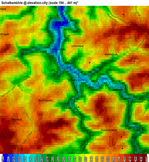
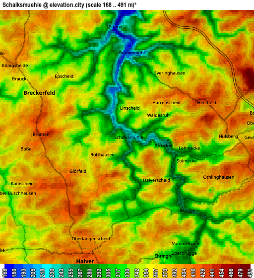
Below is the Elevation map of Schalksmühle, which displays elevation range with different colors. Scale of the first map is from 194 to 441 m (636 to 1447 ft) with average elevation of 343.7 meters (=1128 ft) [note 1]
These maps also provides idea of topography and contour of this city, they are displayed at different zoom levels. More info about maps, scale and edge coordinates you can find below images.
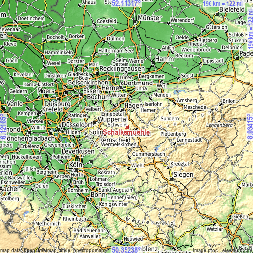
| \ | Map #1 | Map #2 | Topo.Map |
| Scale [m] | 194..441 m | 168..491 m | × |
| Scale [ft] | 636..1447 ft | 551..1611 ft | × |
| Average | 343.7 m = 1128 ft | 359.5 m = 1179 ft | × |
| Width | 6.12 km = 3.8 mi | 12.24 km = 7.6 mi | 195.8 km = 121.7 mi |
| Height | 6.12 km = 3.8 mi | 12.24 km = 7.6 mi | 195.8 km = 121.7 mi |
| ↑Max Latitude | 51.268703° | 51.29619° | 52.11317° |
| Latitude at center | 51.2412° | 51.2412° | 51.2412° |
| ↓Min Latitude | 51.21368° | 51.186144° | 50.35238° |
| ← Min Longitude | 7.483955° | 7.440009° | 6.12165° |
| Longitude center | 7.5279° | 7.5279° | 7.5279° |
| →Max Longitude | 7.571845° | 7.615791° | 8.93415° |
Nearby cities:
Cities around Schalksmühle sort by population:
• Hagen elevation 111 m
13.9 km,  343°
343°
• Lüdenscheid 410 m
7.3 km,  108°
108°
• Gevelsberg 166 m
15.8 km,  303°
303°
• Ennepetal 197 m
13.1 km, 299°
• Radevormwald 373 m
12.5 km,  249°
249°
• Altena 167 m
11.7 km,  59°
59°
• Kierspe 404 m
12.7 km,  159°
159°
• Halver 414 m
6.5 km,  198°
198°
• Hückeswagen 258 m
16.3 km,  231°
231°
• Breckerfeld 388 m
4.6 km, 295°
• Herscheid 428 m
16.5 km, 114°
• Nachrodt-Wiblingwerde 419 m
10.4 km,  36°
36°
Multilingual:
 En español:
Schalksmühle elevación 253 m.
 En France:
Schalksmühle élévation 253 m.
 Auf Deutsch:
Schalksmühle höhe über dem Meeresspiegel ist 253 m.

Sources and notes:
- [note 1] Map square and city borders are not equal. Map elevation data is calculated only from area inside that square.
- [src 1] Elevation data from geonames database provided with same terms of usage.
- [src 2] The elevation map of Schalksmühle is generated using elevation data from NASA's 3 arcsec (90m) resolution SRTM data.
- [src 3] Base (background) map © OpenStreetMap contributors tiles are generated by Geofabrik and OpenTopoMap.
Copyright & License:
This Schalksmühle Elevation Map is licensed under CC BY-SA. You may reuse any part from this page, if you give a proper credit by linking to this URL:
 More info on terms of use page.