Schlüchtern elevation
Schlüchtern (Hesse, Regierungsbezirk Darmstadt), Germany elevation is 211 meters and Schlüchtern elevation in feet is 692 ft above sea level [src 1]. Schlüchtern is a populated place (feature code) with elevation that is 47 meters (154 ft) smaller than average city elevation in Germany.
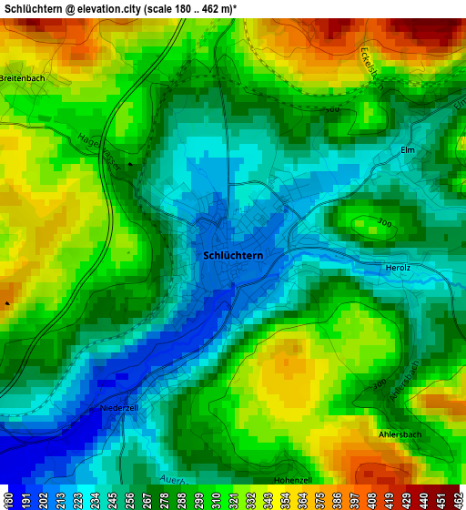
Below is the Elevation map of Schlüchtern, which displays elevation range with different colors. Scale of the first map is from 180 to 462 m (591 to 1516 ft) with average elevation of 287.7 meters (=944 ft) [note 1]
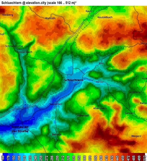
These maps also provides idea of topography and contour of this city, they are displayed at different zoom levels. More info about maps, scale and edge coordinates you can find below images.
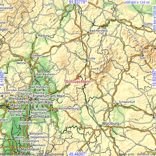
| \ | Map #1 | Map #2 | Topo.Map |
| Scale [m] | 180..462 m | 166..512 m | × |
| Scale [ft] | 591..1516 ft | 545..1680 ft | × |
| Average | 287.7 m = 944 ft | 339.3 m = 1113 ft | × |
| Width | 6.24 km = 3.9 mi | 12.47 km = 7.7 mi | 199.6 km = 124 mi |
| Height | 6.24 km = 3.9 mi | 12.47 km = 7.7 mi | 199.5 km = 124 mi |
| ↑Max Latitude | 50.376944° | 50.404961° | 51.23779° |
| Latitude at center | 50.34891° | 50.34891° | 50.34891° |
| ↓Min Latitude | 50.32086° | 50.292793° | 49.44307° |
| ← Min Longitude | 9.481375° | 9.437429° | 8.11907° |
| Longitude center | 9.52532° | 9.52532° | 9.52532° |
| →Max Longitude | 9.569265° | 9.613211° | 10.93157° |
Nearby cities:
Cities around Schlüchtern sort by population:
• Bad Soden-Salmünster elevation 153 m
13.9 km,  234°
234°
• Neuhof 275 m
13.3 km,  29°
29°
• Steinau an der Straße 175 m
5.9 km, 228°
• Bad Orb 171 m
18.4 km,  223°
223°
• Flieden 299 m
8.8 km,  19°
19°
• Bad Brückenau 315 m
19.3 km,  103°
103°
• Birstein 319 m
16 km,  270°
270°
• Hosenfeld 377 m
17.7 km,  349°
349°
• Freiensteinau 432 m
12.1 km,  314°
314°
• Zeitlofs 248 m
14.2 km,  132°
132°
• Motten 413 m
18.3 km,  73°
73°
• Obersinn 208 m
16.8 km,  157°
157°
Multilingual:
 En español:
Schlüchtern elevación 211 m.
 En France:
Schlüchtern élévation 211 m.
 Auf Deutsch:
Schlüchtern höhe über dem Meeresspiegel ist 211 m.

Sources and notes:
- [note 1] Map square and city borders are not equal. Map elevation data is calculated only from area inside that square.
- [src 1] Elevation data from geonames database provided with same terms of usage.
- [src 2] The elevation map of Schlüchtern is generated using elevation data from NASA's 3 arcsec (90m) resolution SRTM data.
- [src 3] Base (background) map © OpenStreetMap contributors tiles are generated by Geofabrik and OpenTopoMap.
Copyright & License:
This Schlüchtern Elevation Map is licensed under CC BY-SA. You may reuse any part from this page, if you give a proper credit by linking to this URL:
 More info on terms of use page.