Schnaitsee elevation
Schnaitsee (Bavaria, Upper Bavaria), Germany elevation is 576 meters and Schnaitsee elevation in feet is 1890 ft above sea level [src 1]. Schnaitsee is a seat of a fourth-order administrative division (feature code) with elevation that is 318 meters (1043 ft) bigger than average city elevation in Germany.
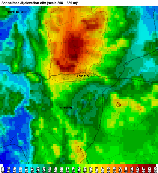
Below is the Elevation map of Schnaitsee, which displays elevation range with different colors. Scale of the first map is from 508 to 659 m (1667 to 2162 ft) with average elevation of 569.3 meters (=1868 ft) [note 1]
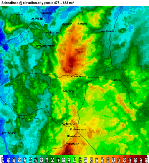
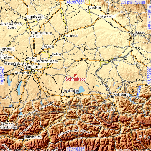
These maps also provides idea of topography and contour of this city, they are displayed at different zoom levels. More info about maps, scale and edge coordinates you can find below images.
| \ | Map #1 | Map #2 | Topo.Map |
| Scale [m] | 508..659 m | 475..668 m | × |
| Scale [ft] | 1667..2162 ft | 1558..2192 ft | × |
| Average | 569.3 m = 1868 ft | 550.5 m = 1806 ft | × |
| Width | 6.53 km = 4.1 mi | 13.06 km = 8.1 mi | 209 km = 129.9 mi |
| Height | 6.53 km = 4.1 mi | 13.06 km = 8.1 mi | 209 km = 129.9 mi |
| ↑Max Latitude | 48.096029° | 48.125371° | 48.99785° |
| Latitude at center | 48.06667° | 48.06667° | 48.06667° |
| ↓Min Latitude | 48.037294° | 48.007902° | 47.11833° |
| ← Min Longitude | 12.322725° | 12.278779° | 10.96042° |
| Longitude center | 12.36667° | 12.36667° | 12.36667° |
| →Max Longitude | 12.410615° | 12.454561° | 13.77292° |
Nearby cities:
Cities around Schnaitsee sort by population:
• Wasserburg am Inn elevation 461 m
10.8 km,  261°
261°
• Obing 567 m
7.9 km,  158°
158°
• Gars 444 m
11.7 km,  325°
325°
• Amerang 538 m
9.4 km,  207°
207°
• Eiselfing 482 m
9.6 km,  252°
252°
• Babensham 488 m
7.7 km,  284°
284°
• Soyen 480 m
12.5 km,  291°
291°
• Unterreit 493 m
6.1 km,  335°
335°
• Pittenhart 560 m
10.1 km,  170°
170°
• Kienberg 550 m
8 km,  116°
116°
• Taufkirchen 486 m
11.1 km,  33°
33°
• Schonstett 485 m
12.7 km,  223°
223°
Multilingual:
 En español:
Schnaitsee elevación 576 m.
 En France:
Schnaitsee élévation 576 m.
 Auf Deutsch:
Schnaitsee höhe über dem Meeresspiegel ist 576 m.

Sources and notes:
- [note 1] Map square and city borders are not equal. Map elevation data is calculated only from area inside that square.
- [src 1] Elevation data from geonames database provided with same terms of usage.
- [src 2] The elevation map of Schnaitsee is generated using elevation data from NASA's 3 arcsec (90m) resolution SRTM data.
- [src 3] Base (background) map © OpenStreetMap contributors tiles are generated by Geofabrik and OpenTopoMap.
Copyright & License:
This Schnaitsee Elevation Map is licensed under CC BY-SA. You may reuse any part from this page, if you give a proper credit by linking to this URL:
 More info on terms of use page.