Schömberg elevation
Schömberg (Baden-Württemberg, Karlsruhe Region), Germany elevation is 629 meters and Schömberg elevation in feet is 2064 ft above sea level [src 1]. Schömberg is a seat of a fourth-order administrative division (feature code) with elevation that is 371 meters (1217 ft) bigger than average city elevation in Germany.
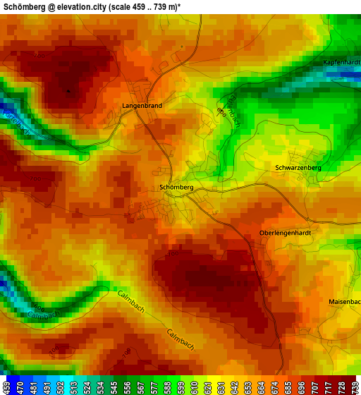
Below is the Elevation map of Schömberg, which displays elevation range with different colors. Scale of the first map is from 459 to 739 m (1506 to 2425 ft) with average elevation of 654.5 meters (=2147 ft) [note 1]
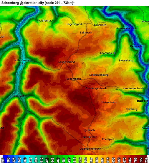
These maps also provides idea of topography and contour of this city, they are displayed at different zoom levels. More info about maps, scale and edge coordinates you can find below images.
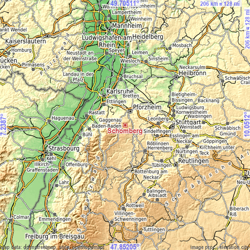
| \ | Map #1 | Map #2 | Topo.Map |
| Scale [m] | 459..739 m | 291..739 m | × |
| Scale [ft] | 1506..2425 ft | 955..2425 ft | × |
| Average | 654.5 m = 2147 ft | 583.3 m = 1914 ft | × |
| Width | 6.44 km = 4 mi | 12.88 km = 8 mi | 206 km = 128 mi |
| Height | 6.44 km = 4 mi | 12.88 km = 8 mi | 206 km = 128 mi |
| ↑Max Latitude | 48.816075° | 48.845004° | 49.70511° |
| Latitude at center | 48.78713° | 48.78713° | 48.78713° |
| ↓Min Latitude | 48.758168° | 48.729189° | 47.85205° |
| ← Min Longitude | 8.601005° | 8.557059° | 7.2387° |
| Longitude center | 8.64495° | 8.64495° | 8.64495° |
| →Max Longitude | 8.688895° | 8.732841° | 10.0512° |
Nearby cities:
Cities around Schömberg sort by population:
• Calw elevation 339 m
10.7 km,  139°
139°
• Birkenfeld 382 m
8.9 km,  354°
354°
• Bad Liebenzell 332 m
6.4 km,  102°
102°
• Bad Wildbad 432 m
8 km,  239°
239°
• Neuenbürg 326 m
7.4 km,  330°
330°
• Neuhausen 491 m
9.7 km,  86°
86°
• Engelsbrand 576 m
5.2 km,  4°
4°
• Bad Teinach-Zavelstein 469 m
11.3 km,  161°
161°
• Oberreichenbach 617 m
6.2 km,  165°
165°
• Unterreichenbach 310 m
6.3 km,  48°
48°
• Dobel 707 m
10.7 km,  277°
277°
• Höfen an der Enz 368 m
4.7 km,  287°
287°
Multilingual:
 En español:
Schömberg elevación 629 m.
 En France:
Schömberg élévation 629 m.
 Auf Deutsch:
Schömberg höhe über dem Meeresspiegel ist 629 m.

Sources and notes:
- [note 1] Map square and city borders are not equal. Map elevation data is calculated only from area inside that square.
- [src 1] Elevation data from geonames database provided with same terms of usage.
- [src 2] The elevation map of Schömberg is generated using elevation data from NASA's 3 arcsec (90m) resolution SRTM data.
- [src 3] Base (background) map © OpenStreetMap contributors tiles are generated by Geofabrik and OpenTopoMap.
Copyright & License:
This Schömberg Elevation Map is licensed under CC BY-SA. You may reuse any part from this page, if you give a proper credit by linking to this URL:
 More info on terms of use page.