Bad Wildbad elevation
Bad Wildbad (Baden-Württemberg, Karlsruhe Region), Germany elevation is 432 meters and Bad Wildbad elevation in feet is 1417 ft above sea level [src 1]. Bad Wildbad is a populated place (feature code) with elevation that is 174 meters (571 ft) bigger than average city elevation in Germany.
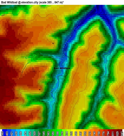
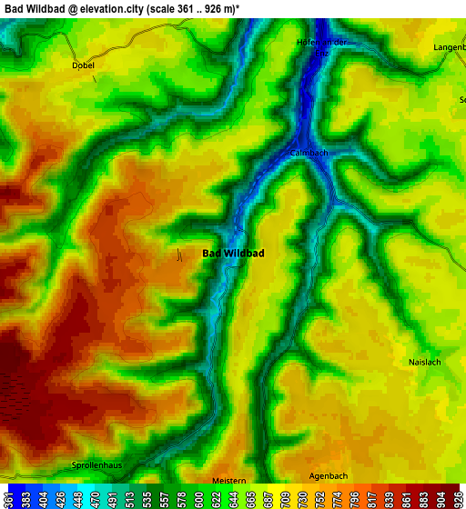
Below is the Elevation map of Bad Wildbad, which displays elevation range with different colors. Scale of the first map is from 385 to 847 m (1263 to 2779 ft) with average elevation of 642.1 meters (=2107 ft) [note 1]
These maps also provides idea of topography and contour of this city, they are displayed at different zoom levels. More info about maps, scale and edge coordinates you can find below images.
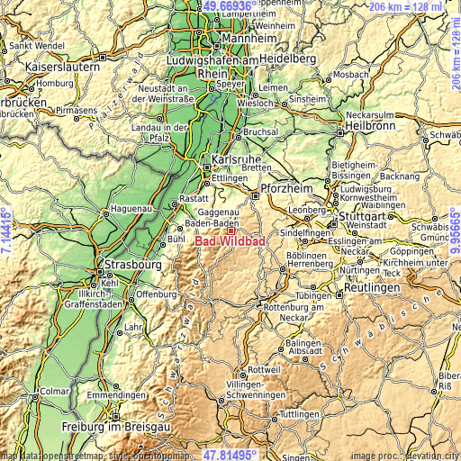
| \ | Map #1 | Map #2 | Topo.Map |
| Scale [m] | 385..847 m | 361..926 m | × |
| Scale [ft] | 1263..2779 ft | 1184..3038 ft | × |
| Average | 642.1 m = 2107 ft | 672.2 m = 2205 ft | × |
| Width | 6.44 km = 4 mi | 12.89 km = 8 mi | 206.2 km = 128.1 mi |
| Height | 6.44 km = 4 mi | 12.89 km = 8 mi | 206.2 km = 128.1 mi |
| ↑Max Latitude | 48.779676° | 48.808626° | 49.66936° |
| Latitude at center | 48.75071° | 48.75071° | 48.75071° |
| ↓Min Latitude | 48.721727° | 48.692727° | 47.81495° |
| ← Min Longitude | 8.506455° | 8.462509° | 7.14415° |
| Longitude center | 8.5504° | 8.5504° | 8.5504° |
| →Max Longitude | 8.594345° | 8.638291° | 9.95665° |
Nearby cities:
Cities around Bad Wildbad sort by population:
• Bad Liebenzell elevation 332 m
13.4 km,  78°
78°
• Schömberg 629 m
8 km,  59°
59°
• Neuenbürg 326 m
11 km,  17°
17°
• Bad Herrenalb 365 m
9.9 km,  302°
302°
• Engelsbrand 576 m
11.7 km,  38°
38°
• Neuweiler 670 m
10 km,  158°
158°
• Bad Teinach-Zavelstein 469 m
12.4 km,  122°
122°
• Oberreichenbach 617 m
8.7 km,  102°
102°
• Loffenau 329 m
12.4 km,  281°
281°
• Dobel 707 m
6.6 km,  326°
326°
• Höfen an der Enz 368 m
6 km, 23°
• Enzklösterle 597 m
11 km,  211°
211°
Multilingual:
 En español:
Bad Wildbad elevación 432 m.
 En France:
Bad Wildbad élévation 432 m.
 Auf Deutsch:
Bad Wildbad im Schwarzwald höhe über dem Meeresspiegel ist 432 m.

Sources and notes:
- [note 1] Map square and city borders are not equal. Map elevation data is calculated only from area inside that square.
- [src 1] Elevation data from geonames database provided with same terms of usage.
- [src 2] The elevation map of Bad Wildbad is generated using elevation data from NASA's 3 arcsec (90m) resolution SRTM data.
- [src 3] Base (background) map © OpenStreetMap contributors tiles are generated by Geofabrik and OpenTopoMap.
Copyright & License:
This Bad Wildbad Elevation Map is licensed under CC BY-SA. You may reuse any part from this page, if you give a proper credit by linking to this URL:
 More info on terms of use page.