Schwabhausen elevation
Schwabhausen (Bavaria, Upper Bavaria), Germany elevation is 507 meters and Schwabhausen elevation in feet is 1663 ft above sea level [src 1]. Schwabhausen is a populated place (feature code) with elevation that is 249 meters (817 ft) bigger than average city elevation in Germany.
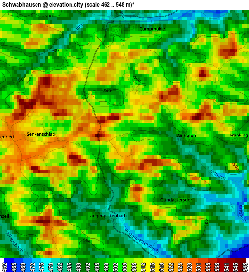
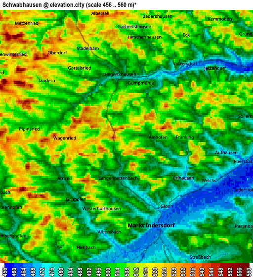
Below is the Elevation map of Schwabhausen, which displays elevation range with different colors. Scale of the first map is from 462 to 548 m (1516 to 1798 ft) with average elevation of 502.3 meters (=1648 ft) [note 1]
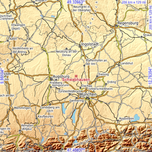
These maps also provides idea of topography and contour of this city, they are displayed at different zoom levels. More info about maps, scale and edge coordinates you can find below images.
| \ | Map #1 | Map #2 | Topo.Map |
| Scale [m] | 462..548 m | 456..560 m | × |
| Scale [ft] | 1516..1798 ft | 1496..1837 ft | × |
| Average | 502.3 m = 1648 ft | 500.1 m = 1641 ft | × |
| Width | 6.49 km = 4 mi | 12.98 km = 8.1 mi | 207.6 km = 129 mi |
| Height | 6.49 km = 4 mi | 12.98 km = 8.1 mi | 207.6 km = 129 mi |
| ↑Max Latitude | 48.430737° | 48.459888° | 49.32663° |
| Latitude at center | 48.40157° | 48.40157° | 48.40157° |
| ↓Min Latitude | 48.372386° | 48.343185° | 47.45937° |
| ← Min Longitude | 11.313345° | 11.269399° | 9.95104° |
| Longitude center | 11.35729° | 11.35729° | 11.35729° |
| →Max Longitude | 11.401235° | 11.445181° | 12.76354° |
Nearby cities:
Cities around Schwabhausen sort by population:
• Markt Indersdorf elevation 469 m
4.8 km,  161°
161°
• Altomünster 510 m
7.6 km,  258°
258°
• Röhrmoos 494 m
10.4 km,  140°
140°
• Petershausen 463 m
8.4 km,  83°
83°
• Erdweg 480 m
8.7 km,  207°
207°
• Vierkirchen 485 m
9 km,  115°
115°
• Hilgertshausen-Tandern 491 m
3.1 km,  355°
355°
• Gerolsbach 462 m
10.2 km,  1°
1°
• Weichs 483 m
4.8 km,  114°
114°
• Ried 450 m
11 km,  319°
319°
• Jetzendorf 484 m
5.6 km,  51°
51°
• Schiltberg 454 m
10.5 km,  310°
310°
Multilingual:
 En español:
Schwabhausen elevación 507 m.
 En France:
Schwabhausen élévation 507 m.
 Auf Deutsch:
Schwabhausen höhe über dem Meeresspiegel ist 507 m.

Sources and notes:
- [note 1] Map square and city borders are not equal. Map elevation data is calculated only from area inside that square.
- [src 1] Elevation data from geonames database provided with same terms of usage.
- [src 2] The elevation map of Schwabhausen is generated using elevation data from NASA's 3 arcsec (90m) resolution SRTM data.
- [src 3] Base (background) map © OpenStreetMap contributors tiles are generated by Geofabrik and OpenTopoMap.
Copyright & License:
This Schwabhausen Elevation Map is licensed under CC BY-SA. You may reuse any part from this page, if you give a proper credit by linking to this URL:
 More info on terms of use page.