Seevetal elevation
Seevetal (Lower Saxony), Germany elevation is 45 meters and Seevetal elevation in feet is 148 ft above sea level [src 1]. Seevetal is a seat of a fourth-order administrative division (feature code) with elevation that is 213 meters (699 ft) smaller than average city elevation in Germany.
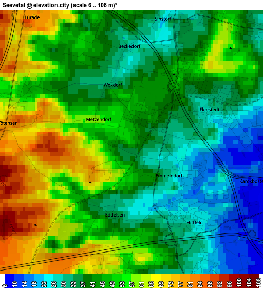
Below is the Elevation map of Seevetal, which displays elevation range with different colors. Scale of the first map is from 6 to 108 m (20 to 354 ft) with average elevation of 46 meters (=151 ft) [note 1]
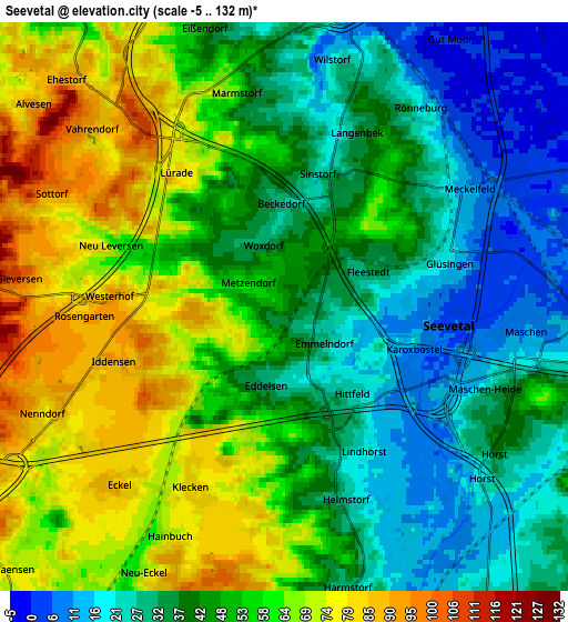
These maps also provides idea of topography and contour of this city, they are displayed at different zoom levels. More info about maps, scale and edge coordinates you can find below images.
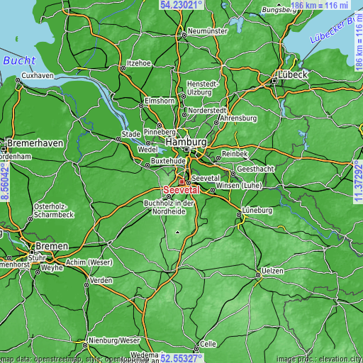
| \ | Map #1 | Map #2 | Topo.Map |
| Scale [m] | 6..108 m | -5..132 m | × |
| Scale [ft] | 20..354 ft | -16..433 ft | × |
| Average | 46 m = 151 ft | 48 m = 157 ft | × |
| Width | 5.83 km = 3.6 mi | 11.65 km = 7.2 mi | 186.5 km = 115.9 mi |
| Height | 5.83 km = 3.6 mi | 11.65 km = 7.2 mi | 186.4 km = 115.8 mi |
| ↑Max Latitude | 53.426193° | 53.45237° | 54.23021° |
| Latitude at center | 53.4° | 53.4° | 53.4° |
| ↓Min Latitude | 53.373791° | 53.347565° | 52.55327° |
| ← Min Longitude | 9.922725° | 9.878779° | 8.56042° |
| Longitude center | 9.96667° | 9.96667° | 9.96667° |
| →Max Longitude | 10.010615° | 10.054561° | 11.37292° |
Nearby cities:
Cities around Seevetal sort by population:
• Harburg elevation 10 m
6.8 km,  9°
9°
• Buchholz in der Nordheide 75 m
10.5 km,  218°
218°
• Neu Wulmstorf 14 m
13.3 km,  303°
303°
• Stelle 8 m
9.8 km,  100°
100°
• Jesteburg 50 m
10.1 km,  185°
185°
• Bendestorf 72 m
7.1 km,  182°
182°
• Appel 30 m
14.7 km,  265°
265°
• Asendorf 37 m
12 km, 176°
• Brackel 45 m
12.4 km,  153°
153°
• Wenzendorf 53 m
14.1 km,  246°
246°
• Marxen 28 m
10.1 km,  165°
165°
• Kleiner Grasbrook 6 m
14.7 km, 6°
Multilingual:
 En español:
Seevetal elevación 45 m.
 En France:
Seevetal élévation 45 m.


Sources and notes:
- [note 1] Map square and city borders are not equal. Map elevation data is calculated only from area inside that square.
- [src 1] Elevation data from geonames database provided with same terms of usage.
- [src 2] The elevation map of Seevetal is generated using elevation data from NASA's 3 arcsec (90m) resolution SRTM data.
- [src 3] Base (background) map © OpenStreetMap contributors tiles are generated by Geofabrik and OpenTopoMap.
Copyright & License:
This Seevetal Elevation Map is licensed under CC BY-SA. You may reuse any part from this page, if you give a proper credit by linking to this URL:
 More info on terms of use page.