Siegburg elevation
Siegburg (North Rhine-Westphalia, Regierungsbezirk Köln), Germany elevation is 71 meters and Siegburg elevation in feet is 233 ft above sea level [src 1]. Siegburg is a seat of a third-order administrative division (feature code) with elevation that is 187 meters (614 ft) smaller than average city elevation in Germany.
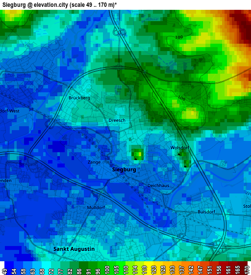
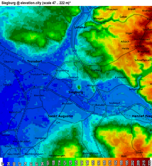
Below is the Elevation map of Siegburg, which displays elevation range with different colors. Scale of the first map is from 49 to 170 m (161 to 558 ft) with average elevation of 73.1 meters (=240 ft) [note 1]
These maps also provides idea of topography and contour of this city, they are displayed at different zoom levels. More info about maps, scale and edge coordinates you can find below images.
| \ | Map #1 | Map #2 | Topo.Map |
| Scale [m] | 49..170 m | 47..222 m | × |
| Scale [ft] | 161..558 ft | 154..728 ft | × |
| Average | 73.1 m = 240 ft | 95.7 m = 314 ft | × |
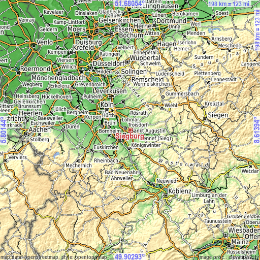
| Width | 6.18 km = 3.8 mi | 12.35 km = 7.7 mi | 197.7 km = 122.8 mi |
| Height | 6.18 km = 3.8 mi | 12.35 km = 7.7 mi | 197.6 km = 122.8 mi |
| ↑Max Latitude | 50.827956° | 50.855706° | 51.68054° |
| Latitude at center | 50.80019° | 50.80019° | 50.80019° |
| ↓Min Latitude | 50.772407° | 50.744608° | 49.90293° |
| ← Min Longitude | 7.163745° | 7.119799° | 5.80144° |
| Longitude center | 7.20769° | 7.20769° | 7.20769° |
| →Max Longitude | 7.251635° | 7.295581° | 8.61394° |
Nearby cities:
Cities around Siegburg sort by population:
• Bonn elevation 64 m
10.8 km,  227°
227°
• Troisdorf 55 m
4.2 km,  283°
283°
• Sankt Augustin 69 m
2.9 km,  195°
195°
• Hennef 70 m
6 km,  117°
117°
• Königswinter 60 m
13 km,  186°
186°
• Niederkassel 59 m
12.1 km, 277°
• Lohmar 77 m
4.3 km,  5°
5°
• Rösrath 89 m
10.8 km,  350°
350°
• Porz am Rhein 54 m
14.2 km,  312°
312°
• Eil 52 m
13.7 km,  319°
319°
• Wahn-Heide 59 m
9.6 km, 312°
• Stoßdorf 67 m
3.6 km, 122°
Multilingual:
 En español:
Siegburg elevación 71 m.
 En France:
Siegburg élévation 71 m.


Sources and notes:
- [note 1] Map square and city borders are not equal. Map elevation data is calculated only from area inside that square.
- [src 1] Elevation data from geonames database provided with same terms of usage.
- [src 2] The elevation map of Siegburg is generated using elevation data from NASA's 3 arcsec (90m) resolution SRTM data.
- [src 3] Base (background) map © OpenStreetMap contributors tiles are generated by Geofabrik and OpenTopoMap.
Copyright & License:
This Siegburg Elevation Map is licensed under CC BY-SA. You may reuse any part from this page, if you give a proper credit by linking to this URL:
 More info on terms of use page.