Sontra elevation
Sontra (Hesse, Regierungsbezirk Kassel), Germany elevation is 225 meters and Sontra elevation in feet is 738 ft above sea level [src 1]. Sontra is a populated place (feature code) with elevation that is 33 meters (108 ft) smaller than average city elevation in Germany.
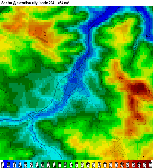
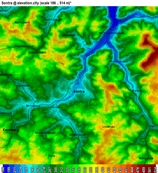
Below is the Elevation map of Sontra, which displays elevation range with different colors. Scale of the first map is from 204 to 463 m (669 to 1519 ft) with average elevation of 309.4 meters (=1015 ft) [note 1]
These maps also provides idea of topography and contour of this city, they are displayed at different zoom levels. More info about maps, scale and edge coordinates you can find below images.
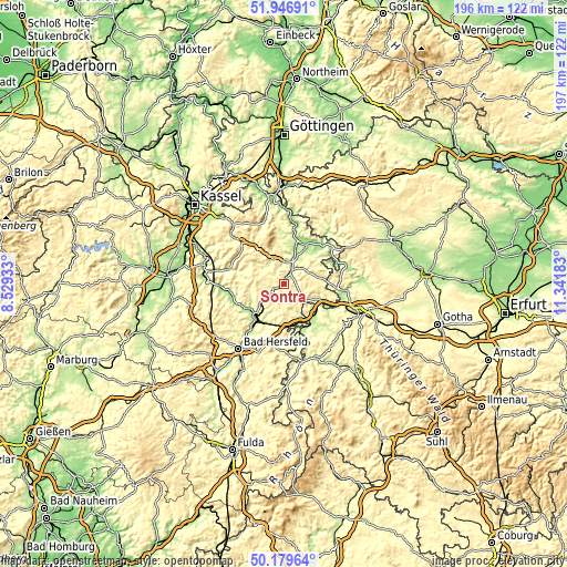
| \ | Map #1 | Map #2 | Topo.Map |
| Scale [m] | 204..463 m | 186..514 m | × |
| Scale [ft] | 669..1519 ft | 610..1686 ft | × |
| Average | 309.4 m = 1015 ft | 323.2 m = 1060 ft | × |
| Width | 6.14 km = 3.8 mi | 12.28 km = 7.6 mi | 196.5 km = 122.1 mi |
| Height | 6.14 km = 3.8 mi | 12.28 km = 7.6 mi | 196.5 km = 122.1 mi |
| ↑Max Latitude | 51.099315° | 51.126903° | 51.94691° |
| Latitude at center | 51.07171° | 51.07171° | 51.07171° |
| ↓Min Latitude | 51.044089° | 51.016451° | 50.17964° |
| ← Min Longitude | 9.891635° | 9.847689° | 8.52933° |
| Longitude center | 9.93558° | 9.93558° | 9.93558° |
| →Max Longitude | 9.979525° | 10.023471° | 11.34183° |
Nearby cities:
Cities around Sontra sort by population:
• Eschwege elevation 175 m
14.9 km,  33°
33°
• Bebra 200 m
14.6 km,  222°
222°
• Rotenburg an der Fulda 188 m
16.8 km,  239°
239°
• Waldkappel 237 m
9.1 km,  333°
333°
• Gerstungen 218 m
14.8 km,  141°
141°
• Nentershausen 287 m
6.1 km,  181°
181°
• Ronshausen 219 m
14.8 km,  203°
203°
• Breitenbach 200 m
16.7 km, 219°
• Cornberg 289 m
6.2 km, 237°
• Ifta 299 m
17.3 km,  91°
91°
• Dankmarshausen 230 m
17.2 km,  160°
160°
• Lauchröden 205 m
17.7 km,  119°
119°
Multilingual:
 En español:
Sontra elevación 225 m.
 En France:
Sontra élévation 225 m.


Sources and notes:
- [note 1] Map square and city borders are not equal. Map elevation data is calculated only from area inside that square.
- [src 1] Elevation data from geonames database provided with same terms of usage.
- [src 2] The elevation map of Sontra is generated using elevation data from NASA's 3 arcsec (90m) resolution SRTM data.
- [src 3] Base (background) map © OpenStreetMap contributors tiles are generated by Geofabrik and OpenTopoMap.
Copyright & License:
This Sontra Elevation Map is licensed under CC BY-SA. You may reuse any part from this page, if you give a proper credit by linking to this URL:
 More info on terms of use page.