Sörup elevation
Sörup (Schleswig-Holstein), Germany elevation is 39 meters and Sörup elevation in feet is 128 ft above sea level [src 1]. Sörup is a seat of a fourth-order administrative division (feature code) with elevation that is 219 meters (719 ft) smaller than average city elevation in Germany.
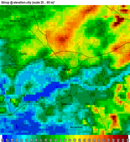
Below is the Elevation map of Sörup, which displays elevation range with different colors. Scale of the first map is from 25 to 65 m (82 to 213 ft) with average elevation of 40.3 meters (=132 ft) [note 1]
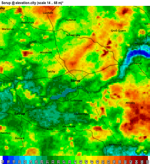
These maps also provides idea of topography and contour of this city, they are displayed at different zoom levels. More info about maps, scale and edge coordinates you can find below images.
| \ | Map #1 | Map #2 | Topo.Map |
| Scale [m] | 25..65 m | 14..68 m | × |
| Scale [ft] | 82..213 ft | 46..223 ft | × |
| Average | 40.3 m = 132 ft | 40.6 m = 133 ft | × |
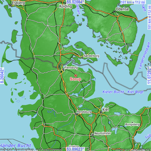
| Width | 5.64 km = 3.5 mi | 11.29 km = 7 mi | 180.6 km = 112.2 mi |
| Height | 5.64 km = 3.5 mi | 11.29 km = 7 mi | 180.6 km = 112.2 mi |
| ↑Max Latitude | 54.742046° | 54.767406° | 55.52084° |
| Latitude at center | 54.71667° | 54.71667° | 54.71667° |
| ↓Min Latitude | 54.691278° | 54.665871° | 53.89623° |
| ← Min Longitude | 9.622725° | 9.578779° | 8.26042° |
| Longitude center | 9.66667° | 9.66667° | 9.66667° |
| →Max Longitude | 9.710615° | 9.754561° | 11.07292° |
Nearby cities:
Cities around Sörup sort by population:
• Satrup elevation 38 m
4.8 km,  235°
235°
• Großsolt 41 m
9.8 km,  259°
259°
• Langballig 29 m
9.5 km,  347°
347°
• Freienwill 42 m
11.1 km,  276°
276°
• Sterup 39 m
4.6 km,  76°
76°
• Steinbergkirche 40 m
7.4 km,  55°
55°
• Quern 47 m
4.9 km,  40°
40°
• Hürup 44 m
9.3 km,  293°
293°
• Munkbrarup 48 m
11.3 km,  325°
325°
• Mohrkirch 27 m
6.4 km,  149°
149°
• Dollerup 29 m
6.9 km,  7°
7°
• Steinberg 15 m
9.3 km,  53°
53°
Multilingual:
 En español:
Sörup elevación 39 m.
 En France:
Sörup élévation 39 m.


Sources and notes:
- [note 1] Map square and city borders are not equal. Map elevation data is calculated only from area inside that square.
- [src 1] Elevation data from geonames database provided with same terms of usage.
- [src 2] The elevation map of Sörup is generated using elevation data from NASA's 3 arcsec (90m) resolution SRTM data.
- [src 3] Base (background) map © OpenStreetMap contributors tiles are generated by Geofabrik and OpenTopoMap.
Copyright & License:
This Sörup Elevation Map is licensed under CC BY-SA. You may reuse any part from this page, if you give a proper credit by linking to this URL:
 More info on terms of use page.