Spreenhagen elevation
Spreenhagen (Brandenburg), Germany elevation is 37 meters and Spreenhagen elevation in feet is 121 ft above sea level [src 1]. Spreenhagen is a seat of a fourth-order administrative division (feature code) with elevation that is 221 meters (725 ft) smaller than average city elevation in Germany.
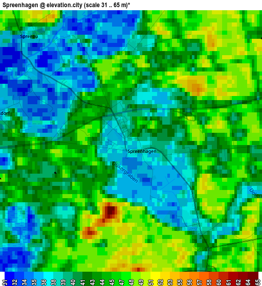
Below is the Elevation map of Spreenhagen, which displays elevation range with different colors. Scale of the first map is from 31 to 65 m (102 to 213 ft) with average elevation of 42.5 meters (=139 ft) [note 1]
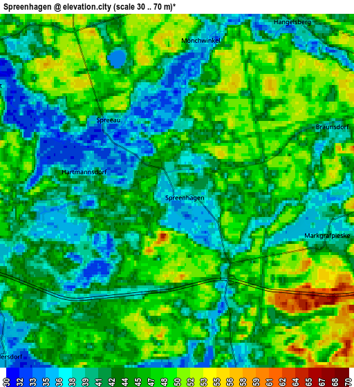
These maps also provides idea of topography and contour of this city, they are displayed at different zoom levels. More info about maps, scale and edge coordinates you can find below images.
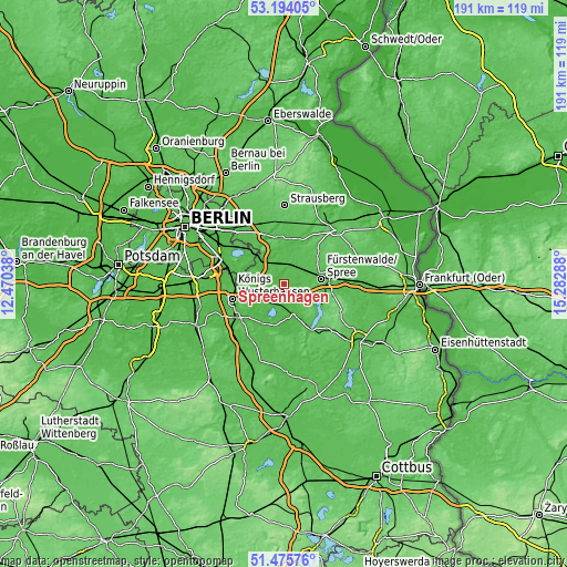
| \ | Map #1 | Map #2 | Topo.Map |
| Scale [m] | 31..65 m | 30..70 m | × |
| Scale [ft] | 102..213 ft | 98..230 ft | × |
| Average | 42.5 m = 139 ft | 44.2 m = 145 ft | × |
| Width | 5.97 km = 3.7 mi | 11.94 km = 7.4 mi | 191.1 km = 118.7 mi |
| Height | 5.97 km = 3.7 mi | 11.94 km = 7.4 mi | 191 km = 118.7 mi |
| ↑Max Latitude | 52.370089° | 52.396912° | 53.19405° |
| Latitude at center | 52.34325° | 52.34325° | 52.34325° |
| ↓Min Latitude | 52.316394° | 52.289522° | 51.47576° |
| ← Min Longitude | 13.832685° | 13.788739° | 12.47038° |
| Longitude center | 13.87663° | 13.87663° | 13.87663° |
| →Max Longitude | 13.920575° | 13.964521° | 15.28288° |
Nearby cities:
Cities around Spreenhagen sort by population:
• Fürstenwalde elevation 44 m
12.7 km,  81°
81°
• Erkner 38 m
11.9 km,  315°
315°
• Storkow 39 m
10.4 km,  158°
158°
• Rahnsdorf 36 m
16.8 km,  310°
310°
• Grünheide 36 m
9.9 km,  334°
334°
• Woltersdorf 51 m
15.2 km, 325°
• Müggelheim 36 m
16.3 km,  297°
297°
• Bad Saarow 52 m
14.5 km,  117°
117°
• Schmöckwitz 37 m
15.8 km,  282°
282°
• Rauen 70 m
10.4 km,  96°
96°
• Wendisch Rietz 42 m
16.7 km,  147°
147°
• Reichenwalde 67 m
12 km,  135°
135°
Multilingual:
 En español:
Spreenhagen elevación 37 m.
 En France:
Spreenhagen élévation 37 m.
 Auf Deutsch:
Spreenhagen höhe über dem Meeresspiegel ist 37 m.

Sources and notes:
- [note 1] Map square and city borders are not equal. Map elevation data is calculated only from area inside that square.
- [src 1] Elevation data from geonames database provided with same terms of usage.
- [src 2] The elevation map of Spreenhagen is generated using elevation data from NASA's 3 arcsec (90m) resolution SRTM data.
- [src 3] Base (background) map © OpenStreetMap contributors tiles are generated by Geofabrik and OpenTopoMap.
Copyright & License:
This Spreenhagen Elevation Map is licensed under CC BY-SA. You may reuse any part from this page, if you give a proper credit by linking to this URL:
 More info on terms of use page.