Tamm elevation
Tamm (Baden-Württemberg, Regierungsbezirk Stuttgart), Germany elevation is 256 meters and Tamm elevation in feet is 840 ft above sea level [src 1]. Tamm is a seat of a fourth-order administrative division (feature code) with elevation that is 2 meters (7 ft) smaller than average city elevation in Germany.
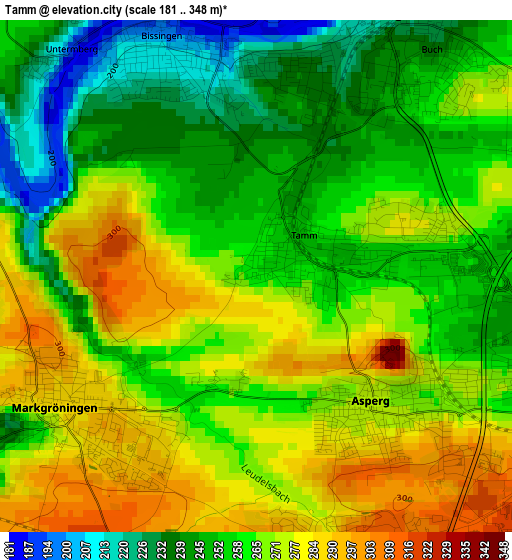
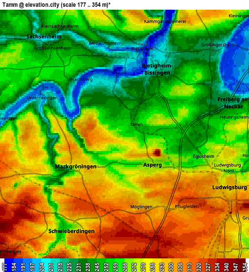
Below is the Elevation map of Tamm, which displays elevation range with different colors. Scale of the first map is from 181 to 348 m (594 to 1142 ft) with average elevation of 263.1 meters (=863 ft) [note 1]
These maps also provides idea of topography and contour of this city, they are displayed at different zoom levels. More info about maps, scale and edge coordinates you can find below images.
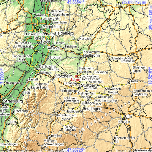
| \ | Map #1 | Map #2 | Topo.Map |
| Scale [m] | 181..348 m | 177..354 m | × |
| Scale [ft] | 594..1142 ft | 581..1161 ft | × |
| Average | 263.1 m = 863 ft | 268.3 m = 880 ft | × |
| Width | 6.42 km = 4 mi | 12.84 km = 8 mi | 205.5 km = 127.7 mi |
| Height | 6.42 km = 4 mi | 12.84 km = 8 mi | 205.5 km = 127.7 mi |
| ↑Max Latitude | 48.948749° | 48.977601° | 49.83541° |
| Latitude at center | 48.91988° | 48.91988° | 48.91988° |
| ↓Min Latitude | 48.890995° | 48.862092° | 47.98725° |
| ← Min Longitude | 9.071615° | 9.027669° | 7.70931° |
| Longitude center | 9.11556° | 9.11556° | 9.11556° |
| →Max Longitude | 9.159505° | 9.203451° | 10.52181° |
Nearby cities:
Cities around Tamm sort by population:
• Ludwigsburg elevation 298 m
6.1 km,  114°
114°
• Bietigheim-Bissingen 226 m
2.7 km,  3°
3°
• Kornwestheim 299 m
8.3 km,  141°
141°
• Sachsenheim 239 m
5.8 km,  320°
320°
• Freiberg am Neckar 256 m
6.5 km,  78°
78°
• Markgröningen 286 m
3 km,  236°
236°
• Asperg 275 m
2.2 km, 138°
• Schwieberdingen 256 m
5.7 km,  211°
211°
• Möglingen 291 m
3.7 km,  167°
167°
• Hemmingen 323 m
8.4 km,  225°
225°
• Pleidelsheim 199 m
7.7 km,  55°
55°
• Oberriexingen 215 m
6.5 km,  276°
276°
Multilingual:
 En español:
Tamm elevación 256 m.
 En France:
Tamm élévation 256 m.


Sources and notes:
- [note 1] Map square and city borders are not equal. Map elevation data is calculated only from area inside that square.
- [src 1] Elevation data from geonames database provided with same terms of usage.
- [src 2] The elevation map of Tamm is generated using elevation data from NASA's 3 arcsec (90m) resolution SRTM data.
- [src 3] Base (background) map © OpenStreetMap contributors tiles are generated by Geofabrik and OpenTopoMap.
Copyright & License:
This Tamm Elevation Map is licensed under CC BY-SA. You may reuse any part from this page, if you give a proper credit by linking to this URL:
 More info on terms of use page.