Tauberbischofsheim elevation
Tauberbischofsheim (Baden-Württemberg, Regierungsbezirk Stuttgart), Germany elevation is 176 meters and Tauberbischofsheim elevation in feet is 577 ft above sea level [src 1]. Tauberbischofsheim is a seat of a third-order administrative division (feature code) with elevation that is 82 meters (269 ft) smaller than average city elevation in Germany.
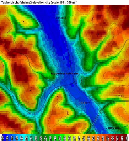
Below is the Elevation map of Tauberbischofsheim, which displays elevation range with different colors. Scale of the first map is from 168 to 356 m (551 to 1168 ft) with average elevation of 259.7 meters (=852 ft) [note 1]
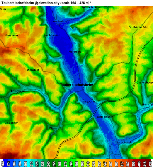
These maps also provides idea of topography and contour of this city, they are displayed at different zoom levels. More info about maps, scale and edge coordinates you can find below images.
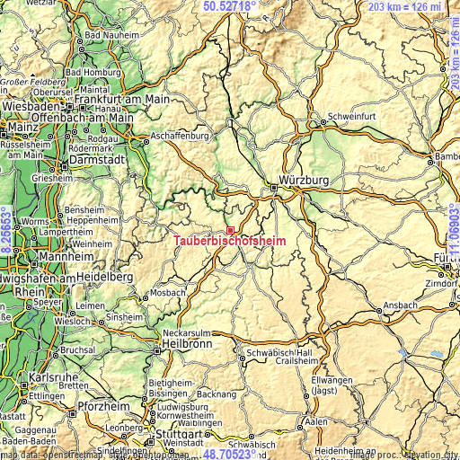
| \ | Map #1 | Map #2 | Topo.Map |
| Scale [m] | 168..356 m | 164..428 m | × |
| Scale [ft] | 551..1168 ft | 538..1404 ft | × |
| Average | 259.7 m = 852 ft | 286.4 m = 940 ft | × |
| Width | 6.33 km = 3.9 mi | 12.66 km = 7.9 mi | 202.6 km = 125.9 mi |
| Height | 6.33 km = 3.9 mi | 12.66 km = 7.9 mi | 202.6 km = 125.9 mi |
| ↑Max Latitude | 49.653179° | 49.681622° | 50.52718° |
| Latitude at center | 49.62472° | 49.62472° | 49.62472° |
| ↓Min Latitude | 49.596244° | 49.567752° | 48.70523° |
| ← Min Longitude | 9.618835° | 9.574889° | 8.25653° |
| Longitude center | 9.66278° | 9.66278° | 9.66278° |
| →Max Longitude | 9.706725° | 9.750671° | 11.06903° |
Nearby cities:
Cities around Tauberbischofsheim sort by population:
• Lauda-Königshofen elevation 195 m
7.4 km,  153°
153°
• Hardheim 294 m
13.8 km,  264°
264°
• Külsheim 320 m
11.2 km,  296°
296°
• Großrinderfeld 311 m
6.8 km,  48°
48°
• Grünsfeld 245 m
6.3 km,  105°
105°
• Werbach 186 m
5.4 km,  341°
341°
• Königheim 262 m
4.8 km, 264°
• Helmstadt 302 m
15.6 km,  12°
12°
• Buch am Ahorn 373 m
12.3 km,  219°
219°
• Neubrunn 290 m
11.8 km,  3°
3°
• Kirchheim 280 m
14.5 km,  76°
76°
• Kleinrinderfeld 309 m
15.6 km,  57°
57°
Multilingual:
 En español:
Tauberbischofsheim elevación 176 m.
 En France:
Tauberbischofsheim élévation 176 m.
 Auf Deutsch:
Tauberbischofsheim höhe über dem Meeresspiegel ist 176 m.

Sources and notes:
- [note 1] Map square and city borders are not equal. Map elevation data is calculated only from area inside that square.
- [src 1] Elevation data from geonames database provided with same terms of usage.
- [src 2] The elevation map of Tauberbischofsheim is generated using elevation data from NASA's 3 arcsec (90m) resolution SRTM data.
- [src 3] Base (background) map © OpenStreetMap contributors tiles are generated by Geofabrik and OpenTopoMap.
Copyright & License:
This Tauberbischofsheim Elevation Map is licensed under CC BY-SA. You may reuse any part from this page, if you give a proper credit by linking to this URL:
 More info on terms of use page.