Taunusstein elevation
Taunusstein (Hesse, Regierungsbezirk Darmstadt), Germany elevation is 381 meters and Taunusstein elevation in feet is 1250 ft above sea level [src 1]. Taunusstein is a populated place (feature code) with elevation that is 123 meters (404 ft) bigger than average city elevation in Germany.
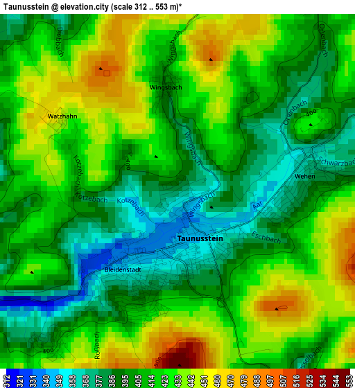
Below is the Elevation map of Taunusstein, which displays elevation range with different colors. Scale of the first map is from 312 to 553 m (1024 to 1814 ft) with average elevation of 412.9 meters (=1355 ft) [note 1]
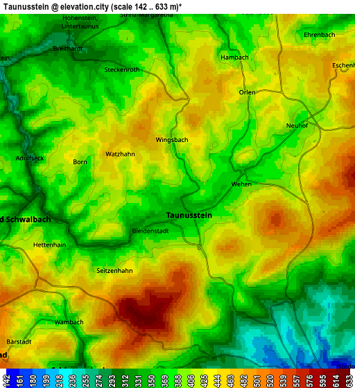
These maps also provides idea of topography and contour of this city, they are displayed at different zoom levels. More info about maps, scale and edge coordinates you can find below images.
| \ | Map #1 | Map #2 | Topo.Map |
| Scale [m] | 312..553 m | 142..633 m | × |
| Scale [ft] | 1024..1814 ft | 466..2077 ft | × |
| Average | 412.9 m = 1355 ft | 400.5 m = 1314 ft | × |
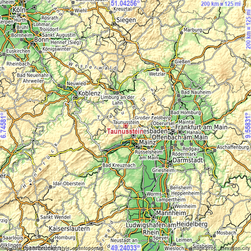
| Width | 6.26 km = 3.9 mi | 12.52 km = 7.8 mi | 200.4 km = 124.5 mi |
| Height | 6.26 km = 3.9 mi | 12.52 km = 7.8 mi | 200.4 km = 124.5 mi |
| ↑Max Latitude | 50.178081° | 50.206215° | 51.04256° |
| Latitude at center | 50.14993° | 50.14993° | 50.14993° |
| ↓Min Latitude | 50.121762° | 50.093578° | 49.24033° |
| ← Min Longitude | 8.108115° | 8.064169° | 6.74581° |
| Longitude center | 8.15206° | 8.15206° | 8.15206° |
| →Max Longitude | 8.196005° | 8.239951° | 9.55831° |
Nearby cities:
Cities around Taunusstein sort by population:
• Wiesbaden elevation 128 m
10.2 km,  137°
137°
• Idstein 276 m
11.1 km,  47°
47°
• Eltville 99 m
13.7 km,  190°
190°
• Niedernhausen 271 m
11.6 km,  82°
82°
• Eppstein 240 m
17.1 km,  92°
92°
• Bad Schwalbach 324 m
5.9 km,  261°
261°
• Budenheim 105 m
14.9 km,  175°
175°
• Schlangenbad 287 m
7.2 km,  208°
208°
• Waldems 356 m
17 km, 49°
• Walluf 118 m
12.2 km, 178°
• Kiedrich 161 m
13.2 km,  201°
201°
• Burgschwalbach 190 m
15.6 km,  341°
341°
Multilingual:
 En español:
Taunusstein elevación 381 m.
 En France:
Taunusstein élévation 381 m.
 Auf Deutsch:
Taunusstein höhe über dem Meeresspiegel ist 381 m.

Sources and notes:
- [note 1] Map square and city borders are not equal. Map elevation data is calculated only from area inside that square.
- [src 1] Elevation data from geonames database provided with same terms of usage.
- [src 2] The elevation map of Taunusstein is generated using elevation data from NASA's 3 arcsec (90m) resolution SRTM data.
- [src 3] Base (background) map © OpenStreetMap contributors tiles are generated by Geofabrik and OpenTopoMap.
Copyright & License:
This Taunusstein Elevation Map is licensed under CC BY-SA. You may reuse any part from this page, if you give a proper credit by linking to this URL:
 More info on terms of use page.