Thannhausen elevation
Thannhausen (Bavaria, Swabia), Germany elevation is 504 meters and Thannhausen elevation in feet is 1654 ft above sea level [src 1]. Thannhausen is a populated place (feature code) with elevation that is 246 meters (807 ft) bigger than average city elevation in Germany.
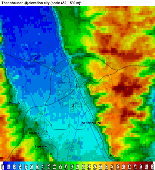
Below is the Elevation map of Thannhausen, which displays elevation range with different colors. Scale of the first map is from 482 to 590 m (1581 to 1936 ft) with average elevation of 524 meters (=1719 ft) [note 1]
These maps also provides idea of topography and contour of this city, they are displayed at different zoom levels. More info about maps, scale and edge coordinates you can find below images.
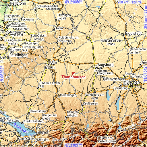
| \ | Map #1 | Map #2 | Topo.Map |
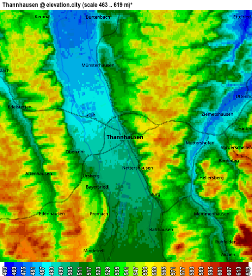
| Scale [m] | 482..590 m | 463..619 m | × |
| Scale [ft] | 1581..1936 ft | 1519..2031 ft | × |
| Average | 524 m = 1719 ft | 529.4 m = 1737 ft | × |
| Width | 6.5 km = 4 mi | 13.01 km = 8.1 mi | 208.1 km = 129.3 mi |
| Height | 6.5 km = 4 mi | 13.01 km = 8.1 mi | 208.1 km = 129.3 mi |
| ↑Max Latitude | 48.312575° | 48.341793° | 49.21056° |
| Latitude at center | 48.28334° | 48.28334° | 48.28334° |
| ↓Min Latitude | 48.254088° | 48.22482° | 47.33897° |
| ← Min Longitude | 10.425225° | 10.381279° | 9.06292° |
| Longitude center | 10.46917° | 10.46917° | 10.46917° |
| →Max Longitude | 10.513115° | 10.557061° | 11.87542° |
Nearby cities:
Cities around Thannhausen sort by population:
• Krumbach elevation 514 m
9.1 km,  239°
239°
• Dinkelscherben 465 m
11.4 km,  50°
50°
• Ursberg 513 m
2.7 km,  219°
219°
• Burtenbach 512 m
6.5 km,  349°
349°
• Ziemetshausen 482 m
5 km,  78°
78°
• Münsterhausen 493 m
3.1 km,  340°
340°
• Langenneufnach 540 m
9.9 km,  100°
100°
• Deisenhausen 517 m
11 km,  253°
253°
• Balzhausen 521 m
4.9 km,  158°
158°
• Aichen 509 m
8 km,  139°
139°
• Aletshausen 531 m
11.1 km,  212°
212°
• Walkertshofen 531 m
10.9 km,  125°
125°
Multilingual:
 En español:
Thannhausen elevación 504 m.
 En France:
Thannhausen élévation 504 m.
 Auf Deutsch:
Thannhausen höhe über dem Meeresspiegel ist 504 m.

Sources and notes:
- [note 1] Map square and city borders are not equal. Map elevation data is calculated only from area inside that square.
- [src 1] Elevation data from geonames database provided with same terms of usage.
- [src 2] The elevation map of Thannhausen is generated using elevation data from NASA's 3 arcsec (90m) resolution SRTM data.
- [src 3] Base (background) map © OpenStreetMap contributors tiles are generated by Geofabrik and OpenTopoMap.
Copyright & License:
This Thannhausen Elevation Map is licensed under CC BY-SA. You may reuse any part from this page, if you give a proper credit by linking to this URL:
 More info on terms of use page.