Tirschenreuth elevation
Tirschenreuth (Bavaria, Upper Palatinate), Germany elevation is 509 meters and Tirschenreuth elevation in feet is 1670 ft above sea level [src 1]. Tirschenreuth is a seat of a third-order administrative division (feature code) with elevation that is 251 meters (823 ft) bigger than average city elevation in Germany.
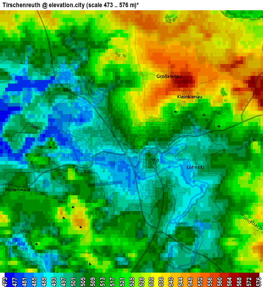
Below is the Elevation map of Tirschenreuth, which displays elevation range with different colors. Scale of the first map is from 473 to 576 m (1552 to 1890 ft) with average elevation of 513.4 meters (=1684 ft) [note 1]
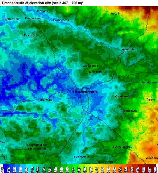
These maps also provides idea of topography and contour of this city, they are displayed at different zoom levels. More info about maps, scale and edge coordinates you can find below images.
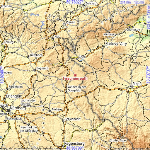
| \ | Map #1 | Map #2 | Topo.Map |
| Scale [m] | 473..576 m | 467..706 m | × |
| Scale [ft] | 1552..1890 ft | 1532..2316 ft | × |
| Average | 513.4 m = 1684 ft | 536.5 m = 1760 ft | × |
| Width | 6.3 km = 3.9 mi | 12.59 km = 7.8 mi | 201.5 km = 125.2 mi |
| Height | 6.3 km = 3.9 mi | 12.59 km = 7.8 mi | 201.5 km = 125.2 mi |
| ↑Max Latitude | 49.910938° | 49.93923° | 50.78027° |
| Latitude at center | 49.88263° | 49.88263° | 49.88263° |
| ↓Min Latitude | 49.854305° | 49.825964° | 48.96799° |
| ← Min Longitude | 12.287175° | 12.243229° | 10.92487° |
| Longitude center | 12.33112° | 12.33112° | 12.33112° |
| →Max Longitude | 12.375065° | 12.419011° | 13.73737° |
Nearby cities:
Cities around Tirschenreuth sort by population:
• Waldsassen elevation 485 m
13.4 km,  351°
351°
• Berg 493 m
15.6 km,  240°
240°
• Mitterteich 522 m
10 km,  320°
320°
• Windischeschenbach 450 m
15.4 km,  233°
233°
• Wiesau 509 m
10.6 km,  285°
285°
• Bärnau 608 m
10.8 km,  137°
137°
• Mähring 648 m
14.2 km,  77°
77°
• Fuchsmühl 599 m
14 km, 288°
• Neualbenreuth 557 m
13.5 km,  36°
36°
• Pechbrunn 591 m
15 km,  308°
308°
• Schwarzenbach 569 m
6 km, 144°
• Leonberg 539 m
7.9 km,  335°
335°
Multilingual:
 En español:
Tirschenreuth elevación 509 m.
 En France:
Tirschenreuth élévation 509 m.
 Auf Deutsch:
Tirschenreuth höhe über dem Meeresspiegel ist 509 m.

Sources and notes:
- [note 1] Map square and city borders are not equal. Map elevation data is calculated only from area inside that square.
- [src 1] Elevation data from geonames database provided with same terms of usage.
- [src 2] The elevation map of Tirschenreuth is generated using elevation data from NASA's 3 arcsec (90m) resolution SRTM data.
- [src 3] Base (background) map © OpenStreetMap contributors tiles are generated by Geofabrik and OpenTopoMap.
Copyright & License:
This Tirschenreuth Elevation Map is licensed under CC BY-SA. You may reuse any part from this page, if you give a proper credit by linking to this URL:
 More info on terms of use page.