Trittau elevation
Trittau (Schleswig-Holstein), Germany elevation is 38 meters and Trittau elevation in feet is 125 ft above sea level [src 1]. Trittau is a seat of a fourth-order administrative division (feature code) with elevation that is 220 meters (722 ft) smaller than average city elevation in Germany.
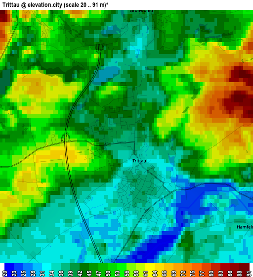
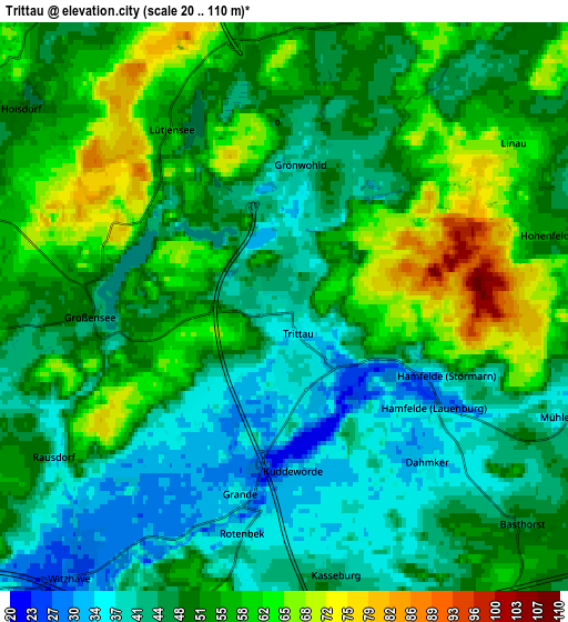
Below is the Elevation map of Trittau, which displays elevation range with different colors. Scale of the first map is from 20 to 91 m (66 to 299 ft) with average elevation of 46.2 meters (=152 ft) [note 1]
These maps also provides idea of topography and contour of this city, they are displayed at different zoom levels. More info about maps, scale and edge coordinates you can find below images.
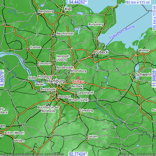
| \ | Map #1 | Map #2 | Topo.Map |
| Scale [m] | 20..91 m | 20..110 m | × |
| Scale [ft] | 66..299 ft | 66..361 ft | × |
| Average | 46.2 m = 152 ft | 50.3 m = 165 ft | × |
| Width | 5.8 km = 3.6 mi | 11.59 km = 7.2 mi | 185.5 km = 115.3 mi |
| Height | 5.8 km = 3.6 mi | 11.59 km = 7.2 mi | 185.5 km = 115.3 mi |
| ↑Max Latitude | 53.64273° | 53.668773° | 54.44262° |
| Latitude at center | 53.61667° | 53.61667° | 53.61667° |
| ↓Min Latitude | 53.590594° | 53.564502° | 52.77424° |
| ← Min Longitude | 10.356055° | 10.312109° | 8.99375° |
| Longitude center | 10.4° | 10.4° | 10.4° |
| →Max Longitude | 10.443945° | 10.487891° | 11.80625° |
Nearby cities:
Cities around Trittau sort by population:
• Großhansdorf elevation 47 m
9.5 km,  305°
305°
• Hoisdorf 51 m
6.6 km,  304°
304°
• Lütjensee 53 m
4.3 km,  329°
329°
• Siek 64 m
6.8 km,  285°
285°
• Großensee 44 m
4 km,  263°
263°
• Sandesneben 46 m
9.9 km,  41°
41°
• Witzhave 26 m
7.1 km,  218°
218°
• Kuddewörde 32 m
3.7 km,  180°
180°
• Grönwohld 40 m
2.8 km,  10°
10°
• Schönberg 58 m
7.6 km, 13°
• Linau 69 m
5.5 km,  55°
55°
• Todendorf 48 m
9.3 km,  338°
338°
Multilingual:
 En español:
Trittau elevación 38 m.
 En France:
Trittau élévation 38 m.


Sources and notes:
- [note 1] Map square and city borders are not equal. Map elevation data is calculated only from area inside that square.
- [src 1] Elevation data from geonames database provided with same terms of usage.
- [src 2] The elevation map of Trittau is generated using elevation data from NASA's 3 arcsec (90m) resolution SRTM data.
- [src 3] Base (background) map © OpenStreetMap contributors tiles are generated by Geofabrik and OpenTopoMap.
Copyright & License:
This Trittau Elevation Map is licensed under CC BY-SA. You may reuse any part from this page, if you give a proper credit by linking to this URL:
 More info on terms of use page.