Unterlüß elevation
Unterlüß (Lower Saxony), Germany elevation is 104 meters and Unterlüß elevation in feet is 341 ft above sea level [src 1]. Unterlüß is a seat of a fourth-order administrative division (feature code) with elevation that is 154 meters (505 ft) smaller than average city elevation in Germany.
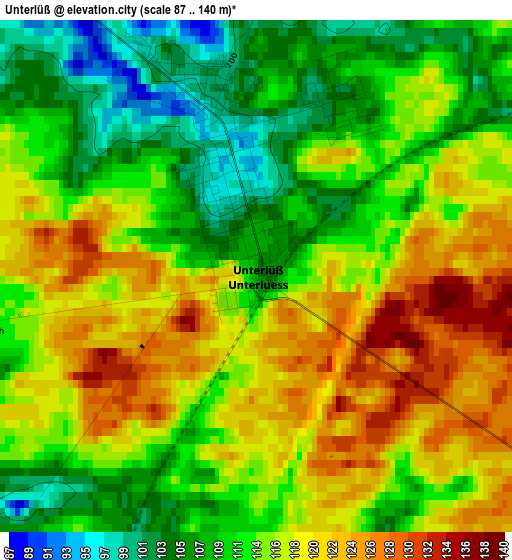
Below is the Elevation map of Unterlüß, which displays elevation range with different colors. Scale of the first map is from 87 to 140 m (285 to 459 ft) with average elevation of 114.5 meters (=376 ft) [note 1]
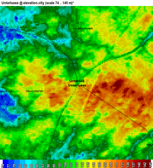
These maps also provides idea of topography and contour of this city, they are displayed at different zoom levels. More info about maps, scale and edge coordinates you can find below images.
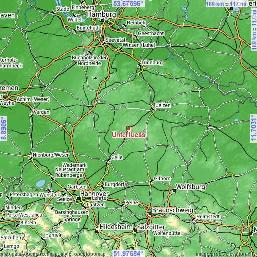
| \ | Map #1 | Map #2 | Topo.Map |
| Scale [m] | 87..140 m | 74..145 m | × |
| Scale [ft] | 285..459 ft | 243..476 ft | × |
| Average | 114.5 m = 376 ft | 108.2 m = 355 ft | × |
| Width | 5.9 km = 3.7 mi | 11.81 km = 7.3 mi | 188.9 km = 117.4 mi |
| Height | 5.9 km = 3.7 mi | 11.81 km = 7.3 mi | 188.9 km = 117.4 mi |
| ↑Max Latitude | 52.86125° | 52.887774° | 53.67596° |
| Latitude at center | 52.83471° | 52.83471° | 52.83471° |
| ↓Min Latitude | 52.808154° | 52.781581° | 51.97684° |
| ← Min Longitude | 10.252905° | 10.208959° | 8.8906° |
| Longitude center | 10.29685° | 10.29685° | 10.29685° |
| →Max Longitude | 10.340795° | 10.384741° | 11.7031° |
Nearby cities:
Cities around Unterlüß sort by population:
• Hermannsburg elevation 55 m
13.9 km,  269°
269°
• Faßberg 67 m
11.4 km,  309°
309°
• Suderburg 58 m
12.4 km,  56°
56°
• Eschede 76 m
11.8 km,  200°
200°
• Wrestedt 48 m
20.2 km,  67°
67°
• Eldingen 65 m
17 km,  171°
171°
• Gerdau 49 m
16.7 km,  28°
28°
• Dedelstorf 93 m
20.3 km,  137°
137°
• Steinhorst 76 m
18.2 km,  157°
157°
• Stadensen 57 m
18 km,  75°
75°
• Sprakensehl 112 m
15.1 km,  119°
119°
• Eimke 66 m
14.6 km,  4°
4°
Multilingual:
 En español:
Unterlüß elevación 104 m.
 En France:
Unterlüß élévation 104 m.
 Auf Deutsch:
Unterlüß höhe über dem Meeresspiegel ist 104 m.

Sources and notes:
- [note 1] Map square and city borders are not equal. Map elevation data is calculated only from area inside that square.
- [src 1] Elevation data from geonames database provided with same terms of usage.
- [src 2] The elevation map of Unterlüß is generated using elevation data from NASA's 3 arcsec (90m) resolution SRTM data.
- [src 3] Base (background) map © OpenStreetMap contributors tiles are generated by Geofabrik and OpenTopoMap.
Copyright & License:
This Unterlüß Elevation Map is licensed under CC BY-SA. You may reuse any part from this page, if you give a proper credit by linking to this URL:
 More info on terms of use page.