Uttenweiler elevation
Uttenweiler (Baden-Württemberg, Tübingen Region), Germany elevation is 576 meters and Uttenweiler elevation in feet is 1890 ft above sea level [src 1]. Uttenweiler is a seat of a fourth-order administrative division (feature code) with elevation that is 318 meters (1043 ft) bigger than average city elevation in Germany.
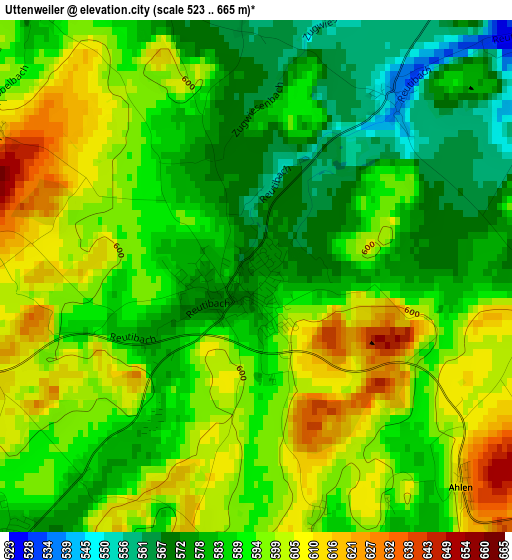
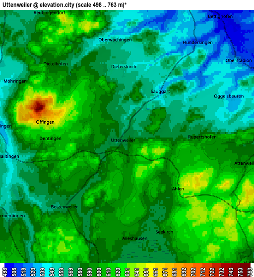
Below is the Elevation map of Uttenweiler, which displays elevation range with different colors. Scale of the first map is from 523 to 665 m (1716 to 2182 ft) with average elevation of 590.6 meters (=1938 ft) [note 1]
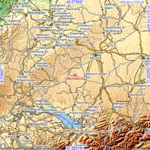
These maps also provides idea of topography and contour of this city, they are displayed at different zoom levels. More info about maps, scale and edge coordinates you can find below images.
| \ | Map #1 | Map #2 | Topo.Map |
| Scale [m] | 523..665 m | 498..763 m | × |
| Scale [ft] | 1716..2182 ft | 1634..2503 ft | × |
| Average | 590.6 m = 1938 ft | 585.2 m = 1920 ft | × |
| Width | 6.52 km = 4.1 mi | 13.04 km = 8.1 mi | 208.6 km = 129.6 mi |
| Height | 6.52 km = 4.1 mi | 13.04 km = 8.1 mi | 208.6 km = 129.6 mi |
| ↑Max Latitude | 48.179311° | 48.208606° | 49.07966° |
| Latitude at center | 48.15° | 48.15° | 48.15° |
| ↓Min Latitude | 48.120672° | 48.091327° | 47.20319° |
| ← Min Longitude | 9.572725° | 9.528779° | 8.21042° |
| Longitude center | 9.61667° | 9.61667° | 9.61667° |
| →Max Longitude | 9.660615° | 9.704561° | 11.02292° |
Nearby cities:
Cities around Uttenweiler sort by population:
• Riedlingen elevation 540 m
10.5 km,  272°
272°
• Ertingen 572 m
12.4 km,  243°
243°
• Munderkingen 518 m
9.7 km,  11°
11°
• Bad Buchau 589 m
9.8 km,  181°
181°
• Mittelbiberach 577 m
12.4 km,  126°
126°
• Dürmentingen 556 m
7.2 km, 239°
• Unlingen 535 m
7.3 km,  285°
285°
• Rottenacker 523 m
10.9 km,  29°
29°
• Neufra 542 m
10.7 km,  257°
257°
• Attenweiler 605 m
6.5 km,  106°
106°
• Oberstadion 525 m
6.9 km,  54°
54°
• Obermarchtal 535 m
9.8 km,  340°
340°
Multilingual:
 En español:
Uttenweiler elevación 576 m.
 En France:
Uttenweiler élévation 576 m.
 Auf Deutsch:
Uttenweiler höhe über dem Meeresspiegel ist 576 m.

Sources and notes:
- [note 1] Map square and city borders are not equal. Map elevation data is calculated only from area inside that square.
- [src 1] Elevation data from geonames database provided with same terms of usage.
- [src 2] The elevation map of Uttenweiler is generated using elevation data from NASA's 3 arcsec (90m) resolution SRTM data.
- [src 3] Base (background) map © OpenStreetMap contributors tiles are generated by Geofabrik and OpenTopoMap.
Copyright & License:
This Uttenweiler Elevation Map is licensed under CC BY-SA. You may reuse any part from this page, if you give a proper credit by linking to this URL:
 More info on terms of use page.