Veilsdorf elevation
Veilsdorf (Thuringia), Germany elevation is 394 meters and Veilsdorf elevation in feet is 1293 ft above sea level [src 1]. Veilsdorf is a seat of a fourth-order administrative division (feature code) with elevation that is 136 meters (446 ft) bigger than average city elevation in Germany.
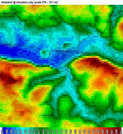
Below is the Elevation map of Veilsdorf, which displays elevation range with different colors. Scale of the first map is from 375 to 511 m (1230 to 1677 ft) with average elevation of 431.3 meters (=1415 ft) [note 1]
These maps also provides idea of topography and contour of this city, they are displayed at different zoom levels. More info about maps, scale and edge coordinates you can find below images.
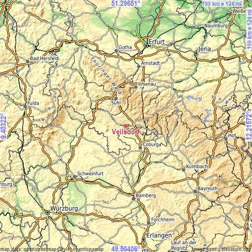
| \ | Map #1 | Topo.Map |
| Scale [m] | 375..511 m | × |
| Scale [ft] | 1230..1677 ft | × |
| Average | 431.3 m = 1415 ft | × |
| Width | 6.23 km = 3.9 mi | 199.3 km = 123.8 mi |
| Height | 6.23 km = 3.9 mi | 199.3 km = 123.8 mi |
| ↑Max Latitude | 50.436758° | 51.29651° |
| Latitude at center | 50.40876° | 50.40876° |
| ↓Min Latitude | 50.380745° | 49.50406° |
| ← Min Longitude | 10.765525° | 9.40322° |
| Longitude center | 10.80947° | 10.80947° |
| →Max Longitude | 10.853415° | 12.21572° |
Nearby cities:
Cities around Veilsdorf sort by population:
• Hildburghausen elevation 387 m
5.8 km,  288°
288°
• Eisfeld 447 m
7.2 km,  74°
74°
• Schleusingen 411 m
11.9 km,  341°
341°
• Weitramsdorf 304 m
17.7 km,  163°
163°
• Lautertal 433 m
14 km,  126°
126°
• Meeder 326 m
11.9 km,  144°
144°
• Schalkau 401 m
14.1 km,  96°
96°
• Sankt Kilian 396 m
13.6 km,  346°
346°
• Themar 330 m
17.4 km,  307°
307°
• Gleichamberg 328 m
15.6 km,  254°
254°
• Masserberg 763 m
16.8 km,  42°
42°
• Römhild 305 m
19.2 km,  265°
265°
Multilingual:
 En español:
Veilsdorf elevación 394 m.
 En France:
Veilsdorf élévation 394 m.
 Auf Deutsch:
Veilsdorf höhe über dem Meeresspiegel ist 394 m.

Sources and notes:
- [note 1] Map square and city borders are not equal. Map elevation data is calculated only from area inside that square.
- [src 1] Elevation data from geonames database provided with same terms of usage.
- [src 2] The elevation map of Veilsdorf is generated using elevation data from NASA's 3 arcsec (90m) resolution SRTM data.
- [src 3] Base (background) map © OpenStreetMap contributors tiles are generated by Geofabrik and OpenTopoMap.
Copyright & License:
This Veilsdorf Elevation Map is licensed under CC BY-SA. You may reuse any part from this page, if you give a proper credit by linking to this URL:
 More info on terms of use page.